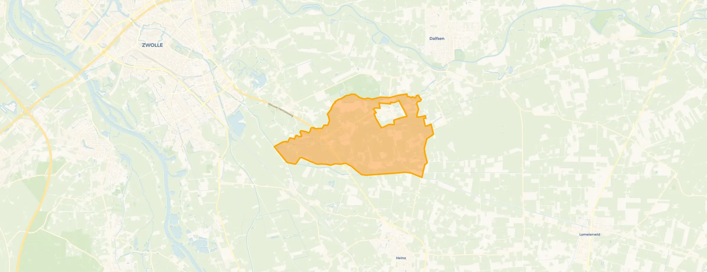
Neighbourhood in Dalfsen
Verspreide huizen Lenthe is located in the province of Overijssel, in the municipality of Dalfsen, in the district Dalfsen The neighbourhood has a total area of 1.148 hectares, of which 1.140 hectares are land and 7 hectares are water. The neighbourhood is coded as BU01480117. The postcode area is 7722JP-7722MG.
Verspreide huizen Lenthe has 505 residents. Of these, 55,4% are men and 45,5% are women. Most residents are 45 to 65 years (34,7%). The other age groups are 23,8% for '65 years or older', 15,8% for '25 to 45 years', 12,9% for '0 to 15 years' and 10,9% for '15 to 25 years'. Of the residents, 43,6% is unmarried, 43,6% is married, 4,0% is divorced and 7,9% is widowed. 480 residents originate from the Netherlands, 20 come from Europe and 5 come from countries outside Europe.
There are 195 households in Verspreide huizen Lenthe. 25,6% of these are single-person households, 38,5% households without children and 35,9% households with children. The average household size is 2,5 persons.
In Verspreide huizen Lenthe there are 400 income recipients. The average income per income recipient is €36.100, which is €300 (1%) higher than the national average of €35.800. Per resident, the average income is €30.400, which is €1.200 (4%) higher than the national average of €29.200. Most residents of Verspreide huizen Lenthe are highly educated. 45,9% have a university or higher professional education (HBO/WO), 29,7% have an intermediate education (HAVO, VWO or MBO 2-4) and 24,3% have a lower education (VMBO or MBO 1).
Of the 505 residents, around 72% are in paid employment, which amounts to 364 people. This is 7% higher than the national average of 65%. The majority of workers are in salaried employment (64%), while 36% are self-employed. In Verspreide huizen Lenthe, 24% of residents receive a benefit. The largest group is those receiving a state pension (AOW). 110 people receive this benefit.
In Verspreide huizen Lenthe there are 189 homes with an average assessed value (WOZ) of €517.000. Of these, around 95% are occupied and 5% unoccupied. Most homes are owner-occupied. This amounts to 14% rental homes and 86% owner-occupied homes. Of the homes, 86% privately owned and 14% owned by other landlords. The most common construction periods in Verspreide huizen Lenthe are 1925-1950 (16%) and 1950-1970 (16%).
There are currently no homes for sale in Verspreide huizen Lenthe. The most recently listed home is Marsweg 5 by De Graaf van Vilsteren Garantiemakelaars. Over the past year, 6 homes were sold in Verspreide huizen Lenthe. On average, a home was sold within 24 days.
There is 1 homes for rent in Verspreide huizen Lenthe. Over the past year, 5 homes were let in Verspreide huizen Lenthe. On average, a listing was let within 38 days.
No recent rental data available for Verspreide huizen Lenthe.
In Verspreide huizen Lenthe there are 196 addresses with a registered energy label. The most common labels are G (34%), B (14%) and C (12%). On average, an address in Verspreide huizen Lenthe uses 4.100 kWh of electricity per year. This is 46% above the national average of 2.810 kWh. Natural gas consumption, at 1.730 m³ per year, is 35% above the national average of 1.280 m³.

The housing stock is mainly post-war — 58% was built between 1945 and 1990. In addition, the most common type is detached houses (72%).
Over the past year a home for sale in Verspreide huizen Lenthe was listed for an average of €559,159 (€3,796 per m²).
Buurt Verspreide huizen Lenthe has 505 residents. The largest age group is 45 to 65 years (35%). Many families: 36% of the households have children.
The housing supply in Verspreide huizen Lenthe is remarkably efficient: 54% has an A, A+ or B label. The average natural gas consumption per household is 1,730 m³ per year.
From Verspreide huizen Lenthe you can on average reach a supermarket at 5.3 km, a GP at 5.5 km, a railway station at 5.4 km, a primary school at 2.4 km (as the crow flies, source: CBS).

Buurtje.nl uses cookies to make the site work and to improve it. In doing so, we process data such as your IP address and the pages you visit.
We use this data for three purposes: running the website (functional), measuring visits so we can improve Buurtje.nl (analytics), and — if you allow it — tailoring ads to your interests (marketing).
How we handle your data is described in our privacy policy. You can change your preferences at any time via 'Cookie preferences' at the bottom of every page.
Choose per category which cookies we may place. Read more in our privacy policy.