Watercirkel 133
Watercirkelbuurt, Amstelveen
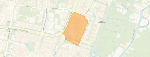 Area
AreaA family home in a green Amstelveen pocket
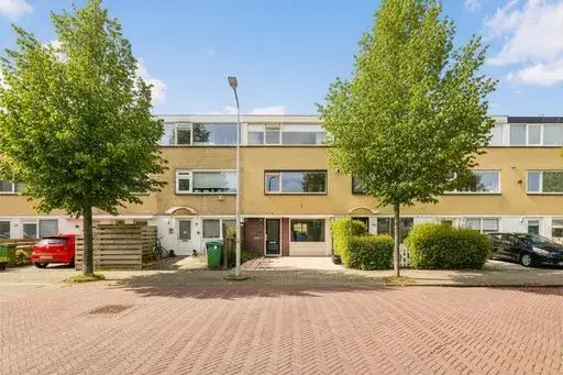
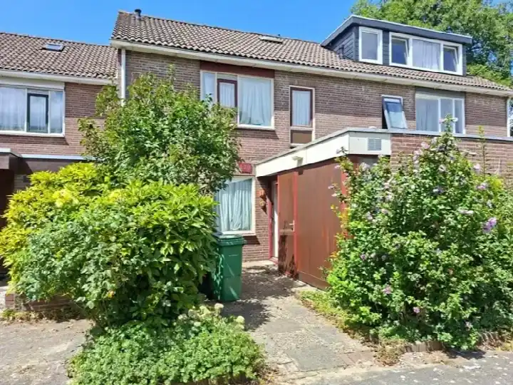
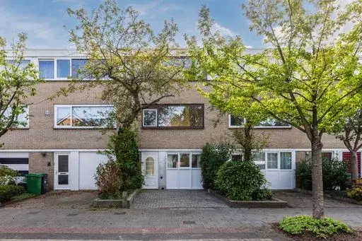
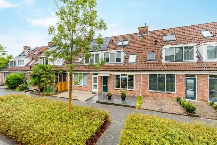
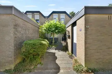
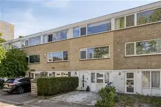
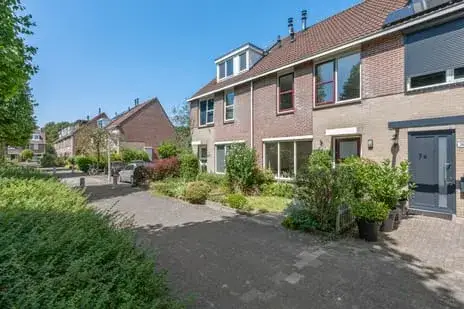
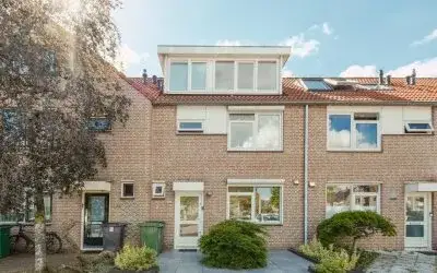
This terraced house sits in the Watercirkelbuurt, a quiet corner of Amstelveen where the streets are lined with greenery and the pace of life feels unhurried. The home was built in 1969 and carries an A energy label, which is an efficient label and should keep heating costs down. With an asking price of €650,000, the price per square metre works out at €5,702 based on the agent's floor area of 114 m². That puts it on the high side compared with the average of €4,855 per m² for terraced houses in Amstelveen, though the home is larger than the neighbourhood average of 119 m².
Inside the house
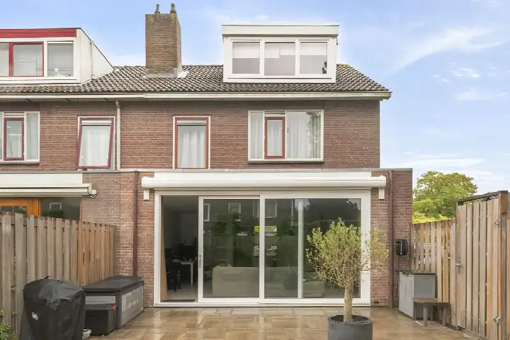
Step inside and you find a five-room layout spread over three floors, with four bedrooms and two bathrooms. The agent lists the living area at 114 m², while the BAG registration records 118 m²; the plot is 145 m² in both. The home has a rear garden, and it is offered with full ownership. According to the agent, the insulation consists of double glazing and HR glazing, and the heating runs on a conventional boiler.
Life in the Watercirkelbuurt
Residents of the wider district give their surroundings an average score of 8.25, based on three reviews. One resident describes it as a "lovely neighbourhood", while another mentions that neighbours get along well, with three supermarkets nearby and little nuisance in the evening or during the day. A third review notes the quiet, green character, with lots of green space and few restaurants and bars. The neighbourhood itself counts around 2,135 residents, and a quarter of the homes were built between 1970 and 1990. For a closer look at the Watercirkelbuurt neighbourhood, the figures paint a picture of a settled, family-oriented area.
Amenities and getting around
The daily routine is well served here. The GP practice is on your doorstep, and the pharmacy is just around the corner. For groceries, Jumbo, Albert Heijn and Lidl are all a couple of streets away, with a PLUS a little further. Primary schools such as de Horizon and De Cirkel are within a ten-minute walk, and the Hermann Wesselink College for secondary education is a couple of streets away. Bus stops at Seine, Watercirkel and Punter, all within a five-minute walk, run lines 174 and 199. The nearest train station is Amsterdam Zuid, about 5.9 km away, and the hospital is a ten-minute walk. The wider municipality of Amstelveen offers plenty beyond the immediate area.
WOZ and address data
The WOZ value is not stated in the available data, so no comparison with the asking price can be made here. The address-level risk data, based on public sources such as the Atlas Leefomgeving and KCAF, gives an indication for the area rather than an inspection of this specific home. The foundation risk is indicated as medium, with the home built in 1969 on peat soil, and the area is a KCAF attention zone where 75% of properties predate 1970. Noise from road traffic is measured at 47 dB Lden and from air traffic at 46 dB Lden, both below the noise standard. For climate risks, pluvial flooding and flood risk are both indicated as medium for the current situation and for 2050, while heat stress is low now but medium by 2050.
Source and agent
At the time of writing, the home is offered via two channels, including Brockhoff Makelaars on Funda and Brockhoff Makelaars directly. The listing has been active since 29 June 2026.
This summary was generated with AI and may contain errors. Always verify the details with the provider.
Features
Details of this home
Transfer
Price
Energy
 Save up to € 400 on your energy billCompare now
Areas and volume
 Insure your home and belongingsGet insured
Layout
Construction
Outdoor space
Frequently asked questions
About Watercirkel 133, Amstelveen
What is the asking price for this terraced house in Amstelveen?
The asking price is €650,000. Based on the agent's floor area of 114 m², that works out at €5,702 per square metre. For comparison, the average asking price per square metre in the Watercirkelbuurt is €4,855, so this home is priced on the high side relative to the neighbourhood average. The home is larger than the typical property in the area, which may partly explain the difference.
How many bedrooms and bathrooms does this home have?
According to the agent, the home has five rooms in total, including four bedrooms and two bathrooms, spread over three floors. The living area is listed at 114 m² by the agent, while the BAG registration records 118 m². The plot measures 145 m². There is also a rear garden, and the property is offered with full ownership.
What is the energy label and what does it mean for heating costs?
The home has an A energy label, which is an efficient label. This means the home is likely to have relatively low heating costs compared with less efficient labels. The agent also notes that the insulation consists of double glazing and HR glazing, and the heating runs on a conventional boiler. These are separate facts from the label itself, but together they point to a home that should be economical to run.
What is the WOZ value of this property?
The WOZ value is not stated in the available data for this listing. The WOZ value is the municipal valuation used for tax purposes, and it is not included in the information provided here. As a result, no comparison between the WOZ value and the asking price can be made, and the historical development of the WOZ value over the past five years is also not available.
What is the foundation risk for this home?
The foundation risk indication for this address is medium, based on public data from sources such as KCAF. This is an area-level indication, not an inspection of this specific home. The home was built in 1969 on peat soil, and the area is a KCAF attention zone where 75% of properties in the postcode area were built before 1970. This information is provided as a factual indication of the risk level.
What are the noise levels like at this address?
The address-level risk data indicates noise from road traffic at 47 dB Lden and from air traffic at 46 dB Lden, both measured in 2022. Both figures are below the noise standard, meaning they do not exceed the legal limit. This is an area-level indication based on public data, not a measurement taken at the property itself.
What supermarkets and schools are nearby?
There are several supermarkets within easy reach: Jumbo at 488 m, Albert Heijn at 536 m, Lidl at 564 m, and a PLUS at 661 m. For schools, the Hermann Wesselink College for secondary education is at 633 m, while primary schools de Horizon and Reformatorische Basisschool De Akker are both at 653 m, and De Cirkel is at 694 m. The GP practice is at 104 m and the pharmacy at 122 m.
How is the public transport connection from this home?
There are three bus stops within a short walk: Amstelveen, Seine at 248 m, Amstelveen, Watercirkel at 301 m, and Amstelveen, Punter at 328 m. All three stops are served by bus lines 174 and 199. The nearest train station is Amsterdam Zuid, which is about 5.9 km away. This gives residents a choice of bus connections close by, with the train station a bit further out.
What is the neighbourhood like according to residents?
Residents of the wider district give their surroundings an average score of 8.25, based on three reviews. One resident calls it a "lovely neighbourhood", while another mentions that neighbours get along well, with three supermarkets in the area and little nuisance in the evening or during the day. A third review describes it as a quiet, green neighbourhood with lots of green space and few restaurants and bars. These reviews describe the district, not just the immediate neighbourhood.
What is the flood risk for this property?
The climate risk data for this address indicates a medium risk of pluvial flooding and a medium flood risk for the current situation. Looking ahead to 2050, both the flood risk and the pluvial flooding risk remain medium. Heat stress is currently low but is expected to be medium by 2050. These are area-level indications based on public climate data, not an assessment of this specific property.