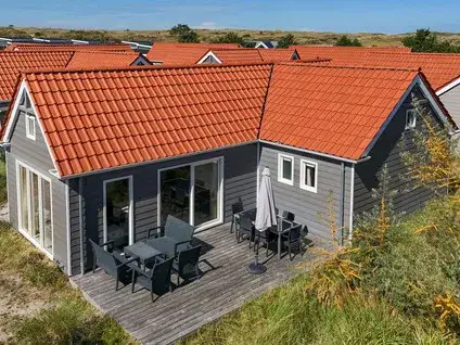
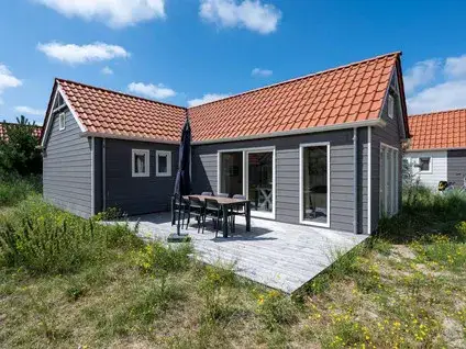
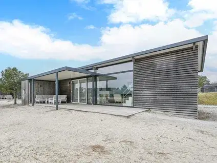
Oranjeweg 46
Verspreide huizen Hollum, Ameland
 Area
AreaA 1942 apartment on Ameland
This apartment on Oranjeweg 46 sits in the Verspreide huizen Hollum area of Hollum, on the island of Ameland. The listing does not state the energy label, so that information is missing from the agent's publication. Built in 1942, the home has a living area of 56 square metres according to the BAG registration, which puts the asking price at 5714 euros per square metre. At 320,000 euros, the asking price is in line with the market, based on the neighbourhood average. For comparison, you can look at other [apartments in Ameland](https://www.koopwoningen/ameland/appartementen/).
The home itself
The apartment dates from 1942 and has a living area of 56 square metres according to the BAG registration. The energy label is also not mentioned, which means you cannot tell from the listing how energy-efficient the home is.
Verspreide huizen Hollum
This is a small neighbourhood with around 95 residents, and the average household size is 1.9 people. A resident of the district gives an average score of 7.75 out of 10, based on one review. This resident says: "A lot of togetherness and safety; if something is wrong, we help each other." They add: "When necessary, we help each other and we also greet everyone we meet." The review reflects the wider district rather than this specific neighbourhood. You can read more about [the Verspreide huizen Hollum neighbourhood](https://www.buurt/verspreide-huizen-hollum-ameland/).
Amenities and transport
The PLUS supermarket is a ten-minute walk away, and the nearest primary school, Christelijke Basisschool Koningin Wilhelmina, is also about a ten-minute walk. The GP practice Huisarts & Apotheek Louwes is in Ballum, a couple of streets away by car. The bus stop Hollum, Vuurtoren/Roompot is on your doorstep, with bus lines 1 and 3. The nearest train station is 43.7 kilometres away, so you would need to travel to the mainland for rail connections. This is all within [the municipality of Ameland](https://www.gemeente/ameland/). According to public risk data at address level, the noise from road traffic is 40 dB Lden, which is not above the noise standard, based on 2022 data. The foundation risk indication is low, with sandy soil and a construction year before 1970. The pluvial flooding risk at heavy rain is medium, while the current flood risk and the flood risk for 2050 are both low. These are area-level indications, not an inspection of this specific home.
Source
At the time of writing, the home is offered only via Van der Velde & Hoen makelaardij o.z.
This summary was generated with AI and may contain errors. Always verify the details with the provider.
Features
Details of this home
Transfer
Price
Energy
 Save up to € 400 on your energy billCompare now
Areas and volume
 Insure your home and belongingsGet insured
Layout
Construction
Outdoor space
The WOZ value is set annually by the municipality with 1 January as its reference date, and therefore lags the market by about a year. It is an estimated market value, not a sale price.
Frequently asked questions
About Oranjeweg 46, Hollum
What is the asking price for this apartment?
The asking price is 320,000 euros. Based on the living area of 56 square metres according to the BAG registration, that works out at 5714 euros per square metre. The price verdict, compared with the neighbourhood average asking price, is that the price is in line with the market.
What is the energy label of this home?
The agent has not published this field, so you cannot tell from the listing how energy-efficient the home is. The home was built in 1942, but no further details about insulation or heating installations are given.
Why are there no property details in this listing?
The agent has not published the energy label in the listing. The address itself is complete, so the location and neighbourhood data are correct.
What is the WOZ value of this apartment?
The municipal valuation is therefore not available for this home, and there is no comparison with the asking price or any historical development to share.
What is the foundation risk for this address?
The foundation risk indication for this address is low, according to public risk data. The soil type is sand, and the home was built before 1970. This is an area-level indication based on public data, not an inspection of this specific home.
What are the flood risks for this property?
The pluvial flooding risk at heavy rain is medium, while the current flood risk is low and the flood risk for 2050 is also low. These are area-level indications from the Klimaateffectatlas, not an assessment of this specific home.
Which supermarkets are near this apartment?
The nearest supermarket is PLUS, about 1.1 kilometres away, which is a ten-minute walk. A SPAR is about 3.9 kilometres away, and further supermarkets are at greater distances. Within five kilometres there are two supermarkets in total.
Which schools are close to this home?
The nearest primary school is Christelijke Basisschool Koningin Wilhelmina, about 945 metres away, which is a ten-minute walk. Openbare Basisschool De Schakel is about 1.2 kilometres away. The nearest secondary school is 8.8 kilometres away, so older children would need to travel further.
What public transport is available nearby?
The bus stop Hollum, Vuurtoren/Roompot is on your doorstep, with bus lines 1 and 3. Two further stops, Hollum, De Blieke and Hollum, Sier aan Zee, are within a few hundred metres. The nearest train station is 43.7 kilometres away.
What do residents say about living in this area?
One resident of the district gives an average score of 7.75 out of 10. They say: "A lot of togetherness and safety; if something is wrong, we help each other." They also mention: "When necessary, we help each other and we also greet everyone we meet." This review reflects the wider district rather than the specific neighbourhood.