De Koog, Texel
 Neighbourhood
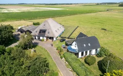
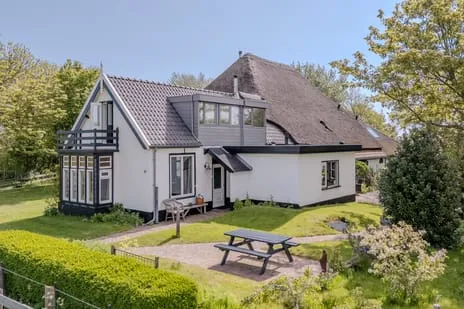
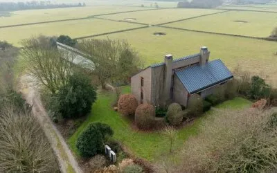
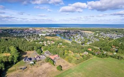
Mienterglop 21 is a detached house in De Koog, a village on the island of Texel. The home was built in 2003 and has an energy label B. The asking price is €2,495,000. With a living area of 147 m² according to the agent, that works out at €16,973 per m², which is on the high side. For comparison, detached houses in Texel are listed at various price points.
The agent describes the property as a house. The living area is 149 m² according to the BAG registration, while the agent lists 147 m². The plot is 1,555 m² according to the BAG, but the agent states 2,620 m². The home has an energy label B.
De Koog is a village on Texel, known for its beach and dunes. Residents of the district Het Oude Land en duingebied give their living environment an average of 8.14, based on three reviews. A resident says: "We have a very social neighbourhood! Everyone is there for each other!" Another adds: "It's a small but cosy and close-knit community." The neighbourhood has about 1,040 inhabitants. The De Koog neighbourhood is part of the municipality of Texel.
For daily groceries, you can walk to Lidl or Jumbo, both just around the corner. The Lubertischool is a ten-minute walk away. The nearest GP is Eilandpraktijk Texel, locatie De Cocksdorp, about 9 km away, and the pharmacy De Texelse Apotheek BV is in Den Burg, about 5 km away. Bus line 28 stops at De Koog, Nikadel, a couple of streets away. The nearest train station is Den Helder, about 16 km away. The municipality of Texel offers further amenities. According to public risk data, the noise level from road traffic is 56 dB Lden, which is above the norm. The foundation risk indication is low, with sandy soil. The climate risk indications are: pluvial flooding at heavy rain is low, current flood risk is low, and flood risk in 2050 is medium. These are area-level indications, not an inspection of this specific home.
At the time of writing, the home is offered only via VOF Makelaardij Texel Vastgoed.
This summary was generated with AI and may contain errors. Always verify the details with the provider.
Details of this home
 Insure your home and belongingsGet insured
About Mienterglop 21, De Koog
The asking price is €2,495,000. With a living area of 147 m² according to the agent, that comes to €16,973 per m². The price is on the high side compared to other detached houses in Texel.
The living area is 149 m² according to the BAG registration, while the agent lists 147 m². The plot is 1,555 m² according to the BAG, but the agent states 2,620 m². The home was built in 2003 and has an energy label B.
The WOZ value is determined by the municipality and is not always included in the listing.
According to public risk data, the noise level from road traffic is 56 dB Lden, which is above the norm. This is an area-level indication, not a measurement at the property itself.
The foundation risk indication is low, with sandy soil. This is based on area-level data and does not constitute an inspection of the specific property.
The climate risk indications are: pluvial flooding at heavy rain is low, current flood risk is low, and flood risk in 2050 is medium. These are area-level indications and not a guarantee for this specific home.
Lidl and Jumbo are both just around the corner, about 700 metres away. SPAR is about 4.2 km away, and Albert Heijn and Aldi are about 5 km away.
The Lubertischool is a ten-minute walk away. For secondary education, OSG de Hogeberg is about 5.6 km away. There are also several other primary schools within about 5.6 km.
Bus line 28 stops at De Koog, Nikadel, a couple of streets away. The Texelhopper also stops nearby. The nearest train station is Den Helder, about 16 km away.
Residents of the district give an average score of 8.14. They describe it as a social and close-knit community. The neighbourhood has about 1,040 inhabitants, with a mix of ages.
Figures on residents, liveability and the housing market
How residents experience their district
We have a very social neighbourhood! Everyone is there for each other! We are the oldest on the street and in need of help, no problem, everyone is there for us! Lovely little neighbourhood, close to the centre! Very cosy to live there! For over 40 years!
Auto-translated to English by AIWe have a very friendly social neighbourhood! Everyone is there for each other! We are the old people, my husband is quite disabled, but we only have to ask and everyone helps us! We are very happy with our little neighbourhood!
Auto-translated to English by AIIt's a small but cosy and close-knit community. The area is also clean and there's little trouble with pests. If I could change something, it would be that more facilities are added or that more is done to make sports clubs more well-known and appealing to young people.
Auto-translated to English by AIFigures on residents, liveability and the housing market
| Sale price | €558,061 | €513,803 |
|---|---|---|
| Sale per m² | €4,659 | – |
How residents experience their municipality
We have a very social neighbourhood! Everyone is there for each other! We are the oldest on the street and in need of help, no problem, everyone is there for us! Lovely little neighbourhood, close to the centre! Very cosy to live there! For over 40 years!
Auto-translated to English by AIWe have a very friendly social neighbourhood! Everyone is there for each other! We are the old people, my husband is quite disabled, but we only have to ask and everyone helps us! We are very happy with our little neighbourhood!
Auto-translated to English by AIIt's a small but cosy and close-knit community. The area is also clean and there's little trouble with pests. If I could change something, it would be that more facilities are added or that more is done to make sports clubs more well-known and appealing to young people.
Auto-translated to English by AIFigures on residents, liveability and the housing market
| Sale price | €558,061 | €513,803 |
|---|---|---|
| Sale per m² | €4,659 | – |
Mienterglop 21, De Koog






Noise, foundation and climate around this address
View more homes nearby


-5c0241e1.webp)