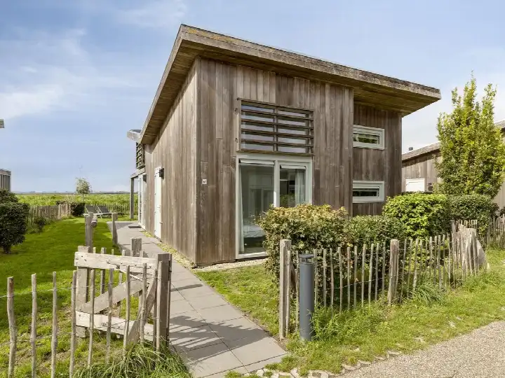
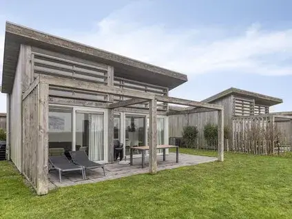
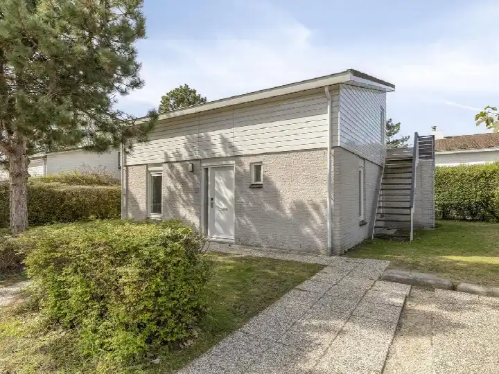
A modern home in a quiet corner of Kamperland
This detached house on Strandloper 76 sits in the Verspreide huizen Kamperland area, a small, spread-out part of Kamperland on Noord-Beveland. The home was built in 2019, so it is recent new-build in a neighbourhood where most homes date from between 1990 and 2010. With an asking price of €325,000, the price is keen compared with the average asking price in the neighbourhood, which comes to €568,307. For context, detached houses in Noord-Beveland are part of a wider market where prices vary widely.
The home itself
This listing does not include details about the layout, such as the number of rooms or bedrooms, nor does it mention any garden, balcony, or garage. What is known is that the home has a living area of 62 m² according to the BAG registration, and the plot measures 426 m². The energy label is A+, which is an efficient label. The asking price works out at €5,242 per m² based on the BAG living area.
The Verspreide huizen Kamperland area
This is a small neighbourhood with about 275 residents, and the average household size is 2.1 people. Around 36% of households are single-person households, and 28% have children. The age spread shows a mix, with 36% of residents between 45 and 65, and 22% aged 65 or older. There are no resident reviews available for this neighbourhood, so there is no direct feedback from people living here. The housing stock is mostly owner-occupied, with 76% of homes being owner-occupied. The Verspreide huizen Kamperland neighbourhood is part of a municipality where recent new-builds like this one are relatively uncommon, as most homes date from earlier decades.
Amenities and transport
For daily errands, the Albert Heijn is just over 2 km away, and the Aldi is a similar distance, so a couple of streets away. The SPAR is a bit further,. For primary education, C B S de Kamperschouw is about 2.1 km away, and Openbare Basisschool De Vliete is about 2.5 km. The nearest GP is Huisartsenpraktijk Kamperland, about 2.1 km away. The nearest pharmacy is in Middelburg, about 11 km away. For public transport, the bus stop Kamperland, Sophiaweg is about 1.2 km away, served by line 31. The nearest train station is Arnemuiden, about 10.3 km away. The municipality of Noord-Beveland offers a rural setting with these amenities spread out.
WOZ value and address data
The WOZ value of this home is €282,000, with a reference date of 1 January 2025. The asking price is 15% above this WOZ value. Over the past five years, the WOZ value has developed according to municipal data, though the specific change is not stated here. As for address-level risks, the noise from road traffic is measured at 37 dB Lden, which is not above the noise standard, based on 2022 data. The foundation risk indication is low, though the soil is clay, which is sensitive to settling. For climate, the pluvial flooding risk is medium, while the flood risk is low both currently and in 2050. These are area-level indications, not an inspection of this specific home.
Source
At the time of writing, the home is offered via multiple channels, including Landal Makelaardij Recreatievastgoed and Landal Makelaardij Recreatievastgoed.
This summary was generated with AI and may contain errors. Always verify the details with the provider.
Features
Details of this home
Transfer
Price
Energy
 Save up to € 400 on your energy billCompare now
Areas and volume
Layout
Construction
Outdoor space
The WOZ value is set annually by the municipality with 1 January as its reference date, and therefore lags the market by about a year. It is an estimated market value, not a sale price.
Frequently asked questions
About Strandloper 76, Kamperland
How does the asking price compare with the WOZ value?
The asking price of €325,000 is 15% above the WOZ value of €282,000, which was set on 1 January 2025. The WOZ value is the municipal valuation for tax purposes, not the current market value. The price is also keen compared with the average asking price in the neighbourhood, which is €568,307, though this home is smaller than the average. The price per m² is €5,242 based on the BAG living area.
What is the energy label of this home?
The energy label is A+, which is an efficient label. This means the home is likely to have relatively low energy costs compared with less efficient labels. In the neighbourhood, only about 10.5% of homes for sale have an A+ label, so this is a relatively uncommon feature. The home was built in 2019, which is recent new-build.
What is the living area of this home?
According to the BAG registration, the living area is 62 m². The plot size is 426 m². The listing does not state the number of rooms or bedrooms, nor does it mention any garden, balcony, or garage. The asking price of €325,000 works out to €5,242 per m² based on the BAG living area.
What is the foundation risk for this address?
The foundation risk indication for this address is low, according to public risk data. The soil type is clay, which is noted as sensitive to settling. This is an area-level indication, not an inspection of this specific home. The data comes from sources like the Atlas Leefomgeving and KCAF, and it gives a general picture of the area rather than a verdict on this property.
What is the flood risk for this home?
The flood risk is low, both currently and in 2050, according to climate risk data. The pluvial flooding risk, which is flooding from heavy rain, is medium. These are area-level indications based on public data from the Klimaateffectatlas, not an inspection of this specific home. The data gives a general sense of the area's vulnerability to flooding.
Which supermarkets are nearby?
The nearest supermarkets are the Albert Heijn at about 2.1 km and the Aldi at about 2.2 km. The SPAR is about 2.6 km away. These are within a short drive or a longer walk. For a larger selection, there are additional supermarkets further out, but these three cover the basics for daily groceries.
What schools are in the area?
There are two primary schools within about 2.5 km: C B S de Kamperschouw at about 2.1 km and Openbare Basisschool De Vliete at about 2.5 km. For secondary education, the nearest school is about 16.7 km away, which is a significant distance. This is something to consider for families with older children.
How far is the nearest bus stop and train station?
The nearest bus stop is Kamperland, Sophiaweg, about 1.2 km away, served by line 31. There is also a stop at Wissenkerke, Nieuweweg, about 1.2 km away, also on line 31. The nearest train station is Arnemuiden, about 10.3 km away. This means public transport options are limited but available.
What is the neighbourhood like demographically?
The Verspreide huizen Kamperland neighbourhood has about 275 residents. The average household size is 2.1 people, and 36% of households are single-person households. Around 28% of households have children. The age distribution shows a mix, with 36% of residents between 45 and 65, and 22% aged 65 or older. There are no resident reviews available for this neighbourhood.