Bentlagestraat 40
Ter Apel, Westerwolde
 Area
AreaA friendly end-of-terrace home in Ter Apel
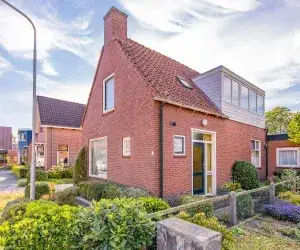
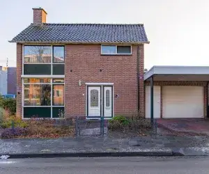
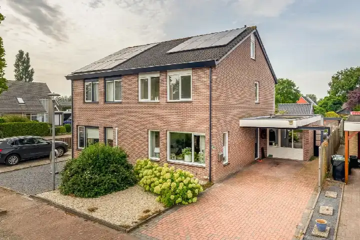
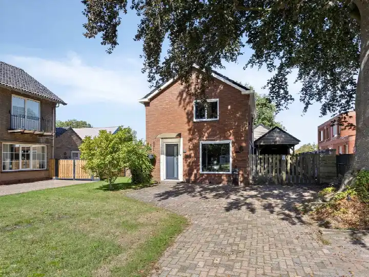
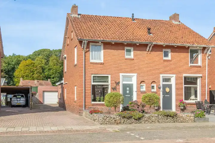
Ter Apel is a village where life moves at a comfortable pace, and this end-of-terrace house on Bentlagestraat sits right in the middle of it. Built in 1965, the home offers 123 square metres of living space on a 440 square metre plot, according to the BAG registration. The asking price of €325,000 is keen compared with the neighbourhood average asking price of €495,031, a difference of 34 percent. For context, [end-of-terrace houses in Westerwolde]( /koopwoningen/westerwolde/hoekwoningen/) are listed at an average of €3,544 per square metre, while this home comes in at €2,642 per square metre.
The home itself
This listing does not include details on the layout, number of rooms, or any outdoor space. What is known is that the house was built in 1965 and carries an energy label D, which means you can expect moderate energy costs. The plot of 440 square metres gives you room to work with, though the agent has not specified how the garden or any outbuildings are arranged.
Ter Apel
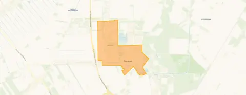
Residents across the municipality of Westerwolde give their living environment an average score of 8.52, based on six reviews. One resident says: "Cosy, helpful, we even have a neighbourhood app, loving, nice neighbourhood to live in." Another adds: "It's a nice area to live in. There are several shops and many things to do (a bit less for the youth) but it remains a fun neighbourhood and beautiful to live in. Beautiful nature areas for walking, cycling, rollerblading and other things." The village itself has around 3,965 inhabitants, with a notable share of residents aged 65 and over. [The municipality of Westerwolde]( /gemeente/westerwolde/) covers a wide rural area, and Ter Apel is its largest village.
Amenities and transport
Daily errands are easy from this address. The Lidl and Jumbo are just around the corner, with the Aldi and Coop a couple of streets away. OBS De Vlinder primary school is on your doorstep, and the Bonifatiusschool is just around the corner, while the Regionale Scholengemeenschap Ter Apel for secondary education is a five-minute walk. The GP practice and BENU pharmacy are both a couple of streets away. Bus stops at Kloosterheerd and Korenakker are on your doorstep, served by lines 42, 72, 73 and 173. The nearest train station is in Emmen, about 14.5 kilometres away.
WOZ and address data
The WOZ value is not stated in the available data, so no comparison with the asking price can be made here. According to public risk data at address level, the noise from road traffic is measured at 50 dB Lden, which is above the Dutch standard, based on 2022 figures. The foundation risk indication is low, with sandy soil and a construction year before 1970. Pluvial flooding at heavy rain is indicated as elevated, while the current flood risk is low and the heat stress indication is low, rising to medium by 2050. These are area-level indications, not an inspection of this specific home.
Source
At the time of writing the home is offered only via Marcel van Dam Makelaardij o.g.
This summary was generated with AI and may contain errors. Always verify the details with the provider.
Features
Details of this home
Transfer
Price
Energy
 Save up to € 400 on your energy billCompare now
Areas and volume
 Insure your home and belongingsGet insured
Layout
Construction
Outdoor space
The WOZ value is set annually by the municipality with 1 January as its reference date, and therefore lags the market by about a year. It is an estimated market value, not a sale price.
Frequently asked questions
About Bentlagestraat 40, Ter Apel
What does the asking price of €325,000 mean for this home?
The asking price is €325,000, which is 34 percent below the average asking price of €495,031 for homes in the neighbourhood. Per square metre, the price is €2,642, compared with an average of €3,544 across the local market. The price verdict is described as keen, meaning it sits on the lower side relative to what is generally asked in this area.
What is known about the layout of this house?
The listing does not state the number of rooms, bedrooms, or bathrooms, nor does it mention a garden, balcony, or garage. The living area is 123 square metres according to the BAG registration, on a plot of 440 square metres. The year of construction is 1965, and the energy label is D. No further details about the interior or outdoor space are provided in the listing.
Why are there no property details in this listing?
The listing for this end-of-terrace house on Bentlagestraat 40 does not include information about the layout, number of rooms, or outdoor space. This means the agent has not specified how the interior is arranged or whether there is a garden, garage, or other features. The available facts are limited to the living area, plot size, year of construction, and energy label.
What is the energy label and what does it mean?
The home has an energy label D. This is a mid-range label, so you can expect moderate energy costs for heating and electricity. In the neighbourhood, 25 percent of the homes for sale have a label D or lower, while 37.5 percent have label B and 37.5 percent have label C. No homes with label A or higher are currently available in the local market.
What do residents say about living in this area?
Residents across the municipality of Westerwolde give their living environment an average score of 8.52, based on six reviews. One resident mentions a cosy, helpful atmosphere with a neighbourhood app, while another highlights the shops, nature areas for walking and cycling, and friendly people. These reviews describe the wider municipality rather than this specific neighbourhood.
What shops and schools are nearby?
The Lidl and Jumbo supermarkets are just around the corner, with the Aldi and Coop a couple of streets away. OBS De Vlinder primary school is on your doorstep, and the Bonifatiusschool is just around the corner. The Regionale Scholengemeenschap Ter Apel for secondary education is a five-minute walk. A GP practice and pharmacy are both within a couple of streets.
How is the public transport connection?
Bus stops at Kloosterheerd and Korenakker are on your doorstep, served by lines 42, 72, 73 and 173. Another stop at Stationsstraat is a couple of streets away with lines 72, 73 and 173. The nearest train station is in Emmen, about 14.5 kilometres away, which requires a bus or car journey to reach.
What are the noise and foundation indications for this address?
Public risk data indicates road traffic noise at 50 dB Lden, which is above the Dutch standard, based on 2022 figures. The foundation risk indication is low, with sandy soil and a construction year before 1970. These are area-level indications from public sources, not an inspection of this specific home.
What is the flood and climate risk for this location?
The pluvial flooding indication at heavy rain is elevated, while the current flood risk is low and remains low by 2050. Heat stress is indicated as low at present, rising to medium by 2050. These figures come from the Klimaateffectatlas and are area-level indications, not an assessment of this particular property.