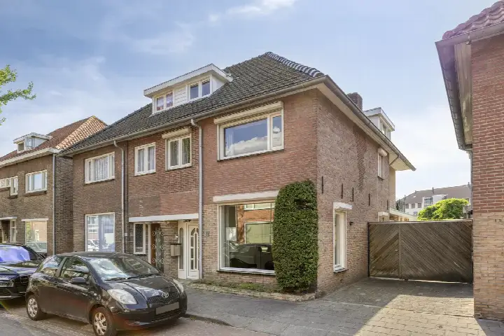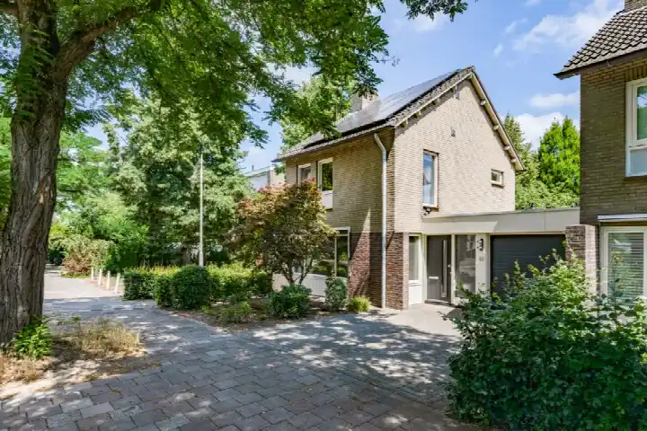
A classic detached home in Aalst
On Emmastraat 1 in Aalst, a village within the municipality of Waalre, stands a detached house from 1936. The home has a living area of 130 square metres according to the agent, while the BAG registration lists 138 square metres. The plot measures 294 square metres. The asking price is €739,000. For context, [detached houses in Waalre]( /koopwoningen/waalre/vrijstaande-woningen/) are listed with an average price of €801,870.
Inside the home
The house has five rooms, including three bedrooms and one bathroom, spread over three floors. The volume is 563 cubic metres. There is a garden around the house: a rear garden of 200 square metres facing north, a front garden of 40 square metres, and additional garden space. The property also includes 5 square metres of storage space. The energy label is B, which is an efficient label.
Life in Aalst
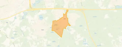
Aalst is a village where people know each other. One resident of the district gives the living environment a score of 8.13 out of 10, based on a single review. This resident says: "People are friendly and greet each other. Children play in the playgrounds and cycle independently on the street without any problems with traffic. Hardly any nuisance and mostly a great neighbourhood." The district has around 3,850 inhabitants, with a mix of ages and household types. The review reflects the district as a whole, not just this specific street. [The Aalst neighbourhood]( /buurt/aalst-waalre/) is part of the municipality of Waalre.
Amenities and transport
Daily errands are easy from here. The Albert Heijn is on your doorstep, and the Jumbo is just around the corner. Basisschool De Drijfveer is a couple of streets away, and De Meent is a five-minute walk. The GP, Medisch Centrum Aalst, huisarts Pikaar, and the pharmacy Apotheek Aalst-Waalre are both just around the corner. The nearest bus stop, Aalst (NB), Maarten Trompstraat, is on your doorstep, with lines 7, 271, 317 and 318. Eindhoven Centraal station is about 5.2 kilometres away. [The municipality of Waalre]( /gemeente/waalre/) offers a range of facilities within reach.
WOZ value and address data
The WOZ value of the home is €631,000, with a reference date of 1 January 2025. The asking price is 17% above this WOZ value. Between 2020 and 2025, the WOZ value rose by 71%, from €370,000 to €631,000. As for address-level risk data, the noise from road traffic is 53 dB Lden, which is above the noise standard, while aircraft noise is 33 dB Lden, below the standard. The foundation risk indication is low, based on the sandy soil and the construction year before 1970. Pluvial flooding at heavy rain is elevated, while the current flood risk is low, and the heat stress indication is low now but medium by 2050. These are area-level indications, not an inspection of this specific home.
Source
At the time of writing, the home is offered via multiple channels, including Niels de Cort Makelaars & Woonadvies.
This summary was generated with AI and may contain errors. Always verify the details with the provider.
Features
Details of this home
Transfer
Price

Areas and volume
Construction
The WOZ value is set annually by the municipality with 1 January as its reference date, and therefore lags the market by about a year. It is an estimated market value, not a sale price.
Frequently asked questions
About Emmastraat 1, Waalre
How does the asking price compare with the WOZ value?
The asking price of €739,000 is 17% above the WOZ value of €631,000, which was set on 1 January 2025. The WOZ value is the municipal valuation, not the current market value. The price per square metre, based on the agent's listed living area of 130 square metres, is €5,685. The neighbourhood average asking price for homes currently for sale is €801,870.
What is the layout of the house?
The house has five rooms in total, including three bedrooms and one bathroom, spread over three floors. The volume is 563 cubic metres. The living area is 130 square metres according to the agent, while the BAG registration lists 138 square metres. The plot measures 294 square metres. There is a rear garden of 200 square metres facing north, a front garden of 40 square metres, and additional garden space, plus 5 square metres of storage.
What is the energy label and what does it mean?
The energy label is B, which is an efficient label. This means the home is relatively energy-efficient compared with less efficient labels, so you can expect moderate energy costs. The label does not say anything about the condition of the building itself. The home was built in 1936, and the energy label reflects the current insulation and heating characteristics as registered.
What is the foundation risk for this home?
The foundation risk indication for this address is low, according to public risk data. This is based on the sandy soil type and the fact that the home was built before 1970, in 1936. This is an area-level indication, not an inspection of this specific home. The data comes from sources such as the Atlas Leefomgeving and KCAF, and it gives a general picture of the risk in the area.
What are the noise levels around this address?
The road traffic noise at this address is 53 dB Lden, which is above the Dutch noise standard. Aircraft noise is 33 dB Lden, which is below the standard. These figures are based on 2022 data and are area-level indications, not measurements taken at the property itself. The noise levels give an impression of the sound environment, but actual experience can vary.
What is the flood risk for this property?
The current flood risk from rivers or the sea is low, and it is expected to remain low by 2050. However, the risk of pluvial flooding, which happens when heavy rain overwhelms drainage, is elevated. The heat stress indication is low now but is expected to become medium by 2050. These are area-level indications from the Klimaateffectatlas, not a detailed assessment of this specific home.
Which supermarkets are nearby?
The nearest supermarket is Albert Heijn, just 179 metres away, so on your doorstep. The Jumbo is 722 metres away, which is just around the corner. There are also other options within a few kilometres, including an AH to go at 2.1 kilometres and another Albert Heijn at 2.4 kilometres. In total, there are 28 supermarkets within 5 kilometres of this address.
What schools are close to this home?
Basisschool De Drijfveer is 453 metres away, a couple of streets from the home. De Meent is 711 metres away, about a five-minute walk. Both are primary schools. For secondary education, Yuverta vmbo en het groene lyceum Eindhoven is about 2.9 kilometres away. There are 38 schools within 5 kilometres, covering primary and secondary education.
How is the public transport in this area?
The nearest bus stop is Aalst (NB), Maarten Trompstraat, just 77 metres away, with bus lines 7, 271, 317 and 318. Another stop, Aalst, De Leesakker, is 174 metres away with line 271. The nearest train station is Eindhoven Centraal, about 5.2 kilometres away. This gives you options for both local and regional travel.
What do residents say about living in Aalst?
One resident of the district gave the living environment a score of 8.13 out of 10. This resident says: "People are friendly and greet each other. Children play in the playgrounds and cycle independently on the street without any problems with traffic. Hardly any nuisance and mostly a great neighbourhood." This review reflects the district as a whole, not just this specific street, and is based on a single review.