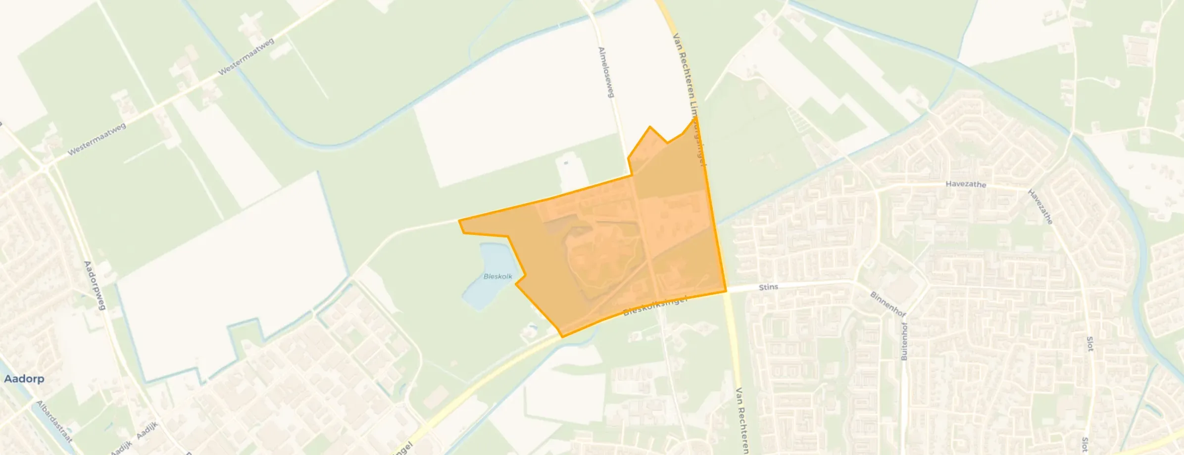
Neighbourhood in Almelo
Aaboer is located in the province of Overijssel, in the municipality of Almelo, in the district Noorderkwartier The neighbourhood has a total area of 41 hectares, of which 41 hectares are land and 0 hectares are water. The neighbourhood is coded as BU01411206. The postcode area is 7602PT-7608PB.
One resident rates the neighbourhood as very good with a score of 8.3. The resident describes this neighbourhood as 'Lots of green and a shopping centre nearby, close to nature where you can enjoy walking.'. Based on a limited number of reviews, no clear trends are visible yet in this neighbourhood.
Aaboer has 235 residents. Of these, 53,2% are men and 46,8% are women. Most residents are 65 years or older (51,1%). The other age groups are 27,7% for '45 to 65 years', 12,8% for '15 to 25 years', 8,5% for '25 to 45 years' and 6,4% for '0 to 15 years'. Of the residents, 42,6% is unmarried, 27,7% is married, 10,6% is divorced and 19,1% is widowed. 205 residents originate from the Netherlands, 10 come from Europe and 20 come from countries outside Europe.
There are 100 households in Aaboer. 60,0% of these are single-person households, 35,0% households without children and 5,0% households with children. The average household size is 1,6 persons. The national average is 2,1 persons.
In Aaboer there are 100 income recipients. The average income per income recipient is €33.300, which is €8.900 (21%) lower than the national average of €42.200. Per resident, the average income is €31.600, which is €3.300 (9%) lower than the national average of €34.900.
In Aaboer, 64% of residents receive a benefit. The largest group is those receiving a state pension (AOW). 110 people receive this benefit.
In Aaboer there are 142 homes with an average assessed value (WOZ) of €326.000. Of these, around 94% are occupied and 6% unoccupied. Most homes are rental properties. This amounts to 80% rental homes and 20% owner-occupied homes. Of the homes, 20% privately owned, 75% owned by housing associations and 5% owned by other landlords. The most common construction periods in Aaboer are 2000-2010 (79%) and 2010-2020 (11%).
There are currently no homes for sale in Aaboer. The most recently listed home is Waterkers 11 by Nieuw Wonen Twente Makelaars op Funda. No homes were sold in Aaboer over the past year.
There are currently no homes for rent in Aaboer. The most recent home is Groene Bruglaan 55, offered by www.woninghuren.nl. No homes were let in Aaboer over the past year.
No recent rental data available for Aaboer.
In Aaboer there are 132 addresses with a registered energy label. The most common labels are A (55%), B (29%) and C (10%). On average, an address in Aaboer uses 2.570 kWh of electricity per year. This is 1% above the national average of 2.550 kWh. With an annual consumption of 590 m³ per address, natural gas consumption is 26% below the national average of 800 m³.
The neighbourhood is mostly a great place to live, but there are also many young people who sometimes think they're something special, and I was once attacked by one. Unfortunately, hygiene is very poor, with lots of wrappers and cans on the ground. From here, you can easily drive to the city centre or to the nearby villages. The community is also good, and there is a retirement home that has just undergone a nice renovation. With public transport, I can easily get to the station and then take the train to my school (Enschede). A five-minute walk away, there is a lovely walking path where I walk and run for hours every week.
Auto-translated to English by AIThe most common type is flats (76%).
Over the past year a home for sale in Aaboer was listed for an average of €400,445 (€3,240 per m²).
A rental home in Aaboer cost an average of €1,320 per month (€13 per m²).
Buurt Aaboer has 235 residents. The largest age group is 65+ years (51%). Notably, 60% of the households are single-person households.
The housing supply in Aaboer is remarkably efficient: 58% has an A, A+ or B label. The average natural gas consumption per household is 590 m³ per year.
From Aaboer you can on average reach a supermarket at 1.4 km, a GP at 1.5 km, a railway station at 4.0 km, a primary school at 1.4 km (as the crow flies, source: CBS).







