Sint Annaparochie Zuidoost is located in the province of Friesland, in the municipality of Waadhoeke, in the district Sint Annaparochie. The neighbourhood has a total area of 29 hectares, of which 29 hectares are land and 0 hectares are water. The neighbourhood is coded as BU19491602. The postcode area is 9076BW-9076PH.
Sint Annaparochie Zuidoost has 795 residents. Of these, 44,0% are men and 55,3% are women. Most residents are 65 years or older (45,9%). The other age groups are 15,7% for '25 to 45 years', 15,7% for '45 to 65 years', 12,6% for '0 to 15 years' and 8,8% for '15 to 25 years'. Of the residents, 36,5% is unmarried, 33,3% is married, 8,8% is divorced and 20,8% is widowed. 715 residents originate from the Netherlands, 20 come from Europe and 55 come from countries outside Europe.
There are 355 households in Sint Annaparochie Zuidoost. 50,7% of these are single-person households, 23,9% households without children and 25,4% households with children. The average household size is 1,9 persons. The national average is 2,1 persons.
In Sint Annaparochie Zuidoost there are 600 income recipients. The average income per income recipient is €27.000, which is €15.200 (36%) lower than the national average of €42.200. Per resident, the average income is €22.600, which is €12.300 (35%) lower than the national average of €34.900. Most residents of Sint Annaparochie Zuidoost are educated to a lower level. 45,5% have a lower education (VMBO or MBO 1), 40,9% have an intermediate education (HAVO, VWO or MBO 2-4) and 13,6% have a university or higher professional education (HBO/WO).
Of the 795 residents, around 63% are in paid employment, which amounts to 501 people. This is 9% lower than the national average of 72%. The majority of workers are in salaried employment (89%), while 11% are self-employed. In Sint Annaparochie Zuidoost, 48% of residents receive a benefit. The largest group is those receiving a state pension (AOW). 340 people receive this benefit.
In Sint Annaparochie Zuidoost there are 455 homes with an average assessed value (WOZ) of €195.000. Of these, around 95% are occupied and 5% unoccupied. Most homes are rental properties. This amounts to 67% rental homes and 33% owner-occupied homes. Of the homes, 33% privately owned, 45% owned by housing associations and 23% owned by other landlords. The most common construction periods in Sint Annaparochie Zuidoost are 1990-2000 (25%) and 1950-1970 (23%).
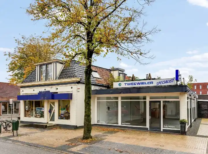
There are currently 3 homes for sale in Sint Annaparochie Zuidoost. The most recently listed home is van Harenstraat 58-60 by Makelaardij Op Maat op Pararius. Over the past year, 5 homes were sold in Sint Annaparochie Zuidoost. On average, a home was sold within 108 days.
The average asking price for a home for sale in Sint Annaparochie Zuidoost over the past year was €356.900. This is 83% higher than the average assessed value (WOZ) of €195.000. The average asking price per m² of floor area is €2.172.
There are currently no homes for rent in Sint Annaparochie Zuidoost. The most recent home is Jan Willem Frisostraat 18, offered by www.frieslandhuurt.nl. No homes were let in Sint Annaparochie Zuidoost over the past year.
No recent rental data available for Sint Annaparochie Zuidoost.
In Sint Annaparochie Zuidoost there are 289 addresses with a registered energy label. The most common labels are A (36%), C (24%) and B (18%). On average, an address in Sint Annaparochie Zuidoost uses 1.870 kWh of electricity per year. This is 27% below the national average of 2.550 kWh. Natural gas consumption, at 860 m³ per year, is 8% above the national average of 800 m³.
The housing stock is mainly post-war — 56% was built between 1945 and 1990.
Over the past year a home for sale in Sint Annaparochie Zuidoost was listed for an average of €396,441 (€2,610 per m²). That is 24% below the Dutch national average.
Buurt Sint Annaparochie Zuidoost has 795 residents. The largest age group is 65+ years (46%). Notably, 51% of the households are single-person households.
From Sint Annaparochie Zuidoost you can on average reach a supermarket at 0.3 km, a GP at 0.4 km, a railway station at 13.2 km, a primary school at 0.3 km (as the crow flies, source: CBS).