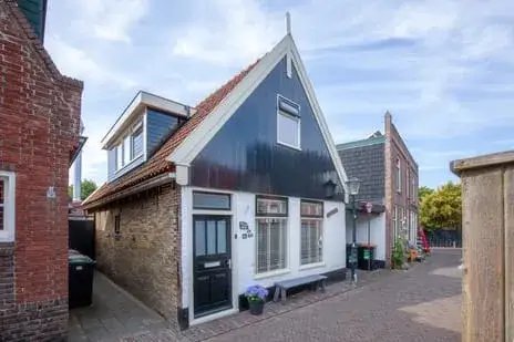
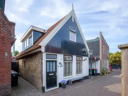
Peperstraat 10
Oosterend, Texel
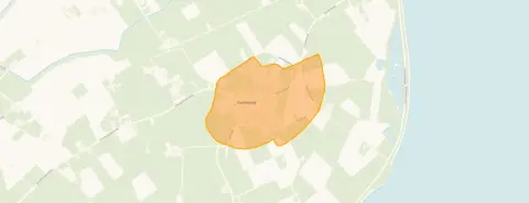 Area
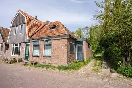
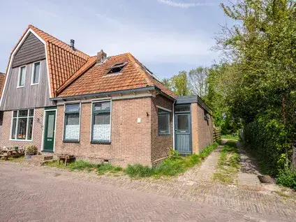
AreaA historic terraced house in Oosterend
Peperstraat 10 sits in the heart of Oosterend, a village on the island of Texel where life moves at its own gentle pace. This terraced house dates from 1750, making it one of the older homes in the area, and carries an energy label F. The asking price of €309,000 is in line with the market, according to the precomputed comparison with the neighbourhood average. For context, terraced houses in Texel give you a sense of what else is available across the municipality.
What the listing tells us
This listing is sparse on details. It does not state the number of rooms, bedrooms, bathrooms, or any information about a garden, balcony, or garage. As a result, the description here is limited to what is known: the property type, the year of construction, and the energy label. The living area is 58 m² according to the BAG registration, and the plot measures 63 m². The price per square metre works out at €5,328 based on the BAG figure.
Life in Oosterend
Oosterend is a small, close-knit community, and residents of the wider district give it an average score of 8.14 out of 10, based on three reviews. "We have a very social neighbourhood! Everyone is there for each other!" says one resident. Another adds: "It's a small but cosy and close-knit community. The area is also clean and there's little trouble with pests." The village has around 940 inhabitants, with a mix of ages and household types. For more on the area, have a look at the Oosterend neighbourhood.
Amenities and getting around
The SPAR supermarket is on your doorstep, just 40 metres away, which makes daily groceries very easy. The nearest primary school, De Bruinvis, is a ten-minute walk, while secondary education is further afield. The GP practice is in De Cocksdorp, and the pharmacy is in Den Burg. The Texelhopper bus stop is a five-minute walk, with line TXL serving the area. The nearest train station is in Den Helder, about 16 km away. The municipality of Texel covers the whole island, with its villages and coastal landscapes.
WOZ and address data
No WOZ value is available for this property, so there is no municipal valuation to compare with the asking price. The address-level risk data indicates that road traffic noise is above the norm, at 49 dB Lden for the reference year 2022. The foundation risk indication is medium, which is an area-level indication based on the fact that the home was built before 1970 and that 90% of properties in this postcode area date from before that year. The soil type is sand. For climate risks, pluvial flooding at heavy rain is elevated, while flood risk is low now and in 2050. Heat stress is low currently but medium by 2050. These are all area-level indications, not an inspection of this specific home.
Source
At the time of writing the home is offered only via Kortekaas & Kooijman makelaars en taxateurs.
This summary was generated with AI and may contain errors. Always verify the details with the provider.
Features
Details of this home
Transfer
Price

Areas and volume
 Insure your home and belongingsGet insured
Layout
Construction
The WOZ value is set annually by the municipality with 1 January as its reference date, and therefore lags the market by about a year. It is an estimated market value, not a sale price.
Frequently asked questions
About Peperstraat 10, Oosterend
How does the asking price compare to other homes in Oosterend?
The asking price of €309,000 is 31% below the neighbourhood average asking price of €448,684, which puts it in line with the market according to the precomputed comparison. The average asking price per square metre in the neighbourhood is €4,033, while this home is listed at €5,328 per m² based on the BAG living area of 58 m². Homes in the area range from €325,000 to €765,000.
What property details are missing from this listing?
The listing does not state the number of rooms, bedrooms, or bathrooms, nor does it mention any garden, balcony, garage, or details about insulation or heating. As a result, the available information is limited to the property type, the year of construction (1750), the energy label F, and the floor areas from the BAG registration.
Why are there no property details in this listing?
The listing is incomplete, which means the agent has not provided information about the layout, rooms, or any outdoor space. What is known is that the home is a terraced house built in 1750 with an energy label F, a living area of 58 m², and a plot of 63 m². For further details, you would need to refer to the information that is available.
What is the energy label and what does it mean for costs?
The energy label for this home is F. Label F is one of the least efficient labels on the scale, so you can expect relatively high energy costs for heating and electricity. The label reflects the energy performance of the home as registered, but the listing does not provide any details about insulation or heating installations. No specific cost figures are available in the listing.
What is the foundation risk for this property?
The foundation risk indication for this address is medium, based on area-level data. This is because the home was built before 1970, specifically in 1750, and 90% of properties in this postcode area date from before 1970. The soil type is sand. This is an area-level indication from public risk data, not an inspection of this specific home.
What are the climate risks for this address?
The climate risk data for this address shows that pluvial flooding at heavy rain is elevated, while flood risk is low both now and in 2050. Heat stress is low currently but is expected to be medium by 2050. These are area-level indications from the Klimaateffectatlas, not an assessment of this specific property. The data gives a general picture of the risks in the area.
What amenities are nearby?
The SPAR supermarket is just 40 metres away, on your doorstep. The nearest primary school, De Bruinvis, is about 5.6 km away, and secondary education is further at around 6.2 km. The GP practice, Eilandpraktijk Texel, is in De Cocksdorp, about 8 km away, and the pharmacy, De Texelse Apotheek, is in Den Burg, about 6 km away. The nearest hospital is in Den Helder.
How is the public transport in the area?
The nearest bus stop is Oosterend, Texelhopper, about 524 metres away, which is a five-minute walk. Bus line TXL serves this stop. The nearest train station is Den Helder, approximately 16 km away. No travel times or destinations are stated in the listing, so the information is limited to the stop name, the line number, and the distances.
What do residents say about living in this area?
Residents of the wider district give an average score of 8.14 out of 10, based on three reviews. One resident says: "We have a very social neighbourhood! Everyone is there for each other!" Another mentions: "It's a small but cosy and close-knit community. The area is also clean and there's little trouble with pests." These reviews describe the district, not specifically the Oosterend neighbourhood.
How old is this home and what does that mean?
The home was built in 1750, making it over 270 years old. This is a fact about the construction year, and the listing does not provide any information about the condition of the property. The energy label is F, which suggests higher energy costs. No details about the maintenance state or any renovations are stated in the listing.








-c5571d9d.webp)
-9cb865c0.webp)