Elferinksweg 47
Stevenfenne, Enschede
 Area
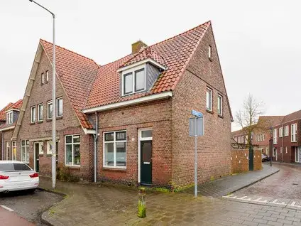
AreaA corner house with character
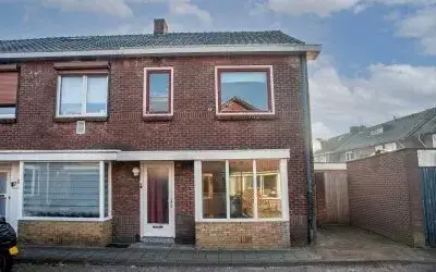
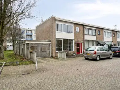
This 1934 corner house on Elferinksweg sits in the Stevenfenne neighbourhood of Enschede. With 95 m² of living space and a 147 m² plot, it has a classic layout and a large garden. The energy label G means heating costs will be high. At €250,000, the asking price is below the neighbourhood average of €271,600, making it a keen option compared to other end-of-terrace houses in Enschede.
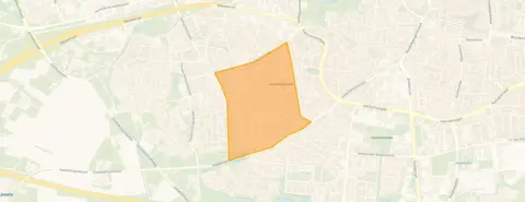
Stevenfenne: cosy and urban
Stevenfenne is a densely built neighbourhood with 2,952 addresses per km², so it feels very urban. One resident describes it as "cosy" and notes that "the Jumbo is the neighbourhood's supermarket". The area has a mix of ages, with many singles and young adults. Most homes are pre-war, and over 70% have a low energy label. The neighbourhood Stevenfenne is lively and well-connected.
Daily life on Elferinksweg
For your morning bread, Dirk is just around the corner, and Aldi and Albert Heijn are a couple of streets away. Kids can walk to De Noorderkroon primary school within a few minutes, while Openbare Basisschool De Spinner is a five-minute walk. The municipality Enschede offers plenty of parks and restaurants nearby.
Source
At the time of writing the home is listed through several channels, including Extra Makelaars, Funda and Vastgoed Nederland.
This summary was generated with AI and may contain errors. Always verify the details with the provider.
Features
Details of this home
Transfer
Price
Energy
 Save up to € 400 on your energy billCompare now
Areas and volume
 Insure your home and belongingsGet insured
Layout
Construction
Outdoor space
Frequently asked questions
About Elferinksweg 47, Enschede
Is €250,000 a fair price for this house?
The asking price of €250,000 is below the average sale price in Stevenfenne (€275,000) and the average asking price (€271,600). Given the 95 m² floor area, that works out to about €2,632 per m², while the neighbourhood average is €3,209 per m². So it is priced keenly, though the low energy label G may mean higher running costs.
What is the neighbourhood like?
Stevenfenne is a very urban area with a high density of addresses. It has a mix of singles, couples and families, and many homes date from before 1945. One resident calls it 'cosy' and appreciates having the Jumbo supermarket nearby. The neighbourhood scores an 8.25 out of 10 based on one review.
How far is the train station?
The nearest train station is 2.6 km away, which is about a 30-minute walk or a short bike ride.
What schools are nearby?
There are several primary schools within walking distance. De Noorderkroon is 260 m away, Openbare Basisschool De Spinner is 502 m, and CBS De Koning is 591 m. For secondary education, the nearest school is 0.9 km away.
What supermarkets are close by?
Dirk is 483 m away, Aldi 584 m, and Albert Heijn 585 m. So you have three supermarkets within a five- to ten-minute walk. There is also a SPAR express at 932 m and a Lidl at 1 km.
What does energy label G mean?
Energy label G is the lowest rating, meaning the home is not energy-efficient. You can expect high heating costs, especially in winter. The house was built in 1934 and likely has poor insulation. In the neighbourhood, over 70% of homes have a label D or lower.
Is there a garden?
The listing does not specify the garden size or orientation, but the corner position may give more outdoor space than a terraced house.