Buurtje.nl takes action against PHP vulnerability
Give feedback Report a problem
Neighbourhood in TynaarloVries
Drenthe›Tynaarlo›Vries›Vries

Neighbourhood Vries

Municipality of Tynaarlo

Vries has 4,040 residentsMost are 65 years or older old
There are 1,865 homes in VriesCurrently there are 26 for sale and 2 for rent
Energy label A is the most common in VriesBased on registered homes

Vries is located in the province of Drenthe, in the municipality of Tynaarlo, in the district Vries. The neighbourhood has a total area of 373 hectares, of which 372 hectares are land and 1 hectares are water. The neighbourhood is coded as BU17300900. The postcode area is 9481AA-9481TR.

Residents

Vries has 4.040 residents. Of these, 48,5% are men and 51,4% are women. Most residents are 65 years or older (33,0%). The other age groups are 28,1% for '45 to 65 years', 18,8% for '25 to 45 years', 11,9% for '0 to 15 years' and 8,2% for '15 to 25 years'. Of the residents, 39,6% is unmarried, 43,7% is married, 7,7% is divorced and 8,9% is widowed. 3.645 residents originate from the Netherlands, 130 come from Europe and 260 come from countries outside Europe.

There are 1.810 households in Vries. 35,4% of these are single-person households, 37,3% households without children and 27,3% households with children. The average household size is 2,1 persons. The national average is 2,1 persons.

In Vries there are 3.200 income recipients. The average income per income recipient is €41.400, which is €800 (2%) lower than the national average of €42.200. Per resident, the average income is €35.600, which is €700 (2%) higher than the national average of €34.900. Most residents of Vries are educated to an intermediate level. 38,1% have an intermediate education (HAVO, VWO or MBO 2-4), 35,4% have a university or higher professional education (HBO/WO) and 26,5% have a lower education (VMBO or MBO 1).

Of the 4.040 residents, around 68% are in paid employment, which amounts to 2.747 people. This is 4% lower than the national average of 72%. The majority of workers are in salaried employment (84%), while 16% are self-employed. In Vries, 39% of residents receive a benefit. The largest group is those receiving a state pension (AOW). 1.190 people receive this benefit.

Housing

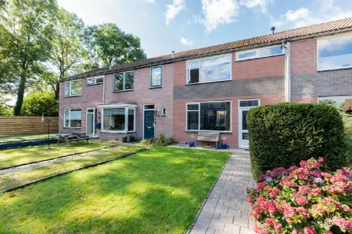
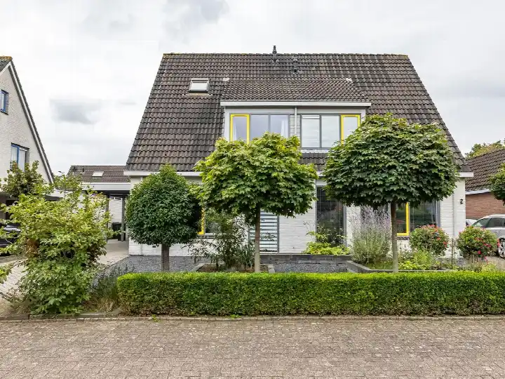
In Vries there are 1.865 homes with an average assessed value (WOZ) of €361.000. Of these, around 98% are occupied and 2% unoccupied. Most homes are owner-occupied. This amounts to 28% rental homes and 72% owner-occupied homes. Of the homes, 73% privately owned, 21% owned by housing associations and 6% owned by other landlords. The most common construction periods in Vries are 1970-1980 (25%) and 1980-1990 (18%).

Homes for sale in Vries

There are currently 26 homes for sale in Vries. The most recently listed home is Volmachten 52 by Lamberink. Over the past year, 51 homes were sold in Vries. On average, a home was sold within 52 days.

The average asking price for a home for sale in Vries over the past year was €544.196. This is 51% higher than the average assessed value (WOZ) of €361.000. The average asking price per m² of floor area is €3.200.

Rental homes in Vries

There are 2 homes for rent in Vries. The most recent home is Eiberkampen 9, offered by www.thuiskompas.nl. Over the past year, 9 homes were let in Vries. On average, a listing was let within 22 days.

The average rent for a rental home in Vries over the past year was €1.087 per month. Per m² of floor area that is €20 per month.

Energy

In Vries there are 1.259 addresses with a registered energy label. The most common labels are A (29%), C (22%) and B (21%). On average, an address in Vries uses 2.590 kWh of electricity per year. This is 2% above the national average of 2.550 kWh. Natural gas consumption, at 1.050 m³ per year, is 31% above the national average of 800 m³.

Street names

  • S.A. Haadsmastraat
  • Boskamp
  • Veenweg
  • Oude Asserstraat
  • Volmachten
  • Oosterkampen
  • Holtkampen
  • Oosterwaterweg
  • Veldkampen
  • Raadhuisplein
  • Etstoel
  • Eiberkampen
  • Kerspel
  • Holtveen
  • Leeuwerikstraat
  • Houtwallen
  • Merelstraat
  • Nieuwe Holtenweg
  • Lottinge
  • Boerhoorn
  • De Fledders
  • Holtenweg
  • Blauwpotskamp
  • Tienkampen
  • Soltstede
  • Nieuwe Rijksweg
  • Westerstraat
  • Eikenlaan
  • Valkenlaan
  • Leliestraat
  • Esveen
  • Verlengde Noordenveldweg
  • Bannerschulte
  • Westeres
  • Domnies Pattie
  • Nijstad
  • Tussenweg
  • Walkampen
  • Het Rocht
  • Mezenstraat
  • Rezzago
  • Molenstraat
  • Esakkers
  • Koekoekstraat
  • Boermarke
  • Oude Rijksweg
  • Koffiedik
  • Drosten
  • Veltenburgerdijk
  • Graskampen
  • Korenbloemstraat
  • De Goorns
  • Tynaarlosestraat
  • Papaverstraat
  • Kerkpad
  • Nachtegaalstraat
  • Klaverkampen
  • Diepsloot
  • Sperwerstraat
  • Kornoeljeplein
  • Lutkekampen
  • Eswal
  • Markestraat
  • Meeuwenlaan
  • Sprikkenveen
  • Noordenveldweg
  • Legakker
  • Waardeel
  • Brinkstraat
  • Voorste Kampen
  • Taarloseweg
  • Wielewaalstraat
  • Asserstraat
  • Tipkampen
  • Sportlaan
  • Groningerstraat
  • Hulstkampen
  • Rietwal
  • Dingspil
  • Reigerstraat
  • Veenkampen
  • Groenkampen
  • Grote Kampen
  • Schultestraat
  • Brink
  • Nieuwe Stukken

Amenities

GP
0,9 km
Pharmacy
1,0 km
Hospital
8,4 km
Supermarket
0,8 km
Railway station
9,8 km
Day nursery
0,7 km
Primary school
0,7 km
Secondary school
8,1 km
Rate Vries

Share your opinion and help improve the neighbourhood.

  • Takes less than 2 minutes
  • Help home seekers
  • Improve your neighbourhood
Write a review
–
Vries has no ratings yet
Ratings can be submitted via the button below
Write a review
Safety
Housing
Cleanliness
Amenities
Education
Community
Greenery
Accessibility

Statistics about the residents

Ages

Residents per age category

Household composition

Households per category
640Single-person households
675Households without children
495Households with children

Gender

Residents by gender
Men
Women

Marital status

Residents by marital status
Married
Unmarried
Divorced
Widowed

Origin

Residents per category of origin
Netherlands
Europe
Outside Europe

Work & income

Labour participation and average income
€35,600 P.A.average per resident2% above the national average
€41,400 P.A.average per income recipient2% below the national average
84%of the employed are in paid employment
16%of the employed are self-employed
68%
of the residents are employed
72%
is the national average

Education level

Residents per education level
VMBO, MBO 1
HAVO/VWO, MBO 2-4
HBO/WO

Wealth

Median wealth per household
Vries
Netherlands

Benefits

Residents per benefit type
Social assistance
Disability
Unemployment

Housing market in Vries

Sale price · Q4 2026
€598.917
average▲ 21,5%
€599.750
median▲ 33,3%
6 sales · vs. Q3 2026
€/m² for sale · Q4 2026
€3.715
average▲ 14,9%
€3.692
median▲ 20,2%
+5% vs. national average

Sales market

Market speed and dynamics, last 12 months
52 days ▼ 12,3%
average time listed · vs. last year
51
sales in the past year
186 m²
average living area
+5%
more expensive than the national average

Rental market

Market speed and dynamics, last 12 months
22 days ▲ 73,4%
average time listed · vs. last year
9
lettings in the past year
55 m²
average living area
-42%
cheaper than the national average

Year built

Age of the housing stock

Energy labels

Sustainability of the housing stock

Living area

Distribution of home sizes

Statistics about the homes

Home types

Addresses per home type

Construction periods

Addresses per construction period

Labels

Addresses per energy label

Energy consumption

Average per address, compared with the Netherlands
Natural gas (m³)
Vries
1.050
Netherlands
800
Electricity (kWh)
Vries
2.590
Netherlands
2.550

Frequently asked questions about Vries

What kind of homes are there in Vries?

The housing stock is mainly post-war — 61% was built between 1945 and 1990.

What do you pay for a house in Vries?

Over the past year a home for sale in Vries was listed for an average of €544,196 (€3,200 per m²). Last quarter prices rose by 21%.

What kind of people live in Vries?

Buurt Vries has 4,040 residents. The largest age group is 65+ years (33%).

How energy-efficient are the homes in Vries?

The housing supply in Vries is remarkably efficient: 72% has an A, A+ or B label. The average natural gas consumption per household is 1,050 m³ per year.

What is within walking distance in Vries?

From Vries you can on average reach a supermarket at 0.8 km, a GP at 0.9 km, a railway station at 9.8 km, a primary school at 0.7 km (as the crow flies, source: CBS).

How many houses are on offer in Vries?

Right now you will find 26 homes for sale and 2 homes for rent in Vries.

Homes Rate your neighbourhood
Buurtje.nl
Buurtje.nl in the appSearch faster and respond first
Open