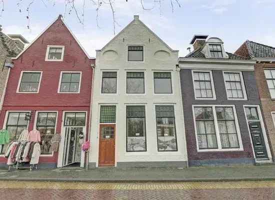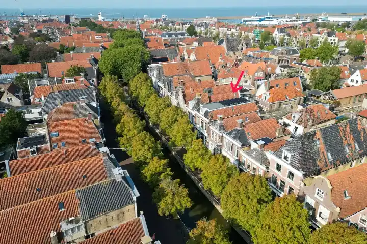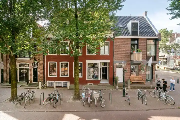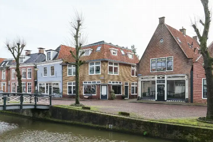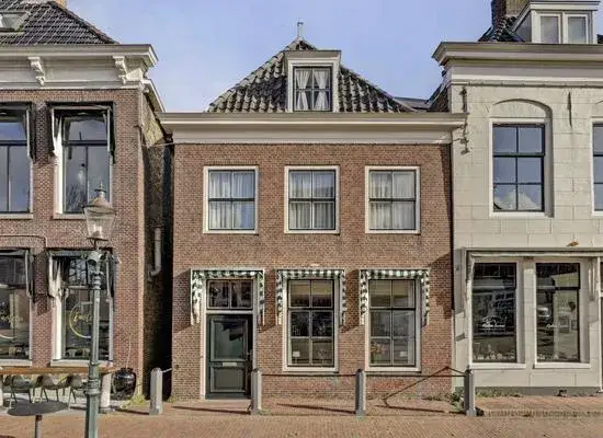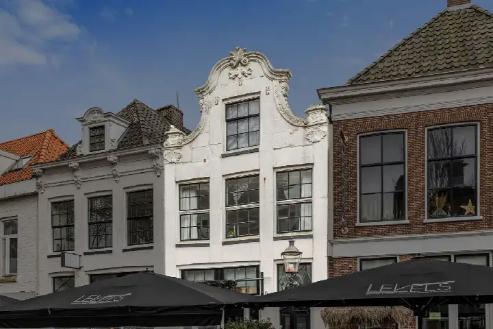





A 19th-century terraced house in the heart of Harlingen
This 1882 terraced house sits right in the centre of Harlingen, in the Binnenstad neighbourhood. The listing did not state an energy label, so that information was missing. With seven rooms spread over two floors, there is plenty of space to work with. The last known asking price of €294,500 was keen compared with the average asking price in the neighbourhood, which came to €511,444. For context, [terraced houses in Harlingen]( /koopwoningen/harlingen/tussenwoningen/ ) are part of a market where 36 homes are currently available. This home has not been online since 14 October 2026.
The home itself
The agent described this as a single-family terraced house with seven rooms, three bedrooms and one bathroom. The living area was listed at 98 m² by the agent, while the BAG registration records 162 m². The plot measured 94 m² according to the agent, against 87 m² in the BAG registration. There is a garden of 15 m² facing northwest, and the home has HR glazing and a central heating boiler. It was offered in full ownership.
Life in the Binnenstad
Residents of the district give their surroundings an average score of 7.36, based on four reviews. One resident describes it as a "nice cosy safe neighbourhood", though adding that there is little nature and no forest. Another says: "Not very involved with each other, almost no contact, little knowledge of each other. There are enough schools and playgrounds here, you have enough facilities to suit your lifestyle, safe enough, fortunately little happens here." The district has 3,445 inhabitants, with a large share of one-person households. [The Binnenstad neighbourhood]( /buurt/binnenstad-harlingen/ ) is home to a mix of ages, with 35% of residents aged 65 or over.
Amenities and transport
Daily errands are easily done on foot. The Jumbo supermarket is just around the corner, with the Aldi a couple of streets away and the Albert Heijn a five-minute walk. Basisschool Sint Michael is on your doorstep, and the Simon Vestdijk regionale scholengemeenschap is a ten-minute walk. The GP practice Huisartsen Havenplein is a five-minute walk, and the BENU Apotheek Westerterp is just around the corner. Bus stops at Steenhouwersstraat and Station are a couple of streets away, served by lines 71, 99 and 197, among others. Harlingen train station is a five-minute walk. [The municipality of Harlingen]( /gemeente/harlingen/ ) offers further facilities within easy reach.
WOZ and address data
The WOZ value is not stated in the available data. As for address-level risk indications, these are area-level indications rather than an inspection of this specific home. The noise level from road traffic is 52 dB Lden, above the noise standard, while railway and aircraft noise stay below their standards. The foundation risk indication is elevated, with the home built in 1882 on clay soil, and 11% of properties in this postcode area have an elevated risk of pile rot. Pluvial flooding at heavy rain is indicated as elevated, while flood risk is low now and in 2050. Heat stress is medium, both now and in 2050.
Source and agent
When this home was still on the market, it was offered via multiple channels, including Stegenga Makelaars on Funda and other listings by the same agency.
This summary was generated with AI and may contain errors. Always verify the details with the provider.
Features
Details of this home
Transfer
Price

Areas and volume
 Insure your home and belongingsGet insured
Layout
Construction
Outdoor space
Frequently asked questions
About Heiligeweg 13, Harlingen
What did the asking price of €294,500 mean for this home?
The asking price was €294,500. Compared with the average asking price in the Binnenstad neighbourhood, which was €511,444, this price was 42% lower. The price per square metre, based on the agent's living area of 98 m², was €3,005, which was 19% below the neighbourhood average of €3,725 per m². These figures come from the current listings in the area.
How many rooms and bedrooms does this terraced house have?
According to the agent, the home had seven rooms in total, including three bedrooms and one bathroom, spread over two floors. The living area was listed at 98 m² by the agent, while the BAG registration records 162 m². The plot was 94 m² according to the agent, against 87 m² in the BAG registration. There is also a garden of 15 m² facing northwest.
Why was there no energy label in this listing?
The agent had not published this field. The address itself is complete, so the location and neighbourhood data are accurate, but the energy label is missing from the available information.
What do residents say about living in this district?
Residents of the district give their surroundings an average score of 7.36, based on four reviews. One resident calls it a "nice cosy safe neighbourhood", though noting there is little nature and no forest. Another resident mentions that people are not very involved with each other, but that there are enough schools and playgrounds, and that little happens there. These reviews describe the wider district, not this specific street.
What shops and schools are within walking distance?
The Jumbo supermarket is about 290 metres away, with the Aldi at 367 metres and the Albert Heijn at 495 metres. Basisschool Sint Michael is 173 metres away, and Openbare basisschool 't Wad is 545 metres. For secondary education, the Simon Vestdijk regionale scholengemeenschap is 565 metres away. The GP practice Huisartsen Havenplein is 548 metres from the home.
How far is the nearest public transport stop?
The nearest bus stop is Harlingen, Steenhouwersstraat, at 329 metres, served by lines 71, 99 and 197. Harlingen station is 443 metres away for buses and 466 metres for the train station itself. The ferry terminal stop is 480 metres away. These stops connect the home to the wider area, though specific destinations and frequencies are not part of the available data.
What does the foundation risk indication mean for this address?
The foundation risk indication for this address is elevated, based on area-level data from the Klimaateffectatlas and KCAF. The home was built in 1882 on clay soil, which may involve wooden piles or a shallow foundation. In this postcode area, 89% of properties were built before 1970, and 11% of properties have an elevated risk of pile rot. This is an area-level indication, not an inspection of this specific home.
What is the noise situation around this home?
The road traffic noise level at this address is 52 dB Lden, which is above the noise standard, based on 2022 data. Railway noise is 30 dB Lden, below the standard, and aircraft noise is 37 dB Lden, also below the standard. These are area-level indications from public data, not measurements taken at the property itself.
How does the living area compare with other homes in the neighbourhood?
The agent listed the living area at 98 m², which was 40% smaller than the neighbourhood average of 164 m². The BAG registration, however, records 162 m². The neighbourhood average was based on current listings in the Binnenstad. The difference between the two sources is not explained in the available data.
What is the flood risk for this property?
The current flood risk for this address is low, and it is expected to remain low in 2050. Pluvial flooding at heavy rain is indicated as elevated. Heat stress is medium, both now and in 2050. These are area-level indications from the Klimaateffectatlas, not an assessment of this specific property.