




A classic apartment in a leafy Den Haag street
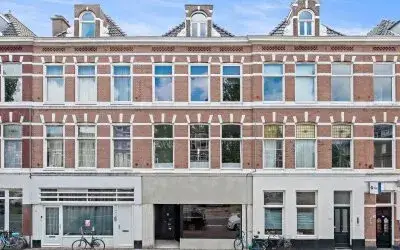
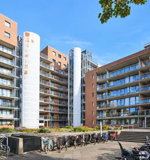
This apartment sits on the first floor of a 1955 building on Stadhoudersplantsoen, a quiet street in the Duinoord district of Den Haag. The area is known for its wide avenues and pre-war architecture, and the sea is within easy reach. With an asking price of €500,000, the price is keen compared with the neighbourhood average asking price of €652,646. For context, [apartments in Den Haag] vary widely in price, but this one sits below the local median.
The home itself
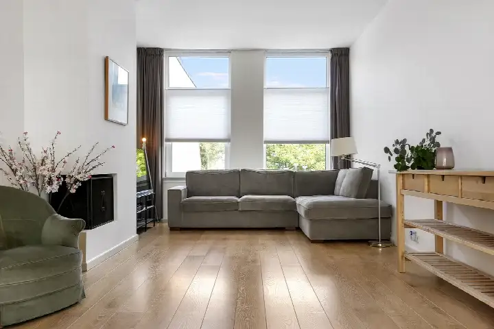
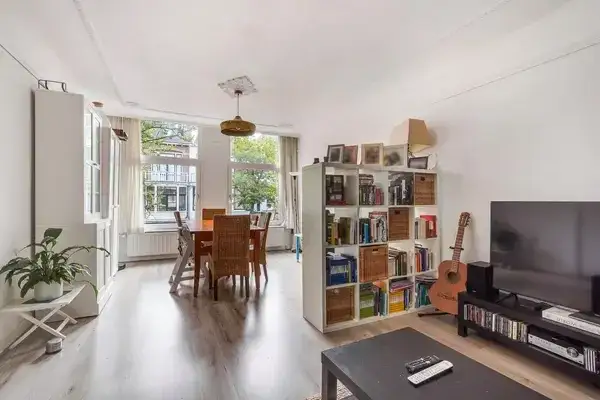
The apartment has three rooms, including two bedrooms and one bathroom, all on a single floor. The living area is 95 m² according to the agent, while the BAG registration lists 93 m². The total volume is 316 m³. The property has an energy label C, which means it is not the most efficient, so expect moderate energy costs. The building dates from 1955, a fact that gives the home its classic character.
Life on Stadhoudersplantsoen
Residents of the wider district give their living environment an average score of 7.04, based on three reviews. One resident says: "Lovely place to live. Close to the sea, city centre and shops. Wide choice of schools. Good community spirit. Street parties etc." Another notes: "I think this is a very nice place to have grown up, it is very accessible by public transport and other modes of transport. Yet there are also small streets where you can play outside." A third review is less positive, with a score of 3.0. The district has a mix of ages, with 35% of residents between 25 and 45, and 54% of households are single-person. For more on the area, see [the Stadhoudersplantsoen neighbourhood].
Amenities and transport
Daily errands are easy from here. The nearest pharmacy, Apotheek Statenkwartier, is just around the corner, and a GP practice is a couple of streets away. Several Albert Heijn supermarkets are within a ten-minute walk, and a PLUS is a bit further. For schools, De Parachute primary school is about 4.8 km away, and Sint-Maartenscollege secondary school is 5.6 km. Public transport is well served: bus line 24 stops at Van Boetzelaerlaan, bus line 21 at Valeriusstraat, and tram line 11 at Houtrust, all just around the corner. The nearest train station, Den Haag Centraal, is about 3.3 km away. For more on the wider area, see [the municipality of Den Haag].
WOZ and address data
No WOZ value is available for this property, so no comparison with the asking price can be made. As for address-level risks, the noise from road traffic is 52 dB Lden, which is above the norm, while railway and aircraft noise are below their norms. The foundation risk indication is medium, based on the building being constructed before 1970, and the area is a KCAF attention zone. These are area-level indications, not an inspection of this specific home. For climate, the risk of pluvial flooding is low, as is the current flood risk, but heat stress is currently medium and could become elevated by 2050.
Source and agent
At the time of writing, the home is offered via multiple channels, including Makelaarsland. The listing is available through at least two sources.
This summary was generated with AI and may contain errors. Always verify the details with the provider.
Features
Details of this home
Transfer
Price
Energy
 Save up to € 400 on your energy billCompare now
Areas and volume
Layout
Construction
Frequently asked questions
About Stadhoudersplantsoen 196, 'S-Gravenhage
How does the asking price compare with other homes in the neighbourhood?
The asking price of €500,000 is 23% below the average asking price in the neighbourhood, which is €652,646. The average price per square metre in the area is €5,761, while this home is listed at €5,263 per m² based on the agent's floor area. The price is described as keen compared with the neighbourhood average.
What is the layout of this apartment?
The apartment has three rooms in total, including two bedrooms and one bathroom, all on a single floor. The living area is 95 m² according to the agent, while the BAG registration lists 93 m². The total volume is 316 m³. The property is located on the first floor of the building.
What is the energy label and what does it mean for costs?
The energy label is C. This is not the most efficient label, so you can expect moderate energy costs for heating and electricity. The label does not indicate the condition of the building itself, only its energy performance. The building was constructed in 1955, which is a separate fact from the energy label.
What is the foundation risk for this property?
The foundation risk indication for this address is medium. This is based on the building being constructed before 1970, and the area is a KCAF attention zone where 100% of properties in the postcode area were built before 1970. This is an area-level indication, not an inspection of this specific home.
What public transport options are available nearby?
There are several stops within a short walk. Bus line 24 stops at Van Boetzelaerlaan, bus line 21 at Valeriusstraat, and tram line 11 at Houtrust, all about 200 metres away. The nearest train station is Den Haag Centraal, approximately 3.3 km from the home.
What amenities are close to this apartment?
The nearest pharmacy, Apotheek Statenkwartier, is about 195 metres away. A GP practice is about 350 metres away. Several Albert Heijn supermarkets are within 650 to 980 metres, and a PLUS is about 1 km away. For schools, De Parachute primary school is about 4.8 km away, and Sint-Maartenscollege secondary school is about 5.6 km away.
What is the neighbourhood like according to residents?
Residents of the wider district give their living environment an average score of 7.04, based on three reviews. One resident praises the proximity to the sea, city centre and shops, and mentions a good community spirit. Another notes good public transport and safe playgrounds for children. A third review is very negative, with a score of 3.0.
Is there a risk of flooding or heat stress in this area?
The risk of pluvial flooding is low, and the current flood risk is also low. However, heat stress is currently medium and could become elevated by 2050. These are area-level indications based on public climate data, not an assessment of this specific property.