Potgieterstraat 1
Potgieterbuurt, Haarlem
 Area
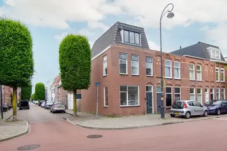
AreaA classic end-of-terrace home in Haarlem
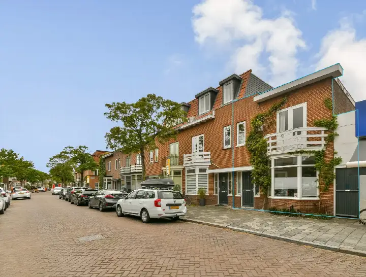
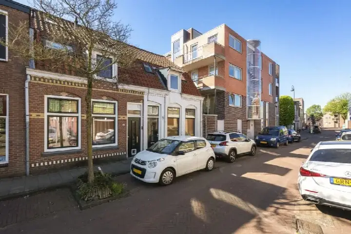
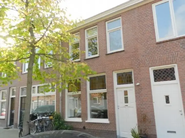
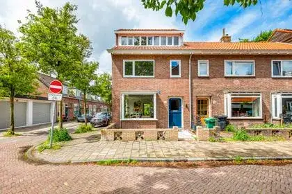
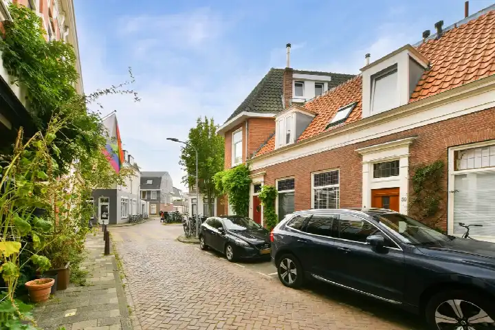
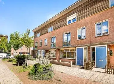
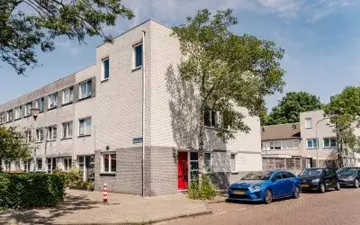
Potgieterstraat 1 is an end-of-terrace house from 1927, sitting in the Potgieterbuurt, a neighbourhood within the Amsterdamsewijk district of Haarlem. The home is set on a quiet road in a residential area, and the asking price of €595,000 is on the high side compared with the average of €544,667 for homes currently for sale in the neighbourhood. For context, the median asking price in the Potgieterbuurt is €599,000, so this home sits close to that figure. Across the municipality, end-of-terrace houses in Haarlem are listed at an average of €5,690 per square metre, while this home is priced at €7,169 per square metre based on the agent's floor area.
Inside the home
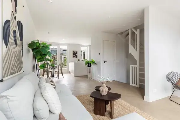
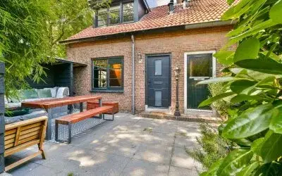
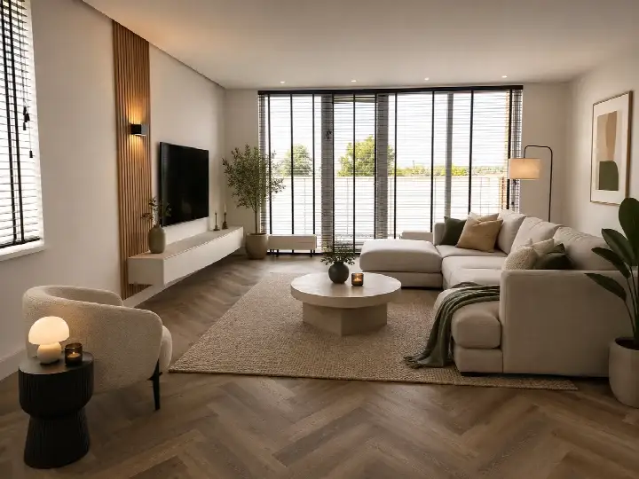
According to the agent, this end-of-terrace house has four rooms, two bedrooms and one bathroom spread over two floors, with a volume of 312 cubic metres. The living area is listed as 83 square metres by the agent, while the BAG registration records 92 square metres; the plot is 106 square metres in both sources. The home has a garden facing southwest, and it is sold as freehold ownership. The agent notes insulation in the roof, double glazing and floor insulation, and the home is heated by a central heating boiler. The energy label is E, which is the least efficient label, so expect higher energy costs.
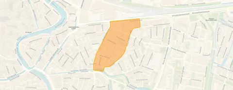
The Potgieterbuurt
With 1,880 residents, the Potgieterbuurt is a compact urban neighbourhood with a high address density of 4,410 per square kilometre, making it very strongly urban. About 67% of the homes are single-family houses, and 52% are owner-occupied. Residents across the municipality of Haarlem give their living environment an average score of 7.29 out of 10, based on 73 reviews. One resident says: "very nice and beautiful neighbourhood." Another, who has lived there for almost 30 years, describes a decline in recent years, mentioning litter and a lack of connection among some newer residents. A third simply calls it a "Nice neighbourhood." The neighbourhood is home to the Potgieterbuurt neighbourhood, where nine homes are currently for sale.
Amenities and transport
The Dekamarkt supermarket is just around the corner, with another and a third just over a kilometre away. The Franciscus Xaveriusschool is a couple of streets away, and the Martin Luther Kingschool is. The Teyler Apotheek BV pharmacy is on your doorstep, while the nearest GP practice, Huisartsenpraktijk te Slaa, is. Bus stops are close by: Haarlem, Nagtzaamplein serves line 2, and Haarlem, Teding van Berkhoutstraat serves lines 2, 567 and 569. Haarlem train station is a ten-minute walk away. The municipality of Haarlem offers a range of amenities within easy reach.
WOZ and address data
No WOZ value is available for this home. The address risk data, which is an area-level indication rather than an inspection of this specific home, shows road traffic noise at 52 dB Lden, which is above the noise standard, while railway noise at 41 dB Lden and aircraft noise at 42 dB Lden are both below the standard. The foundation risk indication is medium, partly because the home was built before 1970, and 71% of properties in this postcode area date from before that year. Pluvial flooding at heavy rain is indicated as medium, while flood risk is low both now and in 2050; heat stress is medium now and in 2050.
Source
At the time of writing, the home is offered via multiple channels, including Cirkel Makelaars, Huispedia and Funda.
This summary was generated with AI and may contain errors. Always verify the details with the provider.
Features
Details of this home
Transfer
Price
Energy
 Save up to € 400 on your energy billCompare now
Areas and volume
 Insure your home and belongingsGet insured
Layout
Construction
Outdoor space
The WOZ value is set annually by the municipality with 1 January as its reference date, and therefore lags the market by about a year. It is an estimated market value, not a sale price.
Frequently asked questions
About Potgieterstraat 1, Haarlem
How does the asking price compare with other homes in the Potgieterbuurt?
The asking price of €595,000 is above the average of €544,667 for the nine homes currently for sale in the neighbourhood, and close to the median of €599,000. The price per square metre is €7,169 based on the agent's floor area of 83 square metres, which is higher than the neighbourhood average of €5,690 per square metre. The homes for sale range from €349,000 to €750,000.
What is the layout of this end-of-terrace house?
According to the agent, the home has four rooms, two bedrooms and one bathroom across two floors, with a volume of 312 cubic metres. The living area is listed as 83 square metres by the agent, while the BAG registration records 92 square metres. The plot is 106 square metres in both sources. There is a garden facing southwest, and the home is sold as freehold ownership.
What does the energy label E mean for this home?
The energy label E is the least efficient label, so you can expect higher energy costs for heating and electricity compared with more efficient homes. The agent notes that the home has roof insulation, double glazing and floor insulation, and it is heated by a central heating boiler. The label itself does not indicate the structural condition of the home.
What are the noise levels around this address?
The address risk data, which is an area-level indication rather than an inspection of this specific home, shows road traffic noise at 52 dB Lden, which is above the noise standard. Railway noise is 41 dB Lden and aircraft noise is 42 dB Lden, both below the standard. These figures are based on public data from the Atlas Leefomgeving.
What is the foundation risk for this home?
The foundation risk indication is medium, based on area-level data from KCAF and the Klimaateffectatlas. The home was built in 1927, before 1970, and 71% of properties in this postcode area date from before that year. In this neighbourhood, 3% of properties have an elevated risk of pile rot. This is an area-level indication, not an inspection of this specific home.
What supermarkets and schools are near this home?
The nearest Dekamarkt is at 290 metres, with another at 686 metres and a third just over a kilometre away. The Franciscus Xaveriusschool is at 224 metres, and the Martin Luther Kingschool is at 515 metres. There are also several other primary schools within a short distance, including the Sint Bernardusschool at 535 metres.
How is the public transport in this area?
The nearest bus stop is Haarlem, Nagtzaamplein at 174 metres, serving line 2. Haarlem, Teding van Berkhoutstraat at 223 metres serves lines 2, 567 and 569, and Haarlem, Zomervaart at 367 metres serves line 2. Haarlem train station is at 1,270 metres, about a ten-minute walk away.
What do residents say about living in this area?
Residents across the municipality of Haarlem give their living environment an average score of 7.29 out of 10, based on 73 reviews. One resident says: "very nice and beautiful neighbourhood." Another, who has lived there for almost 30 years, describes a decline in recent years, mentioning litter and a lack of connection among some newer residents. A third simply calls it a "Nice neighbourhood."
What is the flood risk for this address?
The address risk data, which is an area-level indication, shows that pluvial flooding at heavy rain is medium, while flood risk from rivers or the sea is low both now and in 2050. Heat stress is indicated as medium both now and in 2050. These are area-level indications from the Klimaateffectatlas, not an inspection of this specific home.