







Mr S. Naaijenstraat 28
Andel, Altena
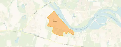 Area
AreaA farmhouse with history in Andel
This semi-detached house on Mr S. Naaijenstraat 28 is a former farmhouse from 1891, sitting in the village of Andel in the municipality of Altena. With its 269 m² of living space according to the BAG registration, it is a substantial home with plenty of character. The asking price of €475,000 is on the low side compared with the average asking price of €582,324 for homes in this neighbourhood, and it sits below the average of €2,684 per m² for the wider market. For context, the current supply of semi-detached houses in Altena shows a range of prices across the municipality.
Inside the home
The agent lists the home with six rooms, five bedrooms and one bathroom spread over three floors, with a volume of 741 m³. The garden is a south-facing back garden of 360 m², which means plenty of afternoon sun. According to the agent, the home has partial double glazing and a central heating boiler. The BAG registration records a living area of 269 m², while the agent's listing states 177 m². The energy label is G, the least efficient label, so expect high heating costs.
Life in Andel
Andel is a village where residents of the municipality give an average score of 7.58 out of 10, based on sixteen reviews. One resident describes it as a quiet neighbourhood with an active neighbourhood association, mainly home to elderly residents and families. Another says it is beautiful and quiet, with super friendly people and a real village feel, though sometimes a bit remote and quite a drive to the motorway, with all essentials nearby. The village has around 2,550 inhabitants, and most homes in the area are owner-occupied. The municipality of Altena covers a wider area with its own character.
Amenities and transport
The SPAR supermarket is just around the corner, with the Jumbo about a ten-minute walk further on. The Ds Gisbertus Voetiusschool is a couple of streets away, and the Chr Basissch De Zaaier is also within walking distance. Huisartsenpraktijk Andel is just around the corner for GP care. Bus line 181 stops at Andel, Kammetweg, a couple of streets away, and the nearest train station is Gorinchem, about 9 km off. The address-level risk data indicates a medium foundation risk, based on the home being built in 1891 on clay soil, with a possible shallow foundation or wooden piles. This is an area-level indication, not an inspection of this specific home. The flood risk is currently elevated, dropping to medium by 2050, and road traffic noise is measured at 41 dB Lden, which stays below the noise standard.
Source
At the time of writing, the home is offered via multiple channels, including Pullen Makelaardij B.V. and Pullen Makelaardij B.V. on Vastgoed Nederland.
This summary was generated with AI and may contain errors. Always verify the details with the provider.
Features
Details of this home
Transfer
Price
Energy
 Save up to € 400 on your energy billCompare now
Areas and volume
 Insure your home and belongingsGet insured
Layout
Construction
Outdoor space
The WOZ value is set annually by the municipality with 1 January as its reference date, and therefore lags the market by about a year. It is an estimated market value, not a sale price.
Frequently asked questions
About Mr S. Naaijenstraat 28, Andel
What is the asking price for this home?
The asking price is €475,000. This is about 18% below the average asking price of €582,324 for homes currently for sale in the neighbourhood. The price per m² is €2,684, based on the agent's listed living area of 177 m². The average price per m² in the neighbourhood is €3,637.
How many rooms and bedrooms does the home have?
According to the agent, the home has six rooms, five bedrooms and one bathroom, spread over three floors. The volume is 741 m³. The garden is a south-facing back garden of 360 m². The agent also notes partial double glazing and a central heating boiler.
What is the energy label and what does it mean?
The energy label is G, which is the least efficient label. This means you can expect high heating costs. The home was built in 1891, and the agent mentions partial double glazing and a central heating boiler. In the neighbourhood, most of the current supply has a better energy label, with 26.7% rated A+ or higher.
What is the WOZ value of this home?
The WOZ value is the municipal valuation used for tax purposes, and it is not always included in property listings. Without this figure, no comparison with the asking price can be made.
What is the foundation risk for this home?
The address-level risk data indicates a medium foundation risk. This is based on the home being built in 1891 on clay soil, with a possible shallow foundation or wooden piles. The area is also a KCAF attention area, with 69% of properties in this postcode built before 1970. This is an area-level indication, not an inspection of this specific home.
What amenities are nearby?
The SPAR supermarket is about 930 m away, and the Jumbo is about 2.5 km off. The Ds Gisbertus Voetiusschool is about 484 m away, and Huisartsenpraktijk Andel is about 830 m away. The nearest pharmacy, Apotheek 'Het Quadraat' in Wijk en Aalburg, is about 5 km away.
How is the public transport in this area?
Bus line 181 stops at Andel, Kammetweg, about 498 m away. The nearest train station is Gorinchem, about 9.2 km off. The nearest bus stop is within walking distance, making it possible to reach nearby towns by public transport.
What is the neighbourhood like?
Andel has around 2,550 inhabitants, with a mix of families and older residents. Residents of the municipality give an average score of 7.58 out of 10. One resident describes it as quiet with an active neighbourhood association, while another mentions a real village feel with friendly people, though it can feel a bit remote and is quite a drive to the motorway.
How does the price compare to other homes in the area?
The asking price of €475,000 is about 18% below the average asking price of €582,324 for homes currently for sale in the neighbourhood. The median asking price is €595,000, and prices range from €329,000 to €1,225,000. The price per m² of €2,684 is also below the neighbourhood average of €3,637.
What is the flood risk for this property?
The address-level risk data indicates an elevated flood risk currently, dropping to medium by 2050. This is an area-level indication based on public climate data, not an inspection of this specific home. The home is located in a clay soil area, which is relevant for the foundation risk as well.









