Boy Edgarlaan 3
Betsy Perkbuurt, Amstelveen
 Area
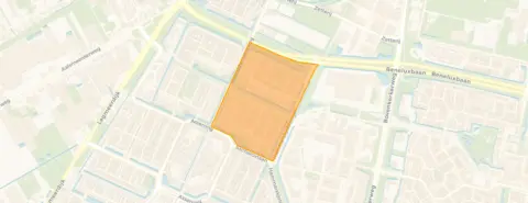
AreaA quiet corner of Amstelveen
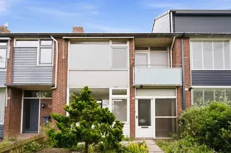
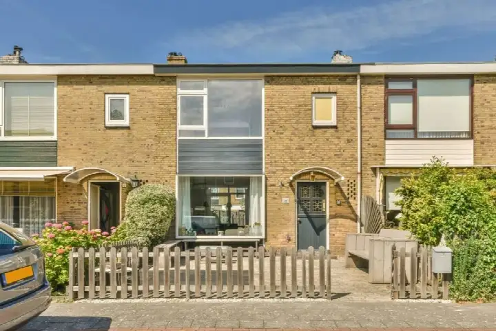
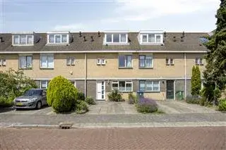
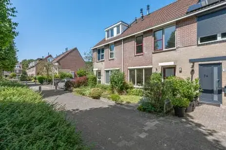
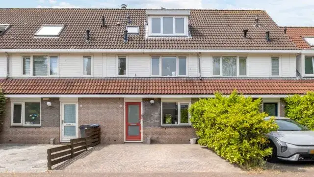
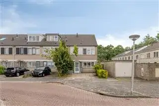
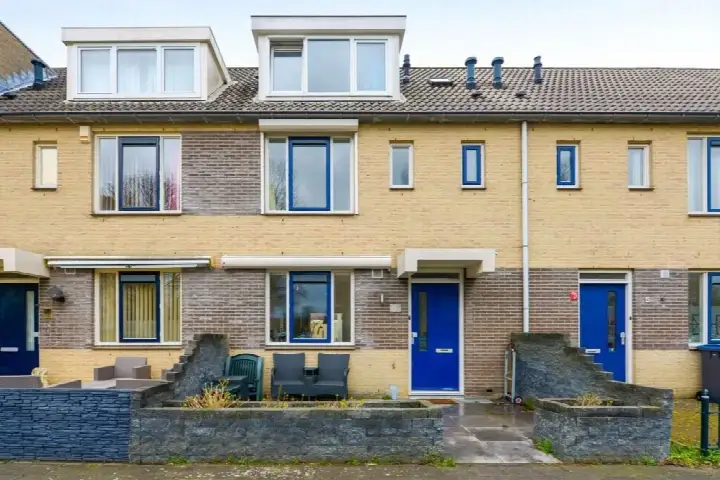
This terraced house on Boy Edgarlaan 3 sits in the Betsy Perkbuurt, a residential pocket of Amstelveen where the streets are calm and the pace is easy. Built in 1995, it is part of a generation of homes that went up in the 1990s, and the whole neighbourhood dates from that same period. With a living area of 109 square metres on a plot of 133 square metres, the asking price of €539,000 works out at €4,945 per square metre. That puts it on the high side compared with the average of €5,897 per square metre for terraced houses in Amstelveen, though the price itself sits below the neighbourhood average of €576,500.
The home itself
The listing gives no details about the layout, so the number of rooms, bedrooms and bathrooms is not stated. What is known is that the house dates from 1995 and carries an energy label B, which is an efficient label and suggests reasonable energy costs. The living area of 109 square metres comes from the BAG registration, and the plot measures 133 square metres. Beyond that, the agent has not provided further information about the interior or any outdoor space.
Life in the Betsy Perkbuurt
Residents across the municipality of Amstelveen give their living environment an average score of 7.95, based on 57 reviews. One resident says: "I have never had any problems in the neighbourhood and hardly any nuisance." Another adds: "Nice neighbourhood to live in with all amenities nearby and pleasant people." The neighbourhood itself has around 1,700 residents, and most homes here are terraced houses from the 1990s. The crime figure for the area stands at 37 recorded incidents, which you can weigh up for yourself. For a closer look at what the Betsy Perkbuurt neighbourhood is like, the reviews give a flavour of everyday life here.
Amenities and transport
Daily errands are well covered. The Albert Heijn and Vomar are both just around the corner, with another Albert Heijn a couple of streets away. For primary education, Openbare Basisschool de Westwijzer is a five-minute walk, and Amsteltaal is just beyond that. The pharmacy Apotheek Asserring BV is a five-minute walk, while Huisartsenpraktijk Brandse is a ten-minute walk. Public transport is close by: bus line 199 stops at Amstelveen, Noorddammerweg on your doorstep, and the Sacharovlaan stop with lines 257, 357 and N57 is just around the corner. The nearest train station is Schiphol Airport, about 5.4 kilometres away. All of this sits within the municipality of Amstelveen.
WOZ and address data
The WOZ value on 1 January 2025 was €650,000, and the asking price of €539,000 sits 17% below that figure. Between 2020 and 2025 the WOZ value rose by 51%, from €430,000 to €650,000. As for the address itself, the area-level indications show road traffic noise at 50 dB Lden and aircraft noise at 50 dB Lden, both above the noise standard, based on 2022 data. The foundation risk indication is low, though the soil is clay, which is sensitive to settlement. Pluvial flooding at heavy rain is low, while the current flood risk is medium and stays medium in 2050. Heat stress is low now but medium by 2050. These are area-level indications from public data, not an inspection of this specific home.
Source
At the time of writing the home is offered only via Atsma Woning- en Bedrijfsmakelaardij en Hypotheken.
This summary was generated with AI and may contain errors. Always verify the details with the provider.
Features
Details of this home
Transfer
Price

Areas and volume
 Insure your home and belongingsGet insured
Construction
The WOZ value is set annually by the municipality with 1 January as its reference date, and therefore lags the market by about a year. It is an estimated market value, not a sale price.
Frequently asked questions
About Boy Edgarlaan 3, Amstelveen
How does the asking price compare with the WOZ value?
The asking price of €539,000 is 17% below the WOZ value of €650,000, which was set on 1 January 2025. The WOZ value is the municipal valuation for tax purposes, not the current market value. Between 2020 and 2025 the WOZ value rose by 51%, from €430,000 to €650,000. The relationship between the asking price and the WOZ value is a fact you can weigh up for yourself.
What is the layout of the home?
The listing does not state the number of rooms, bedrooms or bathrooms. What is known is that the home is a terraced house built in 1995 with a living area of 109 square metres according to the BAG registration, on a plot of 133 square metres. The energy label is B.
What is the energy label and what does it mean?
The home has an energy label B, which is an efficient label. This means you can expect moderate energy costs compared with less efficient labels. The label does not say anything about the condition of the building itself. The listing does not mention any specific insulation features, so the label stands on its own as an indication of energy efficiency.
What are the noise levels around this address?
The area-level data shows road traffic noise at 50 dB Lden and aircraft noise at 50 dB Lden, both above the noise standard, based on 2022 figures. These are indications at area level from public data sources, not a measurement taken at this specific home. The actual noise you experience can depend on the exact position of the house and other local factors.
What is the foundation risk for this home?
The foundation risk indication for this address is low, according to area-level data. The soil type is clay, which is noted as sensitive to settlement. This is an indication at area level, not an inspection of this specific property. The listing itself does not provide any further information about the foundation of this particular home.
What are the flood and heat risks at this address?
The area-level climate data shows pluvial flooding at heavy rain is low, while the current flood risk is medium and remains medium in 2050. Heat stress is low at present but is expected to be medium by 2050. These are indications at area level from the Klimaateffectatlas, not an assessment of this specific home. They describe the broader area around the address.
Which supermarkets are nearby?
The Albert Heijn and Vomar are both about 577 metres away, which is a five-minute walk. Another Albert Heijn is at 667 metres, and further options include an Albert Heijn at 1.5 kilometres and a Coop at 1.5 kilometres. In total there are 31 supermarkets within five kilometres of the home, so daily grocery shopping is well covered.
Which schools are close to this home?
Openbare Basisschool de Westwijzer is the nearest primary school at 347 metres, a five-minute walk. Amsteltaal is at 469 metres, and Elif Amstelveen at 670 metres. Katholieke basisschool De Triangel is at 706 metres and Karel Eykmanschool at just over a kilometre. There are 43 schools within five kilometres in total.
What public transport options are available?
Bus line 199 stops at Amstelveen, Noorddammerweg, about 248 metres away. The Sacharovlaan stop with lines 257, 357 and N57 is at 333 metres, and the Sacharovlaan tram stop with lines 6 and 25 is at 398 metres. The nearest train station is Schiphol Airport at 5.4 kilometres. The listing does not state travel times or destinations for these services.
What is the neighbourhood like according to residents?
Residents across the municipality of Amstelveen give an average score of 7.95, based on 57 reviews. One resident says: "I have never had any problems in the neighbourhood and hardly any nuisance." Another says: "Nice neighbourhood to live in with all amenities nearby and pleasant people." These reviews describe the wider municipality rather than the Betsy Perkbuurt specifically.
How does the price per square metre compare?
The asking price of €539,000 for a living area of 109 square metres works out at €4,945 per square metre, based on the BAG registration. The average price per square metre for homes in the neighbourhood is €5,897. The neighbourhood average is based on 10 available homes, with prices ranging from €400,000 to €900,000.
Why are there no property details in this listing?
The listing does not state the number of rooms, bedrooms, bathrooms, or any details about a garden, balcony or garage. It also does not mention insulation or heating installations. The available information is limited to the property type, year of construction, energy label, living area and plot size.