Noordersingel 30
Noordeinde, Lansingerland
 Area
AreaA 1912 terraced house on Noordersingel
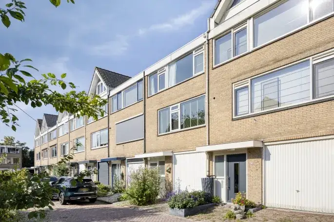
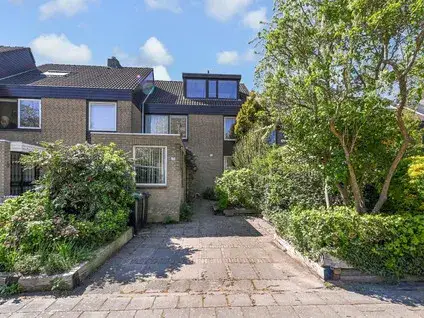
Noordersingel 30 is a terraced house from 1912, sitting in the Noordeinde neighbourhood of Berkel En Rodenrijs. The home has an A+ energy label, which is an efficient label, so you can expect relatively modest energy costs. The asking price is €450,000, which is in line with the market according to the precomputed comparison against the neighbourhood average. For context, [terraced houses in Lansingerland] give you a sense of what similar homes go for in the wider municipality.
The home itself
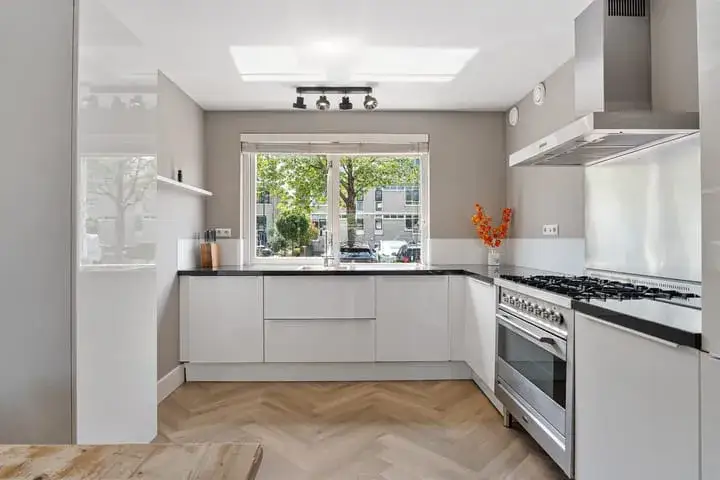
This listing does not include details on the layout, number of rooms, or outdoor space. What is stated is the year of construction, 1912, and the energy label A+. The living area is 76 m² according to the BAG registration, and the plot is 98 m². The price per square metre works out to €5,921 based on the BAG figure. Beyond these facts, the agent has not provided further property details in this listing.
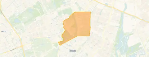
Noordeinde, a quiet corner of Berkel En Rodenrijs
Noordeinde is a small neighbourhood with 1,635 residents, and about 85% of the homes are owner-occupied. Residents across [the municipality of Lansingerland] give their living environment an average score of 7.83, based on twelve reviews. One resident describes it as "cosy and peaceful," noting that "you have both houses, nature, the village with all the shops and public transport within walking distance." Another says neighbours greet each other when they meet, though the bond is not especially close. The reviews cover the municipality as a whole, not just Noordeinde itself.
Amenities and transport
The Jumbo supermarket is just around the corner at about a ten-minute walk, with Albert Heijn, Hoogvliet, and Aldi a bit further out. For primary education, De Poolster and De Wilgenhoek are both within a ten-minute walk. The nearest GP is Huisartsenpraktijk Linthorst in Berkel en Rodenrijs, and Apotheek Meerpolder is the closest pharmacy. Bus line 174 stops at Planetenweg, about a ten-minute walk away, and the nearest train station is Zoetermeer Oost, roughly 3.5 km from the home.
WOZ and address data
The WOZ value is not stated in the available data, so no comparison with the asking price or historical development can be made here. Regarding address-level risks, the noise from road traffic is measured at 50 dB Lden, which is above the noise standard for the reference year 2022. Railway noise is 32 dB Lden and aircraft noise is 36 dB Lden, both below their respective standards. The foundation risk indication is medium, based on the home being built in 1912 on clay soil, which may involve wooden piles or a shallow foundation. Pluvial flooding at heavy rain is indicated as medium, as is the current and 2050 flood risk. These are area-level indications from public data, not an inspection of this specific home.
Source
At the time of writing, the home is offered via DB-Makelaars.
This summary was generated with AI and may contain errors. Always verify the details with the provider.
Features
Details of this home
Transfer
Price
Energy
 Save up to € 400 on your energy billCompare now
Areas and volume
 Insure your home and belongingsGet insured
Layout
Construction
Outdoor space
The WOZ value is set annually by the municipality with 1 January as its reference date, and therefore lags the market by about a year. It is an estimated market value, not a sale price.
Frequently asked questions
About Noordersingel 30, Berkel En Rodenrijs
What is the asking price for this terraced house?
The asking price is €450,000. This is in line with the market according to the precomputed comparison against the neighbourhood average asking price. The price per square metre is €5,921 based on the BAG living area of 76 m².
What property details are available for this home?
The listing states the home is a terraced house built in 1912 with an A+ energy label. The living area is 76 m² according to the BAG registration, and the plot is 98 m². No information is provided on the number of rooms, bedrooms, bathrooms, or any outdoor space such as a garden or balcony.
Why are there no property details in this listing?
The listing does not include details on the layout, number of rooms, or outdoor space. This means the agent has not provided these specifics in the available data. The only property facts stated are the year of construction, the energy label, and the floor areas from the BAG registration.
What is the energy label and what does it mean?
The home has an A+ energy label, which is an efficient label. This means you can expect relatively modest energy costs compared to less efficient labels. The label is a fact about the home's energy performance, and no further structural conclusions should be drawn from it. The year of construction is 1912, but the label does not indicate anything about the condition of the building.
What is the foundation risk for this address?
The foundation risk indication is medium, based on area-level data. The home was built in 1912 on clay soil, which may involve wooden piles or a shallow foundation. Additionally, 64% of properties in this postcode area were built before 1970, which is a KCAF attention area. This is an area-level indication from public data, not an inspection of this specific home.
What is the noise situation around this home?
Road traffic noise is measured at 50 dB Lden, which is above the noise standard for the reference year 2022. Railway noise is 32 dB Lden, below the standard, and aircraft noise is 36 dB Lden, also below the standard. These are area-level indications from public data, not measurements taken at the property itself.
What flood risk applies to this address?
Pluvial flooding at heavy rain is indicated as medium, and the current flood risk is also medium. The flood risk for 2050 is likewise indicated as medium. These are area-level indications from the Klimaateffectatlas, not an assessment of this specific property. No further details on flood protection measures are stated in the data.
Which supermarkets are nearby?
The nearest supermarket is Jumbo, about 1.4 km away, which is roughly a ten-minute walk. Albert Heijn, Hoogvliet, and Aldi are all around 2.4 km from the home. In total, there are 27 supermarkets within a 5 km radius. The distances are approximate and based on the nearest locations in the data.
What schools are close to this home?
The nearest primary schools are De Poolster at about 1.6 km and De Wilgenhoek at about 1.7 km, both within a ten-minute walk. Basisschool De Klipper and CBS Prins Johan Friso are around 2.1 km away. There are 65 schools within a 5 km radius, covering primary and secondary education. The nearest secondary school is about 4 km away.
How is the public transport connection?
Bus line 174 stops at Planetenweg, about 986 m away, and at Sterrenweg, about 1 km away. The nearest train station is Zoetermeer Oost, approximately 3.5 km from the home. The bus stops are within a ten-minute walk. No travel times or destinations for the bus line are stated in the data.
What do residents say about living in this area?
Residents across the municipality of Lansingerland give their living environment an average score of 7.83, based on twelve reviews. One resident describes it as "cosy and peaceful," noting the mix of houses, nature, and the village with shops and public transport within walking distance. Another says neighbours greet each other when they meet, though the bond is not especially close. These reviews cover the municipality, not just Noordeinde.
What is the neighbourhood Noordeinde like?
Noordeinde has 1,635 residents, with about 85% of homes being owner-occupied. The average household size is 2.5 people, and 40% of households have children. The age spread shows 35% of residents are between 45 and 65, and 20% are 65 or older. These figures come from CBS data and describe the neighbourhood as a whole.