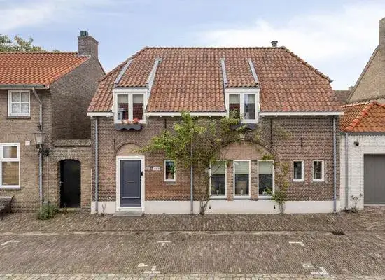
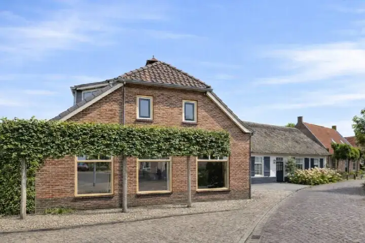
Oudheusdensestraat 7
Heusden, Heusden
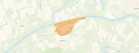 Area
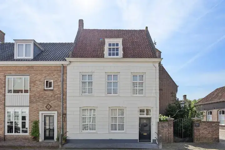
AreaA historic terraced house in Heusden
This terraced house on Oudheusdensestraat 7 sits in the heart of Heusden, a town where history is part of daily life. The asking price of €795,000 is on the high side compared with the average asking price in the neighbourhood, which comes to €611,896. That puts the price roughly 30 percent above the neighbourhood average. The living area of 174 m² is about 40 percent larger than the average of 124 m² in the area. For context, the asking prices for [terraced houses in Heusden] range from €369,000 to €1,150,000.
Inside the home
Built in 1850, this home has five rooms, four bedrooms and one bathroom. The agent lists the living area at 174 m², while the BAG registration records 175 m². The plot measures 135 m² according to both the agent and the BAG registration. The energy label is C, which means the home is moderately efficient, so heating costs will be noticeable but not extreme.
Life in Heusden
Heusden is a village where residents know each other and look out for one another. One resident describes it as a nice neighbourhood where everyone respects each other and neighbours help when needed, with shops, a church, a school and the town hall all nearby. Another resident, however, is far less positive, mentioning loitering youths and a lack of police presence. A third resident points to traffic safety concerns in and around Hamelpark, noting that although the area is designated as a woonerf, some drivers treat it like a racetrack. Across the municipality of Heusden, residents give an average score of 7.33 based on eight reviews. The neighbourhood has 1,315 inhabitants, with a relatively large share of residents aged 65 and over. The municipality of Heusden is responsible for the area's public spaces and services.
Amenities and transport
Daily errands are easy to manage from this address. The nearest supermarket, Coop, is just around the corner, with Aldi and Jumbo a bit further away. Primary school BS De Dromenvanger is a ten-minute walk, and the nearest GP practice, Huisartsenpraktijk AMEEdic, is a couple of streets away in Genderen. The pharmacy, Apotheek 'Het Quadraat', is also within reach. Bus line 135 stops on your doorstep at Oud Heusdensestraat, and line 208 stops at Burchtplein, a couple of streets away. The nearest train station is 's-Hertogenbosch, about 12 km away. The municipality of Heusden manages the local infrastructure and public facilities.
WOZ and address data
No WOZ value is available for this property. The address-level risk data indicates that road traffic noise is above the standard, at 60 dB Lden. The foundation risk indication is elevated, based on the fact that the home was built in 1850 on clay soil, which may mean wooden piles or a shallow foundation. In this postcode area, 82 percent of buildings were constructed before 1970, and 4 percent of properties have an elevated risk of pile rot. Pluvial flooding at heavy rain is indicated as elevated, as is the current flood risk, with the flood risk for 2050 assessed as medium. Heat stress is currently low but is expected to become medium by 2050. These are area-level indications from public data sources, not an inspection of this specific home.
Source and agent
At the time of writing, the home is offered via multiple channels, including Lelieveld makelaardij and a listing on Pararius. The agent is Lelieveld makelaardij.
This summary was generated with AI and may contain errors. Always verify the details with the provider.
Features
Details of this home
Transfer
Price

Areas and volume
 Insure your home and belongingsGet insured
Layout
Construction
Frequently asked questions
About Oudheusdensestraat 7, Heusden
How does the asking price compare with other homes in Heusden?
The asking price of €795,000 is about 30 percent above the average asking price in the neighbourhood, which is €611,896. The median asking price is €550,000, and prices range from €369,000 to €1,150,000. The price per square metre is €4,569 based on the agent's listed living area of 174 m².
What is the layout of this terraced house?
According to the agent, the home has five rooms, four bedrooms and one bathroom. The living area is listed at 174 m², while the BAG registration records 175 m². The plot measures 135 m². The home was built in 1850 and has an energy label C.
What do residents say about living in Heusden?
Residents of the municipality of Heusden give an average score of 7.33 based on eight reviews. One resident praises the village for its mutual respect and helpful neighbours, with amenities nearby and easy access to nature. Another resident mentions concerns about loitering youths, while a third points to traffic safety issues in the Hamelpark area.
What are the nearest schools and supermarkets?
The nearest primary school is BS De Dromenvanger, about 750 metres away. The closest supermarket is Coop, roughly 900 metres from the home, with Aldi and Jumbo about 2.5 km away. The nearest GP practice is Huisartsenpraktijk AMEEdic in Genderen, about 3.2 km away.
What public transport options are available nearby?
Bus line 135 stops at Oud Heusdensestraat, about 46 metres from the home. Line 208 stops at Burchtplein, roughly 287 metres away, and both lines 135 and 208 stop at Demer, about 305 metres away. The nearest train station is 's-Hertogenbosch, approximately 11.8 km from the property.
What is the foundation risk for this property?
The foundation risk indication for this address is elevated, based on area-level data. The home was built in 1850 on clay soil, which may mean wooden piles or a shallow foundation. In this postcode area, 82 percent of buildings were constructed before 1970, and 4 percent of properties have an elevated risk of pile rot. This is an area-level indication, not an inspection of this specific home.
What is the flood risk for this area?
The current flood risk is indicated as elevated, with the risk for 2050 assessed as medium. Pluvial flooding at heavy rain is also indicated as elevated. Heat stress is currently low but is expected to become medium by 2050. These are area-level indications from public data sources, not an assessment of this specific property.
How old is this home and what does that mean?
The home was built in 1850, making it one of the older properties in the area. In the neighbourhood, 77.8 percent of homes were built before 1945. The energy label is C, which means the home is moderately efficient, so heating costs will be noticeable but not extreme.







-475cbb73.webp)