




A bright apartment in the heart of Helmond
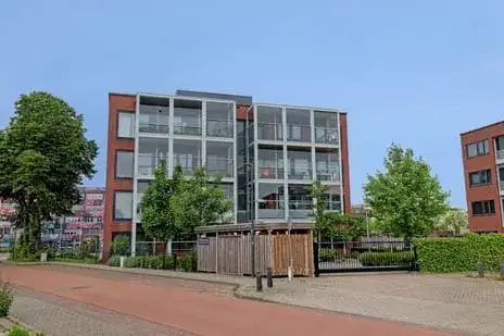
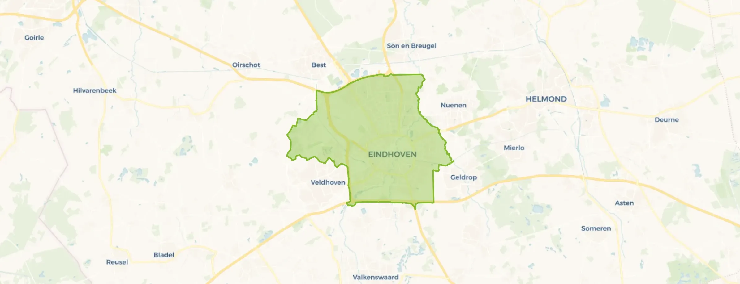
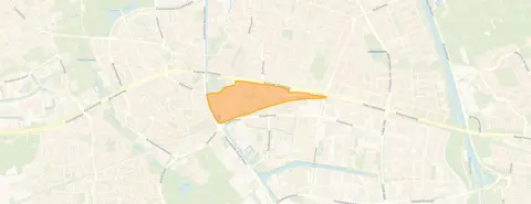
This apartment sits on the fifth floor of a building from 1997, right in the centre of Helmond with an unobstructed view. The home is part of the Stationsgebied neighbourhood, a lively part of town that is home to around 1,165 people. With the station just around the corner, this is a spot that feels connected to the rest of the country. The asking price is €400,000. For context, there are currently 9 apartments for sale in the area, and the average asking price in the neighbourhood is €386,833, with an average of €3,941 per square metre. If you are looking at apartments in Helmond, this one stands out for its central position and its price.
Inside the home
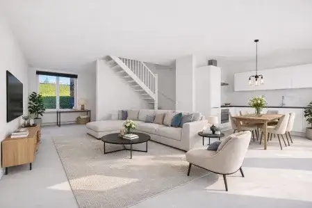
This apartment has two rooms in total, with one bedroom and one bathroom, all on a single floor. The living area is 86 square metres according to the agent, while the BAG registration lists it as 87 square metres. The home has a balcony, and the agent mentions roof, wall and floor insulation, as well as a central heating boiler. It is offered as full ownership, so there is no leasehold to worry about. The energy label is B, which is an efficient label, meaning you can expect moderate energy costs. The property is located on the fifth floor, giving it that free view the agent highlights.
Life in Stationsgebied
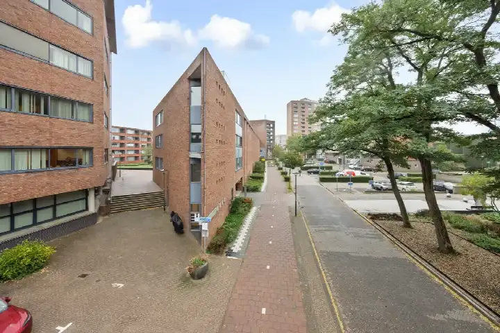
Stationsgebied is a compact neighbourhood where most homes were built between 1990 and 2010, and it shows in the streetscape. Residents of the district give it an average score of 8.13 out of 10, based on four reviews. One resident, who has lived here for ten years, describes it as "quite a quiet and cosy neighbourhood" and says it is "not too busy". Another resident mentions that houses are being renovated and insulated on the outside, though they note that maintenance of front and back gardens is poor and there is no waste enforcement. The neighbourhood has a mix of ages, with 45% of residents between 25 and 45, and 26% aged 65 or over. It is a place where many people live alone, with 67% of households being single-person. For a sense of what it is like to live here, the Stationsgebied neighbourhood page has more details.
Amenities and getting around
Daily errands are easy from this address. For groceries, Zapolski is on your doorstep, Lidl is just around the corner, and Ekoplaza is a couple of streets away. For secondary education, Jan van Brabant College vestiging Molenstraat is just around the corner, while Brede basisschool De Vuurvogel is a ten-minute walk for primary school children. The nearest GP, Huisartsenpraktijk Pril, is just around the corner, and the BENU Apotheek 't Heelhuis is a couple of streets away. The hospital, Elkerliek Ziekenhuis, is about a ten-minute walk. For public transport, the bus stop Helmond, Station is just around the corner with lines 23, 24, 25, 26, 51, 52, 53, 54, 55, 150 and 320, and Helmond train station is also just around the corner. All of this is within the municipality of Helmond, which offers a full range of services.
WOZ value and address data
The WOZ value of this home is €345,000, with a reference date of 1 January 2025. The asking price is 16% above this WOZ value. Over the past five years, the WOZ value has risen by 72%, from €201,000 in 2020 to €345,000 in 2025. As for the address itself, the noise level from road traffic is 61 dB Lden, which is above the noise standard, while railway noise is 43 dB Lden and industrial noise is 46 dB Lden, both below the standard. The foundation risk indication is low, though the soil is peat, which is sensitive to settling. For climate, the pluvial flooding indication is elevated, while flood risk is low both now and in 2050, and heat stress is medium now and in 2050. These are area-level indications based on public data, not an inspection of this specific home.
Source and agent
At the time of writing, this home is offered via multiple channels, including MGM Makelaardij and other platforms. The listing has been available since 10 November 2026.
This summary was generated with AI and may contain errors. Always verify the details with the provider.
Features
Details of this home
Transfer
Price
Energy
 Save up to € 400 on your energy billCompare now
Areas and volume
Layout
Construction
Outdoor space
The WOZ value is set annually by the municipality with 1 January as its reference date, and therefore lags the market by about a year. It is an estimated market value, not a sale price.
Frequently asked questions
About Stationsstraat 76, Helmond
What is the asking price for this apartment?
The asking price for this apartment is €400,000. For context, the average asking price for homes in the neighbourhood is €386,833, and the average price per square metre is €3,941. There are currently 9 homes for sale in the area. The asking price is a fact from the listing, and no judgement is made here about whether it is high or low relative to the market.
What is the layout of this apartment?
According to the agent, this apartment has two rooms in total, with one bedroom and one bathroom, all on a single floor. The living area is 86 square metres according to the agent, while the BAG registration lists it as 87 square metres. There is a balcony, and the home is located on the fifth floor. The agent also mentions roof, wall and floor insulation, and a central heating boiler. The property is offered as full ownership.
What is the energy label and what does it mean?
The energy label is B, which is an efficient label. This means you can expect moderate energy costs compared to less efficient labels. The agent also mentions that the home has roof, wall and floor insulation, which is a separate fact. The energy label is based on the official registration, and the insulation is what the agent states in the listing. No further conclusions about the construction should be drawn from the label alone.
What are the noise levels around this address?
According to public data at the address level, the noise from road traffic is 61 dB Lden, which is above the noise standard. Railway noise is 43 dB Lden and industrial noise is 46 dB Lden, both below the standard. These are area-level indications, not measurements taken at the property itself. The data comes from the Atlas Leefomgeving and other public sources, and they give an indication of the sound environment in the vicinity.
What is the foundation risk for this home?
The foundation risk indication for this address is low, according to public data. However, the soil type is peat, which is noted as being sensitive to settling. This is an area-level indication, not an inspection of this specific home. It means that the general area has a low risk indication, but the soil condition is something to be aware of. No further conclusions about the condition of this particular property should be drawn from this data.
What are the flood and heat stress risks?
For climate risks, the pluvial flooding indication is elevated, meaning there is a higher chance of flooding from heavy rain. The flood risk from rivers or the sea is low, both now and in 2050. Heat stress is medium, both now and in 2050. These are area-level indications based on the Klimaateffectatlas, and they describe the general area around the address, not the specific property. They give a sense of how the location may be affected by climate-related events.
What supermarkets are nearby?
There are several supermarkets within easy reach. Zapolski is on your doorstep, just 369 metres away. Lidl is just around the corner at 563 metres, and Ekoplaza is a couple of streets away at 761 metres. There is also an AH XL at 884 metres, which is about a ten-minute walk. With 27 supermarkets within 5 kilometres, you have plenty of options for daily groceries, whether you prefer a quick trip or a larger shop.
How close is the nearest school?
For secondary education, Jan van Brabant College vestiging Molenstraat is just around the corner, at 304 metres. For primary education, Brede basisschool De Vuurvogel is about a ten-minute walk, at 757 metres. There are also several other schools within a short distance, including De Korenaer Helmond and De Hilt, both around 900 metres away. In total, there are 40 schools within 5 kilometres, covering primary, secondary and special education.
What public transport options are available?
The nearest bus stop is Helmond, Station, just 216 metres away, with lines 23, 24, 25, 26, 51, 52, 53, 54, 55, 150 and 320. The train station Helmond is also very close, at 208 metres. There are additional bus stops at Helmond, Zuidende (518 metres) and Helmond, Piet Blomplein (590 metres). This gives you a range of options for getting around, whether by bus or by train, without needing to walk far.
What is the neighbourhood like according to residents?
Residents of the district give it an average score of 8.13 out of 10, based on four reviews. One resident, who has lived there for ten years, says it is "quite a quiet and cosy neighbourhood" and "not too busy". Another resident notes that houses are being renovated and insulated on the outside, but mentions poor maintenance of front and back gardens and no waste enforcement. These reviews describe the wider district, not just the immediate neighbourhood, and they offer a mixed but generally positive picture.