Muurhuizen 177
Hof, Amersfoort
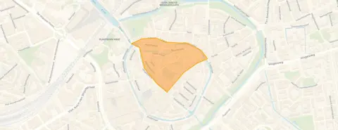 Area
AreaA monumental end-of-terrace house on the Muurhuizen
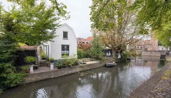
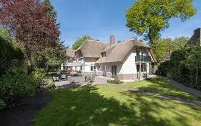
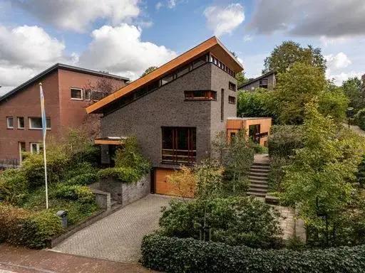
On the historic Muurhuizen, one of Amersfoort's most atmospheric streets, stands this end-of-terrace house from 1936. The home is part of the Hof neighbourhood, right in the heart of the city. With a price of €1,750,000, this asking price is sharply above the average for end-of-terrace houses in Amersfoort, which sits at €453,333. This listing does not state the energy label. As a result, you cannot judge the home's energy efficiency from the listing.
The home itself
The agent does not provide details on the layout, number of rooms, or outdoor space. According to the BAG registration, the living area is 286 m², and the plot is 263 m². The home was built in 1936, so it has a pre-war character.
The Hof neighbourhood
Hof is a small, intimate neighbourhood within the Stadskern district, with just 735 residents. It is a very urban area, with an address density of 4,484 per km². Residents of the municipality of Amersfoort give their living environment an average score of 7.91, based on 72 reviews. One resident says: "Idyllic green authentic neighbourhood. A mixed group of people makes the neighbourhood special." Another notes: "there is a lot of green in my neighbourhood, but there are also many old people." The neighbourhood has a high proportion of one-person households (73%), and many residents are between 25 and 45 years old. For more on the area, see the Hof neighbourhood.
Amenities and transport
Daily life is well catered for. A SPAR supermarket is on your doorstep, with a Coop just around the corner and an Albert Heijn a couple of streets away. Basisschool Sint Joris is a five-minute walk, and the nearest GP, Huisartsenpraktijk Stadsring, is also within walking distance. The pharmacy, Stadsapotheek Jansen, is a couple of streets away. For public transport, bus stop De Flint is just around the corner, served by line 5, and Blekerseiland is a five-minute walk with lines 5, 6, 8, 15, 101, 102, 315 and N17. Amersfoort Centraal station is a ten-minute walk. The municipality of Amersfoort offers all this and more, as you can see on the municipality of Amersfoort.
WOZ and address data
The WOZ value is not stated in this listing, so no comparison with the asking price or historical development is available. According to public address-level risk data (Atlas Leefomgeving, KCAF, Klimaateffectatlas), the noise level from road traffic is 60 dB Lden, which is above the standard. The foundation risk indication is low, based on the soil type (sand) and the pre-1970 construction year. For climate, the indication for pluvial flooding at heavy rain is elevated, as is the current flood risk, while the flood risk for 2050 is low. Heat stress is currently low but is expected to be medium by 2050. These are area-level indications, not an inspection of this specific home.
Source and agent
At the time of writing, the home is offered via multiple channels, including Telman & Van Leeuwen Makelaars.
This summary was generated with AI and may contain errors. Always verify the details with the provider.
Features
Details of this home
Transfer
Price
Energy
 Save up to € 400 on your energy billCompare now
Areas and volume
 Insure your home and belongingsGet insured
Layout
Construction
Outdoor space
The WOZ value is set annually by the municipality with 1 January as its reference date, and therefore lags the market by about a year. It is an estimated market value, not a sale price.
Frequently asked questions
About Muurhuizen 177, Amersfoort
What is the asking price for this home?
The asking price is €1,750,000. This is sharply above the average asking price of €453,333 for homes in the Hof neighbourhood. The price per square metre, based on the BAG living area of 286 m², is €6,119. The neighbourhood average price per m² is €7,550, so this home is priced below that per square metre, but the total price is high due to the large living area.
What is the living area of this home?
According to the BAG registration, the living area is 286 m², and the plot is 263 m². This is 361% larger than the neighbourhood average of 62 m².
What is the WOZ value of this home?
The WOZ value is not stated in this listing. The WOZ value is the municipal valuation, but it is not available here. Without it, we cannot compare the asking price to the WOZ value or show its historical development.
What is the foundation risk for this home?
The foundation risk indication for this address is low, according to public data. This is based on the soil type (sand) and the fact that the home was built before 1970. This is an area-level indication, not an inspection of the specific home.
What are the noise levels around this home?
The noise level from road traffic is 60 dB Lden, which is above the standard. Noise from rail traffic is 35 dB Lden, and from industry 45 dB Lden, both below the standard. These are area-level indications from public data, not measurements at the property itself.
What supermarkets are nearby?
A SPAR supermarket is just 217 metres away, on your doorstep. A Coop is 467 metres away, and an Albert Heijn is 635 metres away. There are also a SPAR express and an Ekoplaza within 700 metres. So daily groceries are easily accessible.
Which schools are close to this home?
Basisschool Sint Joris is 425 metres away, a five-minute walk. Michaelschool, for special primary education, is 473 metres away. Kindcentrum Vlinderslag is 593 metres away. There are also several other primary schools within a kilometre.
What public transport options are available?
Bus stop De Flint is 373 metres away, served by line 5. Blekerseiland is 428 metres away, with lines 5, 6, 8, 15, 101, 102, 315 and N17. Amersfoort Centraal train station is 1,265 metres away, about a ten-minute walk.
What is the Hof neighbourhood like?
Hof is a small neighbourhood with 735 residents, very urban with an address density of 4,484 per km². Many residents live alone (73% of households). Residents of the municipality of Amersfoort rate their living environment 7.91 out of 10. One resident describes it as an "idyllic green authentic neighbourhood."
Why are there no property details in this listing?
The agent has not published details such as the energy label. The address itself is complete, so location and neighbourhood data are accurate.