Buurtje.nl takes action against PHP vulnerability
Give feedback Report a problem
Neighbourhood in RhedenRheden
Gelderland›Rheden›Rheden›Rheden

Neighbourhood Rheden

Municipality of Rheden

7.1
Residents give Rheden a good ratingThis score is based on 1 response
View
Rheden has 7,350 residentsMost are 45 to 65 years old
There are 3,558 homes in RhedenCurrently there are 28 for sale and 0 for rent
Energy label A is the most common in RhedenBased on registered homes

Rheden is located in the province of Gelderland, in the municipality of Rheden, in the district Rheden. The neighbourhood has a total area of 283 hectares, of which 262 hectares are land and 21 hectares are water. The neighbourhood is coded as BU02750100. The postcode area is 6991AC-6991ZX.

One resident rates the neighbourhood as good with a score of 7.1. The resident describes this neighbourhood as 'Not much contact but otherwise fine'. Based on a limited number of reviews, no clear trends are visible yet in this neighbourhood.

Residents

Rheden has 7.350 residents. Of these, 49,0% are men and 51,0% are women. Most residents are 45 to 65 years (28,8%). The other age groups are 23,9% for '65 years or older', 23,1% for '25 to 45 years', 15,2% for '0 to 15 years' and 9,1% for '15 to 25 years'. Of the residents, 44,6% is unmarried, 39,7% is married, 9,0% is divorced and 6,6% is widowed. 6.090 residents originate from the Netherlands, 470 come from Europe and 790 come from countries outside Europe.

There are 3.385 households in Rheden. 37,8% of these are single-person households, 29,7% households without children and 32,5% households with children. The average household size is 2,1 persons. The national average is 2,1 persons.

In Rheden there are 5.900 income recipients. The average income per income recipient is €38.700, which is €3.500 (8%) lower than the national average of €42.200. Per resident, the average income is €32.100, which is €2.800 (8%) lower than the national average of €34.900. Most residents of Rheden are educated to an intermediate level. 46,6% have an intermediate education (HAVO, VWO or MBO 2-4), 29,3% have a university or higher professional education (HBO/WO) and 24,1% have a lower education (VMBO or MBO 1).

Of the 7.350 residents, around 71% are in paid employment, which amounts to 5.219 people. This is 1% lower than the national average of 72%. The majority of workers are in salaried employment (85%), while 15% are self-employed. In Rheden, 32% of residents receive a benefit. The largest group is those receiving a state pension (AOW). 1.570 people receive this benefit.

Housing

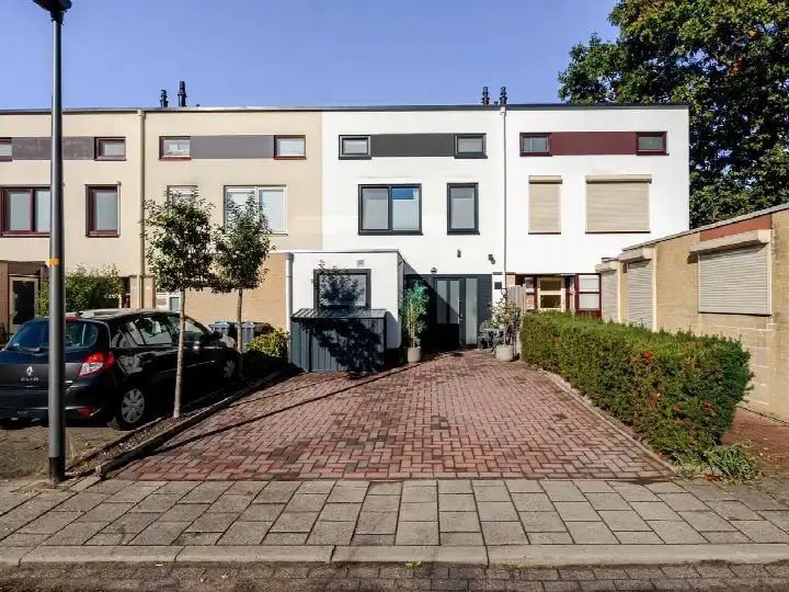
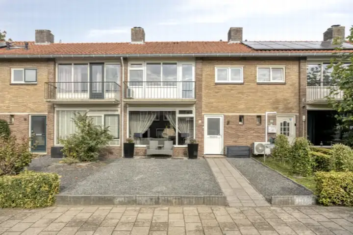
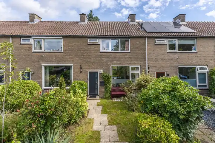
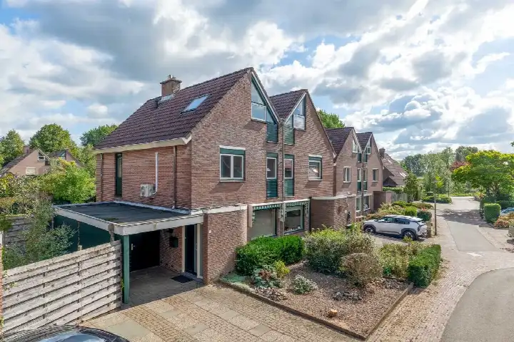
In Rheden there are 3.558 homes with an average assessed value (WOZ) of €346.000. Of these, around 96% are occupied and 4% unoccupied. Most homes are owner-occupied. This amounts to 44% rental homes and 56% owner-occupied homes. Of the homes, 57% privately owned, 32% owned by housing associations and 11% owned by other landlords. The most common construction periods in Rheden are 1950-1970 (42%) and 1925-1950 (14%).

Homes for sale in Rheden

There are currently 28 homes for sale in Rheden. The most recently listed home is Grada Vleemingstraat 19 by Droomhuis Makelaardij Rheden. Over the past year, 90 homes were sold in Rheden. On average, a home was sold within 48 days.

The average asking price for a home for sale in Rheden over the past year was €455.756. This is 32% higher than the average assessed value (WOZ) of €346.000. The average asking price per m² of floor area is €4.132.

Rental homes in Rheden

There are currently no homes for rent in Rheden. The most recent home is Worth Rhedenseweg 2, offered by Blinq Makelaars op Pararius. Over the past year, 2 homes were let in Rheden. On average, a listing was let within 39 days.

The average rent for a rental home in Rheden over the past year was €1.925 per month. Per m² of floor area that is €13 per month.

Energy

In Rheden there are 2.072 addresses with a registered energy label. The most common labels are A (25%), C (24%) and B (14%). On average, an address in Rheden uses 2.390 kWh of electricity per year. This is 6% below the national average of 2.550 kWh. Natural gas consumption, at 900 m³ per year, is 13% above the national average of 800 m³.

Street names

  • Wurfbainlaan
  • IJsselweg
  • Grada Vleemingstraat
  • Holtbankseweg
  • Jan Pieterszoon Coenstraat
  • W.G.F. Thomassenweg
  • Lijsterstraat
  • Buurmeestersstraat
  • Laakweg
  • Marijkestraat
  • Suze Groenewegstraat
  • Schietbergseweg
  • Veerweg
  • Klinker
  • Europalaan
  • Vorsterstraat
  • Oranjeweg
  • Doctor Langemeijerweg
  • Meester B. van Leeuwenplein
  • Willem Barentszstraat
  • Massenweg
  • De Del
  • Apollostraat
  • Merelstraat
  • Olivier van Noortstraat
  • Siersteen
  • Jolinkweg
  • Cornelia Weertsemastraat
  • Cornelis Houtmanstraat
  • Emmaweg
  • Over-Heuvenseweg
  • Waardweg
  • Pinkelseweg
  • Mauritiusstraat
  • Schoolweg
  • Klaverstraat
  • Koningsland
  • Zwarteweg
  • Ambtsjonkerstraat
  • Johan van Meeckerenstraat
  • Smidsweg
  • Scheuterstraat
  • Dr. P.G. Bekkeringpad
  • Broekveldseweg
  • Valkenbergerweg
  • Wilhelminaweg
  • Lathumse Veerpad
  • Wethouder Winterinkstraat
  • Daem van Heerdtplein
  • Buurtweg
  • Schoutenlaan
  • Methorsterweg
  • Steenbakkersweg
  • Gasthuisbouwing
  • Koperwiekstraat
  • Pinksterbloemstraat
  • Smederijstraat
  • Esperantostraat
  • Willem Bontekoestraat
  • Groenestraat
  • De Hoge Kamp
  • Korenbloemstraat
  • Worth Rhedenseweg
  • Julianaweg
  • Berggrind
  • Korte Buurtweg
  • Grindheuvel
  • Havelandseweg
  • Klaproosstraat
  • Margrietstraat
  • Nassaustraat
  • Prins Hendrikweg
  • Kareel
  • Dorpsstraat
  • Prins Bernhardweg
  • Speenkruidstraat
  • Tasveld
  • Dokter Beumer Plantsoen
  • Blauwe Pad
  • Kerkstraat
  • Mommensteeg
  • Holtrichterstraat
  • IJsselsingel
  • Steenslag
  • Arnhemseweg
  • Leeuwerikenweg
  • Jan van Riebeeckstraat
  • Heuvenseweg
  • Van Delenstraat
  • Sportlaan
  • Boterbloemstraat
  • Abel Tasmanstraat
  • Dovenetelstraat
  • Parallelweg
  • Beatrixlaan
  • Pieter Stuyvesantstraat
  • Anthony van Diemenstraat
  • Arnhemsestraatweg
  • Haverweg
  • Scherpenhofseweg
  • Irenestraat

Amenities

GP
0,7 km
Pharmacy
0,7 km
Hospital
9,7 km
Supermarket
0,6 km
Railway station
0,8 km
Day nursery
0,5 km
Primary school
0,5 km
Secondary school
4,1 km
Rate Rheden

Share your opinion and help improve the neighbourhood.

  • Takes less than 2 minutes
  • Help home seekers
  • Improve your neighbourhood
Write a review
7.1
Residents give Rheden a good rating
This score is based on 1 response
Join the conversation
Safety
Housing
Cleanliness
Amenities
Education
Community
Greenery
Accessibility

Experiences of Rheden

Join the conversation
7.1
Lila
Family · Semi-detached
01-05-2025
Not much contact but otherwise fine

Busy streets, lots of greenery, many shops but also many that are empty and the people are fine, but not much contact with them

Auto-translated to English by AI

Statistics about the residents

Ages

Residents per age category

Household composition

Households per category
1,280Single-person households
1,005Households without children
1,100Households with children

Gender

Residents by gender
Men
Women

Marital status

Residents by marital status
Married
Unmarried
Divorced
Widowed

Origin

Residents per category of origin
Netherlands
Europe
Outside Europe

Work & income

Labour participation and average income
€32,100 P.A.average per resident8% below the national average
€38,700 P.A.average per income recipient8% below the national average
85%of the employed are in paid employment
15%of the employed are self-employed
71%
of the residents are employed
72%
is the national average

Education level

Residents per education level
VMBO, MBO 1
HAVO/VWO, MBO 2-4
HBO/WO

Wealth

Median wealth per household
Rheden
Netherlands

Benefits

Residents per benefit type
Social assistance
Disability
Unemployment

Housing market in Rheden

Sale price · Q4 2026
€398.188
average▼ 17,4%
€383.250
median▼ 9,2%
8 sales · vs. Q3 2026
€/m² for sale · Q4 2026
€3.861
average▼ 2,7%
€3.763
medianstabiel
-12% vs. national average

Price trend for sale

Sale price per quarter · Q3 '25 – Q4 '26
Average
Median

Sales market

Market speed and dynamics, last 12 months
48 days ▼ 24,6%
average time listed · vs. last year
90
sales in the past year
122 m²
average living area
-12%
cheaper than the national average

Year built

Age of the housing stock

Energy labels

Sustainability of the housing stock

Living area

Distribution of home sizes

Statistics about the homes

Home types

Addresses per home type

Construction periods

Addresses per construction period

Labels

Addresses per energy label

Energy consumption

Average per address, compared with the Netherlands
Natural gas (m³)
Rheden
900
Netherlands
800
Electricity (kWh)
Rheden
2.390
Netherlands
2.550

Frequently asked questions about Rheden

What does the housing stock in Rheden look like?

The housing stock is mainly post-war — 66% was built between 1945 and 1990.

How much does a home cost in Rheden?

Over the past year a home for sale in Rheden was listed for an average of €455,756 (€4,132 per m²). That is 12% below the Dutch national average. Last quarter prices fell by 17%.

How sustainable is the housing supply in Rheden?

A considerable share of the supply in Rheden is less efficient: 30% has an E, F or G label. The average natural gas consumption per household is 900 m³ per year.

Which amenities are close to Rheden?

From Rheden you can on average reach a supermarket at 0.6 km, a GP at 0.7 km, a railway station at 0.8 km, a primary school at 0.5 km (as the crow flies, source: CBS).

What is the current housing supply in Rheden?

Right now you will find 28 homes for sale in Rheden.

Homes Rate your neighbourhood
Buurtje.nl
Buurtje.nl in the appSearch faster and respond first
Open