Schuitenberg 10
Binnenstad, Roermond
 Area
AreaA historic terraced house in the heart of Roermond
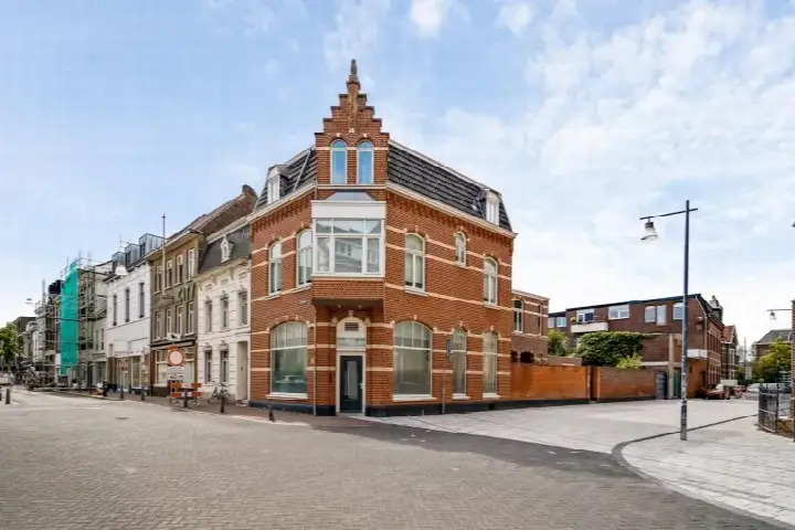
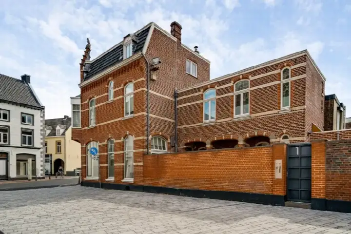
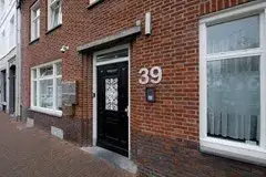
This terraced house on Schuitenberg 10 sits in the Binnenstad, the historic heart of Roermond, where the streets hum with the rhythm of a compact city centre. The home dates from 1887, making it one of the older properties in a neighbourhood where nearly half the housing stock was built before 1945. With a living area of 95 m² according to the BAG registration, the asking price of €299,000 works out at €3,147 per m². That puts it 34% below the average asking price of €452,542 for terraced houses in Roermond, so on price this one sits on the low side of the local market.
A compact home with a story
The listing gives no details on the layout, number of rooms, or any outdoor space, so the picture of the interior remains incomplete. What is clear is that this is a compact terraced house from the late nineteenth century, with an energy label F. Label F is one of the least efficient labels, so expect higher energy costs than you would with a more modern home. The plot measures 47 m² according to the BAG registration.
Life in the Binnenstad
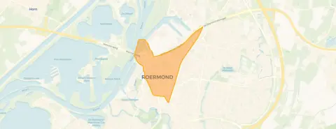
Living here means being part of a dense, urban neighbourhood with 6,060 residents, two-thirds of them single-person households. Across the municipality of Roermond, residents give their living environment an average score of 7.81 based on 19 reviews. One resident praises the "top location", noting it is "quietly situated in nature on a dead-end road" with "good accessibility to the city and motorway and all amenities". Another describes a "cosy neighbourhood with lovely people" and says they are "in general very satisfied". A third resident mentions the greenery is "very well maintained" but misses benches and picnic spots. The neighbourhood recorded 932 crimes in the latest figures, a number you can weigh for yourself. The Binnenstad neighbourhood is very strongly urban, with an address density of 2,563 per km².
Amenities and getting around
The daily routine is easy here. The pharmacy is on your doorstep, and the GP practice Huisartsen Aan de Singel is just around the corner. For groceries, Ekoplaza is a couple of streets away, with Jumbo a five-minute walk and Albert Heijn a ten-minute walk. Basisschool De Steenen Brug is a couple of streets away, and the nearest secondary school is a ten-minute walk. Bus line 2 stops at Minderbroederssingel just around the corner, while lines 67 and 68 serve Zwartbroekplein a couple of streets away. Roermond train station is a five-minute walk, and the Laurentius Ziekenhuis hospital is a ten-minute walk. The municipality of Roermond keeps everything within easy reach.
WOZ and address data
No WOZ value is available for this property, so there is no municipal valuation to compare with the asking price. The address does carry some risk indications at area level, not as an inspection of this specific home. Road traffic noise is measured at 52 dB Lden, above the noise standard, while railway noise at 39 dB Lden stays below it. The foundation risk indication is elevated, with the home built in 1887 on clay soil, and 1% of properties in this postcode area showing an elevated risk of pile rot. Pluvial flooding at heavy rain is indicated as elevated, while flood risk is low now and in 2050. Heat stress is medium now, rising to elevated by 2050.
Source
At the time of writing the home is offered only via Damen Makelaardij.
This summary was generated with AI and may contain errors. Always verify the details with the provider.
Features
Details of this home
Transfer
Price
Energy
 Save up to € 400 on your energy billCompare now
Areas and volume
 Insure your home and belongingsGet insured
Layout
Construction
Outdoor space
Frequently asked questions
About Schuitenberg 10, Roermond
How does the asking price compare to other homes in the Binnenstad?
The asking price of €299,000 is 34% below the average asking price of €452,542 for homes in this neighbourhood. The median asking price in the Binnenstad is €324,000, so this terraced house sits below that too. With a living area of 95 m², the price per m² comes to €3,147, compared to the neighbourhood average of €3,954 per m².
What is known about the layout of this home?
The listing does not state the number of rooms, bedrooms, or bathrooms, nor does it mention any garden, balcony, or other outdoor space. The living area is 95 m² according to the BAG registration, and the plot measures 47 m². The home was built in 1887 and has an energy label F.
Why are there no property details in this listing?
The listing does not state the layout, number of rooms, or any outdoor space. As a result, the interior of the home remains unknown from the listing alone. The available facts are the living area of 95 m², the plot of 47 m², the construction year of 1887, and the energy label F.
What does the energy label F mean for this home?
Energy label F is one of the least efficient labels, so the home will likely come with higher energy costs than a property with a better label. In the Binnenstad, 45% of the homes for sale have an energy label A or better, while 15% have a label D or lower. The label F puts this home in the lower group.
What is the foundation risk for this address?
The foundation risk indication for this address is elevated, based on area-level data rather than an inspection of this specific home. The home was built in 1887 on clay soil, and 1% of properties in this postcode area have an elevated risk of pile rot according to the Klimaateffectatlas. This is an indication for the area, not a verdict on this particular property.
How is the noise situation at this address?
Road traffic noise at this address is measured at 52 dB Lden, which is above the noise standard. Railway noise is measured at 39 dB Lden, which stays below the standard. These are area-level indications from public data, not measurements taken at the property itself.
What are the flooding and heat risks for this location?
Pluvial flooding at heavy rain is indicated as elevated for this address, while flood risk from rivers is low both now and in 2050. Heat stress is currently medium, rising to elevated by 2050. These are area-level indications based on public climate data, not an assessment of this specific home.
Which supermarkets are closest to this home?
Ekoplaza is the nearest supermarket, just around the corner at 279 metres. Jumbo is a five-minute walk away at 378 metres, and Albert Heijn is a ten-minute walk at 701 metres. Aldi is also within a ten-minute walk at 760 metres, with Lidl further out at 1.6 km.
What schools are near this home?
Basisschool De Steenen Brug is the nearest primary school, a couple of streets away at 333 metres. Openbare Basisschool aan de Roer is a ten-minute walk at 869 metres, and De Zonnewijzer is at 950 metres. The nearest secondary school is 1.7 km away.
How is the public transport from this address?
Bus line 2 stops at Roermond, Minderbroederssingel just around the corner at 189 metres. Lines 67 and 68 serve Roermond, Zwartbroekplein at 293 metres. Roermond train station is a five-minute walk at 409 metres, giving access to the national rail network.
What do residents say about living in this area?
Across the municipality of Roermond, residents give their living environment an average score of 7.81 based on 19 reviews. One resident praises the "top location", noting it is "quietly situated in nature on a dead-end road" with "good accessibility to the city and motorway". Another describes a "cosy neighbourhood with lovely people" and says they are "in general very satisfied".
What is the demographic makeup of the Binnenstad?
The Binnenstad has 6,060 residents, with 67% living in single-person households. The average household size is 1.4 people. The largest age group is 25 to 45-year-olds at 37%, followed by those aged 65 and over at 25%. Only 9% of households have children.