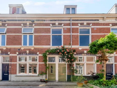
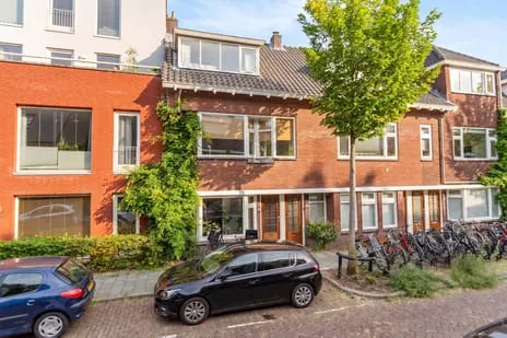
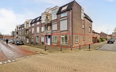
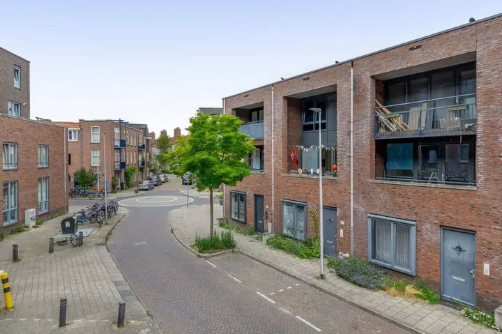
Bilderdijkstraat 64BS
Nieuw Engeland Th. a. Kempisplantsoen en omgeving, Utrecht
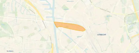 Neighbourhood
A classic apartment in Utrecht West
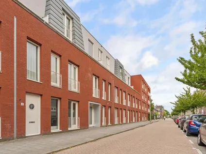
This apartment sits in the lively Nieuw Engeland, Th. a. Kempisplantsoen en omgeving neighbourhood, part of Utrecht's West district. The area is known for its pre-war housing stock and a mix of cultures, with the Kanaalstraat nearby. At €450,000, the asking price is on the high side compared to the average of €519,308 for homes currently for sale in the neighbourhood, but it is below the median of €525,000. For context, the average price per m² in the neighbourhood is €6,743, while this home asks €4,286 per m². If you're looking at [apartments in Utrecht], this one stands out for its size.
Inside the home
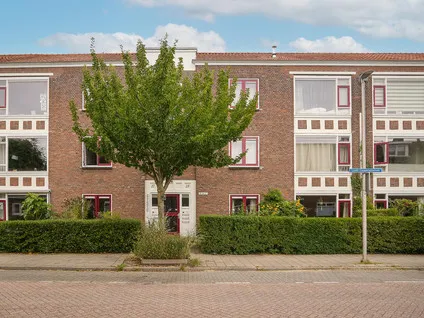
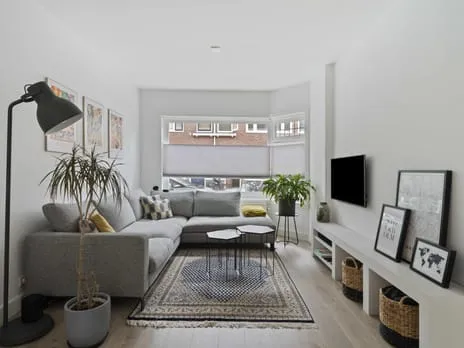
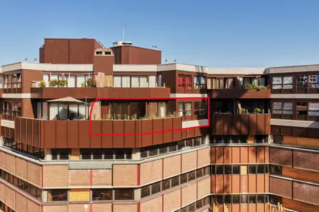
Built in 1906, this apartment spans two floors and includes four rooms, three bedrooms, and one bathroom. The living area is listed as 105 m² by the agent, while the BAG registration records 97 m². The home features a roof terrace, a central heating boiler, and is a full ownership (volle eigendom). It is located on the second floor of the building. The energy label is D, which means you can expect moderate energy costs.
The neighbourhood
Residents give the neighbourhood a high average score of 8.25 out of 10, based on three reviews. One resident says: "I have good experience in this neighbourhood, people are respectful, it's a nice place to live." Another notes: "It's a nice and safe neighbourhood. I'm also very happy with the renovation of the Kanaalstraat, it's now more accessible and nicer to walk through." The area is home to about 5,860 people, with a high proportion of one-person households (57%). The housing stock is mostly pre-war, with half of the homes built before 1945. For more details, see [the Nieuw Engeland, Th. a. Kempisplantsoen en omgeving neighbourhood].
Amenities and transport
Daily errands are easy: the Albert Heijn is just around the corner, and there are several other supermarkets within a short walk, including an Aldi and an Ekoplaza. For primary education, Kindercampus Molenpark is a couple of streets away, and KBS De Pijlstaart is a ten-minute walk. The nearest GP is Gezondheidscentrum Lombok, Huisartsen, and the pharmacy is Lombok Apotheek BV, both just around the corner. Public transport is well served: the bus stop Utrecht, Hasebroekstraat is on your doorstep with lines 12, 13, 28, 73, N1, and 120. Utrecht Centraal station is a ten-minute walk. The municipality of Utrecht offers all this and more, as you can see on [the municipality of Utrecht].
WOZ and address data
The WOZ value is €557,000 as of 1 January 2025, and the asking price is 19% below that value. Between 2020 and 2025, the WOZ value rose by 91%, from €291,000 to €557,000. As for address risks, these are area-level indications, not an inspection of this specific home. The noise level from road traffic is 57 dB Lden, which is above the norm, while railway and aircraft noise are below the norm. The foundation risk indication is medium, and the pluvial flooding risk is medium. The current flood risk is elevated, but by 2050 it is expected to be low. Heat stress is medium both now and in 2050.
Source and agent
At the time of writing, the home is offered via multiple channels, including Ludenhoff makelaars & taxateurs o.g. Utrecht.
This summary was generated with AI and may contain errors. Always verify the details with the provider.
Features
Details of this home
Transfer
Price

Areas and volume
 Insure your home and belongingsGet insured
Layout
Construction
Outdoor space
Location
The WOZ value is set annually by the municipality with 1 January as its reference date, and therefore lags the market by about a year. It is an estimated market value, not a sale price.
Frequently asked questions
About Bilderdijkstraat 64BS, Utrecht
How does the asking price compare to the WOZ value?
The asking price of €450,000 is 19% below the WOZ value of €557,000, which was set on 1 January 2025. This means the asking price is lower than the municipal valuation. The WOZ value is not the same as the market value, but it is an official indicator. The price per square metre, based on the agent's listed area of 105 m², is €4,286, which is lower than the neighbourhood average of €6,743 per m².
What is the layout of this apartment?
According to the agent, this apartment has four rooms, including three bedrooms and one bathroom, spread over two floors. The living area is listed as 105 m², though the BAG registration records 97 m². The home is located on the second floor and includes a roof terrace. It has a central heating boiler and is a full ownership property, meaning there is no leasehold.
What is the energy label and what does it mean?
The energy label is D. This label indicates that the home is not among the most efficient, so you can expect moderate energy costs. The label is based on the building's characteristics, but it does not tell you about the actual condition of the insulation or installations. In the neighbourhood, about 46% of homes for sale have a label A or better, so this home is less efficient than many others.
What are the noise levels like at this address?
According to public data, the noise level from road traffic is 57 dB Lden, which is above the Dutch noise norm. Railway noise is 47 dB Lden and aircraft noise is 41 dB Lden, both below the norm. These are area-level indications, not measurements taken at the property itself. If you are sensitive to noise, you may want to consider this, but the data does not specify the exact impact inside the home.
What is the foundation risk for this home?
The foundation risk indication for this address is medium. This is based on the fact that the building was constructed before 1970 (in 1906) and that the area is a KCAF attention area, with 100% of properties in this postcode built before 1970. Additionally, 2% of properties in the neighbourhood have an elevated risk of pile rot, according to the Klimaateffectatlas. This is an area-level indication, not an inspection of this specific home.
What are the flood risks for this property?
The current flood risk is indicated as elevated, but by 2050 it is expected to be low. Pluvial flooding (from heavy rain) is medium. These are area-level indications from public data, not a detailed assessment of this property. The risk levels are based on models and can change over time.
Which supermarkets are nearby?
There are several supermarkets within a short walk. The nearest Albert Heijn is just around the corner at 315 metres. Another Albert Heijn, an Aldi, and an Ekoplaza are all about 546 metres away, which is a five-minute walk. There is also an Aldi at 687 metres. This gives you plenty of options for daily groceries.
What schools are in the area?
For primary education, Kindercampus Molenpark is a couple of streets away at 489 metres, and KBS De Pijlstaart is at 611 metres. There is also Van Asch van Wijckschool at 676 metres. For secondary education, Christelijk Gymnasium Utrecht is at 708 metres. These distances are approximate walking distances.
How is the public transport in this neighbourhood?
The nearest bus stop is Utrecht, Hasebroekstraat, just around the corner at 222 metres, with lines 12, 13, 28, 73, N1, and 120. Another stop, Utrecht, Moskeeplein, is at 394 metres with similar lines. Utrecht Centraal train station is about 837 metres away, which is a ten-minute walk. This makes it easy to get around the city and beyond.
What do residents say about living here?
Residents rate the neighbourhood highly, with an average score of 8.25 out of 10, based on three reviews. One resident says: "I have good experience in this neighbourhood, people are respectful, it's a nice place to live." Another mentions: "It's a nice and safe neighbourhood. I'm also very happy with the renovation of the Kanaalstraat, it's now more accessible and nicer to walk through." A third notes it's "Quiet" with "Few bars/restaurants" but "Nice people."
How has the WOZ value developed over the past five years?
The WOZ value has increased by 91% between 2020 and 2025, from €291,000 to €557,000. This is a significant rise, reflecting the strong housing market in Utrecht. The reference date for the current WOZ value is 1 January 2025. This development is based on municipal data and does not predict future changes.
Experiences from Nieuw Engeland Th. a. Kempisplantsoen en omgeving
How residents experience their neighbourhood
I have good experience in this neighbourhood, people are respectful, it's a nice place to live
Auto-translated to English by AIIt's a nice and safe neighbourhood. I'm also very happy with the renovation of the Kanaalstraat, it's now more accessible and nicer to walk through. I've occasionally been catcalled near the Albert Heijn, which I really think shouldn't happen, but I'm not sure what we can do about it. I think there are enough shops in the area and I would recommend it.
Auto-translated to English by AIFew bars/restaurants Nice people
Auto-translated to English by AIStatistics for Nieuw Engeland Th. a. Kempisplantsoen en omgeving
Figures on residents, liveability and the housing market
| Sale price | €509,733 | €499,000 |
|---|---|---|
| Sale per m² | €6,489 | – |
| Rent price | €1,850 p/m | €1,850 p/m |
Experiences from West
How residents experience their district
Cosy, student-like, park on the doorstep, where people sit when the weather is nice. Pub in the neighbourhood, shopping centre within walking distance and Kanaalstraat nearby.
Auto-translated to English by AIEspecially great that there are so many nice shops in the area. The walks to the Muntkade and Park Oog en Al also often make my day. The house I live in is old and hasn't been properly maintained by the landlord for a long time.
Auto-translated to English by AIIt's a reasonably quiet neighbourhood. But there is absolutely no social contact.
Auto-translated to English by AIMy experience in the neighbourhood used to be very good. It was fun and cosy. Now there are some people living there who make it a lot less cosy and cause unjustified nuisance. You are wrongly accused and the police are called immediately. Personally, I don't think it's a safe neighbourhood, cars also drive very fast and there are many children who are careless with scooters or fatbikes.
Auto-translated to English by AII quite like it there
Auto-translated to English by AIThe neighbourhood is restless and there is often rubbish on the street. And by restless I mean that in November fireworks go off at night and people often hang around on the street until late. There is a snack bar and several shops in the area. However, there is a lot of hassle, for example with the sewerage that needs to be repaired. When residents report this, it sometimes takes months before anything is done about it, and even then it is not done properly. More police are also needed in the neighbourhood.
Auto-translated to English by AII have good experience in this neighbourhood, people are respectful, it's a nice place to live
Auto-translated to English by AIIt's a beautiful neighbourhood with well-maintained houses and gardens, but there is little contact between residents. Although the surroundings are inviting and tidy, you hardly see people on the street and there is little interaction. Everyone seems to go their own way, which makes the neighbourhood, despite its beauty, a bit lonely.
Auto-translated to English by AIStatistics for West
Figures on residents, liveability and the housing market
| Sale price | €635,553 | €610,376 |
|---|---|---|
| Sale per m² | €6,842 | – |
| Rent price | €1,826 p/m | €1,775 p/m |
| Rent per m² | €23 p/m | – |
Experiences from Utrecht
How residents experience their municipality
De Nieuwegracht is een rustige en schone kant van het centrum van Utrecht. Aan de overkant ligt een mooi park en een grote weide. Hier is het over het algemeen rustig, soms helaas niet heel schoon. Op de wandelpaden liggen op sommige plekken erg veel sigaretten. De buurt is erg goed bereikbaar op de fiets en te voet. De auto is niet aan te raden, hoewel de Nieuwegracht in vergelijking met de Oudegracht en Twijnstraat veel makkelijker is voor auto's.
Auto-translated to English by AILeuke gemixte buurt waar mensen oog voor elkaar hebben en het rustig wonen is. Het grootste voordeel is dat alle voorzieningen dichtbij zijn zoals Leidsche Rijn centrum, winkelcentrum parkwijk, bushalte, treinstation, scholen, sportclubs, parken, bioscoop en horeca.
Auto-translated to English by AIHeerlijk rustige buurt op slechts 20 minuten afstand van het centrum van Utrecht. Park Hoge Weide, scholen, supermarkten en sportvoorzieningen zijn om de hoek.
Auto-translated to English by AIThe neighborhood is considered safe, has an active and engaged community, and is well maintained. Neighborhood relations are good. Residents have access to quality housing, reputable schools, and attractive green spaces such as Wilhelminapark, Oosterspoorbaan and Minstroom. The centre is within reach, and Oost offers a nice number of shops.
Auto-translated to English by AICosy, student-like, park on the doorstep, where people sit when the weather is nice. Pub in the neighbourhood, shopping centre within walking distance and Kanaalstraat nearby.
Auto-translated to English by AILunetten zuid is a fairly extensive area, but there are common characteristics: There is little traffic on the streets, even the ring road is relatively quiet. Many houses are situated around a shared green space with some play facilities. This quickly creates a bond with the neighbours. Because Lunetten is separated from the city by a park and forts, which are part of the UNESCO heritage, it has some village-like features. If you value your privacy and don't like contact, then Leidsche rijn is more likely a place where you'll feel at home. Lunetten is not a place of high fences, but rather has a scent of granola with a hint of wokeness. If you feel at home with that, you are very welcome, but if you are not willing to do something for the neighbourhood or your neighbours, there are plenty of other places where you will feel at home.
Auto-translated to English by AII've lived in Zuilen for 26 years and still consider it one of the best neighbourhoods in Utrecht. With shops, schools, buses and the train station all nearby, everything is within reach. And with the beautiful Julianapark just around the corner, the area also has a lovely place to relax. As far as I'm concerned, an absolute top location.
Auto-translated to English by AIEspecially great that there are so many nice shops in the area. The walks to the Muntkade and Park Oog en Al also often make my day. The house I live in is old and hasn't been properly maintained by the landlord for a long time.
Auto-translated to English by AIStatistics for Utrecht
Figures on residents, liveability and the housing market
| Sale price | €594,392 | €545,276 |
|---|---|---|
| Sale per m² | €6,538 | – |
| Rent price | €1,906 p/m | €1,879 p/m |
| Rent per m² | €24 p/m | – |
Location and amenities
Bilderdijkstraat 64BS, Utrecht







Risks and environmental factors
Noise, foundation and climate around this address
Noise levels
Foundation risk
Rainwater flooding
Flooding
Heat stress

Similar homes
View more homes nearby