Frans Douvenstraat 29
Roerzicht, Roermond
 Area
AreaA grand old terraced house in Roerzicht
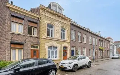
On Frans Douvenstraat 29 in Roerzicht, a neighbourhood in Roermond, stands a terraced house from 1880. With a living area of 246 square metres according to the BAG registration, this is a home with real presence. The asking price of €525,000 is keen compared with the average asking price of €604,850 in the neighbourhood, which works out at €2,134 per square metre based on the BAG surface area. For context, terraced houses in Roermond are the property type on offer here.
The home itself
This listing does not state the layout, number of rooms, bedrooms or bathrooms, nor any details about the garden, insulation or heating installations. The year of construction is 1880 and the energy label is G, the least efficient label, so expect high energy costs. The plot measures 177 square metres according to the BAG registration.
Roerzicht
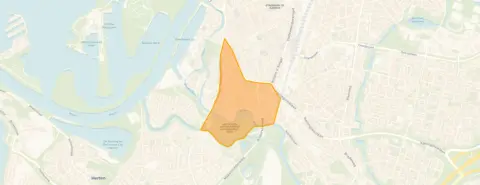
Roerzicht is a small neighbourhood with around 1,330 residents, and a quarter of them are 65 or older. Residents across the municipality of Roermond give their living environment an average score of 7.91, based on twenty reviews. One resident says: "Quietly situated in nature on a dead-end road. Good accessibility to the city and motorway and all amenities. All types of schools within very short cycling distance." Another resident adds: "It's a quiet neighbourhood with lots of greenery, but it could be even more for my liking." A third resident is simply "satisfied" with the "cosy neighbourhood with lovely people". The reviews describe the Roerzicht neighbourhood as quiet and green, though the sample is small.
Amenities and transport
Daily errands are easily done from this address. Ekoplaza is just around the corner, with Jumbo a couple of streets away and Aldi a ten-minute walk. Basisschool De Steenen Brug is a couple of streets away, and Openbare Basisschool aan de Roer is a ten-minute walk. The GP and pharmacy are both just around the corner at Huisartsen Aan de Singel and Apotheek Roermond aan de Singel, while Laurentius Ziekenhuis is a ten-minute walk. Bus stops at Zwartbroekplein (lines 67 and 68) and Bisschop Lindanussingel (line 2) are on your doorstep, and Roermond train station is a ten-minute walk. The municipality of Roermond is well served by these connections.
WOZ and address data
No WOZ value is available for this property. The address risk data, which is an area-level indication rather than an inspection of this specific home, shows road traffic noise at 47 dB and railway noise at 47 dB, both below the noise standard. The foundation risk indication is medium, with the note that the home was built in 1880 on clay soil, possibly on wooden piles or a shallow foundation, and that the entire postcode area falls within a KCAF attention zone. Pluvial flooding at heavy rain is low, while the current flood risk is elevated and remains elevated in 2050. Heat stress is currently low but rises to medium by 2050.
Source
At the time of writing the home is offered only via M3 Makelaardij.
This summary was generated with AI and may contain errors. Always verify the details with the provider.
Features
Details of this home
Transfer
Price

Areas and volume
 Insure your home and belongingsGet insured
Layout
Construction
Outdoor space
Frequently asked questions
About Frans Douvenstraat 29, Roermond
What does the asking price of €525,000 mean for this home?
The asking price is €525,000 for a terraced house with a living area of 246 square metres according to the BAG registration. That works out at €2,134 per square metre. Compared with the average asking price of €604,850 in the neighbourhood, this price is keen, which means it is below the neighbourhood average. The price verdict is based on the neighbourhood average asking price and is precomputed.
What is known about the layout of this home?
The listing does not state the number of rooms, bedrooms or bathrooms, nor which floor they are on. The living area is 246 square metres according to the BAG registration, and the plot measures 177 square metres. No details about a garden, balcony or garage are given in the listing.
Why is there no WOZ value mentioned?
The WOZ is the municipal valuation on a reference date and comes from the municipality, not from the estate agent. Since it is not available for this property, no comparison with the asking price or historical development can be made.
What does the foundation risk indication mean?
The foundation risk indication for this address is medium. This is an area-level indication based on public risk data, not an inspection of this specific home. The notes mention that the home was built in 1880 on clay soil, possibly on wooden piles or a shallow foundation, and that the entire postcode area falls within a KCAF attention zone because all buildings predate 1970.
What are the flood and heat risks at this address?
The area-level climate data shows that pluvial flooding at heavy rain is low, while the current flood risk is elevated and remains elevated in 2050. Heat stress is currently low but rises to medium by 2050. These are indications at area level from the Klimaateffectatlas, not an assessment of this particular property.
Which supermarkets are nearby?
Ekoplaza is about 400 metres away, just around the corner. Jumbo is about 765 metres away, a couple of streets further, and Aldi is about 900 metres away. Albert Heijn is about 1.1 kilometres and Lidl about 1.6 kilometres. In total there are 14 supermarkets within five kilometres of this address.
Which schools are within walking distance?
Basisschool De Steenen Brug is about 364 metres away, a couple of streets from the home. Openbare Basisschool aan de Roer is about 682 metres away, a ten-minute walk. De Zonnewijzer is about 868 metres away. There are 33 schools within five kilometres, including primary and special education.
How is the public transport connection?
Bus stops are close by: Zwartbroekplein with lines 67 and 68 is about 208 metres away, and Bisschop Lindanussingel with line 2 is about 294 metres away. Roermond train station is about 772 metres away, a ten-minute walk. The bus lines are given as numbers only, without destinations or frequencies.
What do residents say about living in this area?
Residents across the municipality of Roermond give their living environment an average score of 7.91, based on twenty reviews. One resident praises the quiet location in nature on a dead-end road with good accessibility to the city and motorway. Another mentions the quiet, green neighbourhood with well-maintained greenery, though they miss benches and picnic spots. A third resident is satisfied with the cosy neighbourhood and lovely people.
What is the energy label and what does it mean?
The energy label is G, which is the least efficient label on the scale. This means you should expect high energy costs for heating and electricity. The label is a fact about the home's energy performance and does not say anything about the structural condition of the building. No insulation details are stated in the listing.