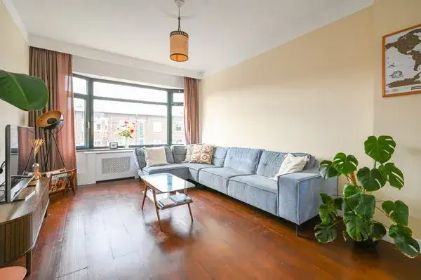
Zamenhofstraat 29
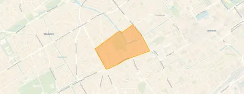
Rond de Energiecentrale, Den Haag
 Area
AreaA modern start in an older part of town
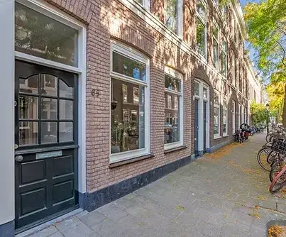
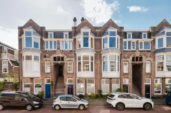
This apartment on Zamenhofstraat 29 sits in the Rond de Energiecentrale neighbourhood, part of the Regentessekwartier district in Den Haag. It is a recent build from 2020, which stands out in an area where most homes date from before 1945. The asking price of €469,000 is on the high side compared with the neighbourhood average asking price of €369,260, and it is also above the average price per square metre in the area. For context, apartments in Den Haag typically sell at a range of prices, and this one sits at the upper end.
The home itself
The listing gives the living area as 66 square metres according to the BAG registration. The energy label is A+, which is an efficient label. The home was built in 2020, so it is relatively new. The agent does not provide further details about the layout, such as the number of rooms or bedrooms, or about any outdoor space or installations.
A neighbourhood in transition
Rond de Energiecentrale is a densely populated area, with over 9,000 addresses per square kilometre, making it very strongly urban. Residents give the neighbourhood an average score of 7.88 out of 10, based on eight reviews. One resident says: "Put more green in our neighbourhood and also maintain it." Another resident, who lives on the Joseph Ledelstraat, mentions that windows are often left ajar at night and asks for more surveillance. The neighbourhood has a mix of ages, with a large share of residents between 25 and 45. The housing stock is mostly older, but this home is part of the newer additions. The Rond de Energiecentrale neighbourhood is lively and central, though the reviews suggest some residents would like more greenery and a stronger sense of safety.
Daily life and getting around
For groceries, the nearest Albert Heijn is just around the corner, and there are several other supermarkets within a short walk. The nearest primary school, De Parachute, is a bit further away, about a ten-minute walk. The nearest GP practice is MediCor Gezondheidszorg, Huisartsenzorg, locatie Rijswijkseplein, and the pharmacy, BENU Apotheek de Wasserij, is on your doorstep. For public transport, the Monstersestraat tram stop is just around the corner, with lines 2 and 4, and the Loosduinseweg stop is also nearby with line 11. The nearest train station, Den Haag HS, is about a ten-minute walk. The municipality of Den Haag offers a wide range of amenities within easy reach. According to area-level risk data, the noise from road traffic is above the standard, at 50 dB Lden, while noise from rail, air and industry is below the standard. The foundation risk indication is low, though the area is a KCAF attention zone, with 30% of properties in this postcode area built before 1970. For climate, the indication for pluvial flooding at heavy rain is elevated, while the flood risk is low now and in 2050. Heat stress is currently medium and is expected to become elevated by 2050. These are area-level indications, not an inspection of this specific home.
Source
At the time of writing, the home is offered only via Janson Makelaardij B.V.
This summary was generated with AI and may contain errors. Always verify the details with the provider.
Features
Details of this home
Transfer
Price
Energy
 Save up to € 400 on your energy billCompare now
Areas and volume
 Insure your home and belongingsGet insured
Layout
Construction
Outdoor space
The WOZ value is set annually by the municipality with 1 January as its reference date, and therefore lags the market by about a year. It is an estimated market value, not a sale price.
Frequently asked questions
About Zamenhofstraat 29, 'S-Gravenhage
How does the asking price compare with other homes in the neighbourhood?
The asking price of €469,000 is 27% above the neighbourhood average asking price of €369,260. The average price per square metre in the neighbourhood is €5,243, while this home is listed at €7,106 per square metre based on the BAG living area. The neighbourhood has 46 homes for sale, with prices ranging from €174,000 to €925,000.
What is the energy label of this apartment?
The energy label is A+, which is an efficient label. In the neighbourhood, only 12.7% of the homes for sale have an A+ label, so this is a relatively rare feature. The home was built in 2020, which is recent compared with the majority of the housing stock in the area, where 76.4% was built before 1945.
What is the living area of this apartment?
The living area is 66 square metres according to the BAG registration. The agent does not provide a separate figure, so this is the only stated area. The price per square metre is calculated on this basis, at €7,106.
What is the WOZ value of this home?
The WOZ value is the municipal valuation, which is separate from the asking price. Without this figure, it is not possible to compare the asking price with the official valuation.
What is the noise situation around this address?
According to area-level data, the noise from road traffic is above the standard, at 50 dB Lden. Noise from rail traffic is 31 dB Lden, from air traffic 20 dB Lden, and from industry 45 dB Lden, all below the standard. These are indications for the area, not measurements at the home itself.
What is the foundation risk for this area?
The foundation risk indication is low. However, the area is a KCAF attention zone, meaning that 30% of the properties in this postcode area were built before 1970. This is an area-level indication and does not reflect an inspection of this specific home, which was built in 2020.
What are the climate risks for this location?
Area-level data indicates that the risk of pluvial flooding at heavy rain is elevated, while the flood risk is low now and in 2050. Heat stress is currently medium and is expected to become elevated by 2050. These are indications for the area, not a prediction for this specific home.
Which supermarkets are nearby?
The nearest Albert Heijn is about 600 metres away, and there are several other supermarkets within a short walk, including another Albert Heijn at 742 metres, a Coop at 801 metres, and more Albert Heijn stores at 821 and 898 metres. In total, there are 93 supermarkets within five kilometres.
Which schools are in the area?
The nearest primary school is De Parachute, about 3.5 kilometres away. Other primary schools include Protestants Christelijke Basisschool Groen van Prinsterer and KC de Telescoop. For secondary education, Sint-Maartenscollege and Gymnasium Novum are also within about 4.3 kilometres.
What public transport options are available?
The nearest tram stop is Monstersestraat, about 180 metres away, with lines 2 and 4. The Loosduinseweg stop is about 200 metres away with line 11, and the Elandstraat stop is about 408 metres away with line 3. The nearest train station is Den Haag HS, about 2 kilometres away.
What is the neighbourhood like according to residents?
Residents give the neighbourhood an average score of 7.88 out of 10, based on eight reviews. One resident asks for more green spaces and better maintenance, while another mentions concerns about surveillance at night. The neighbourhood is very strongly urban, with a high population density and a mix of ages.