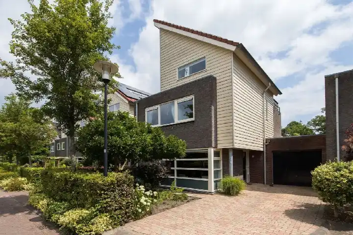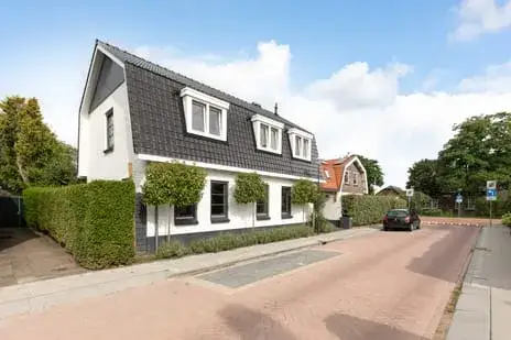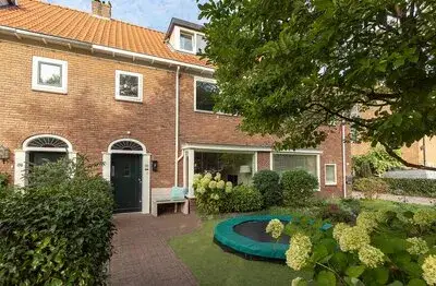





A 1934 detached house on the edge of the woods
This detached house from 1934 sits in Hollandsche Rading Kern, a village-like neighbourhood in the municipality of De Bilt. The home is surrounded by greenery and the woods are close by, giving the area a calm, rural feel. With a price of €850,000, the asking price is on the high side compared with the average asking price in the neighbourhood. The price per square metre, based on the agent's floor area, comes to €7,456. For context, detached houses in De Bilt are part of a wider market where prices vary considerably.
The home itself
According to the agent, the house has four rooms, three bedrooms and one bathroom spread over two floors. The living area is listed as 114 m² by the agent, while the BAG registration records 98 m². The plot measures 505 m². The home has a garden all around and a balcony. It is fully owned. The agent mentions insulation in the roof, HR+ glazing, wall insulation and floor insulation. Heating is provided by a central heating boiler, a wood stove and partial underfloor heating.
Life in Hollandsche Rading Kern
Residents of the municipality of De Bilt give their living environment an average score of 6.22, based on four reviews. One resident describes the wider area as green and quiet, with old trees, characteristic houses and gardens that give it a park-like character. Another resident is far less positive, mentioning a deteriorating living environment and safety concerns. The neighbourhood itself has around 1,330 inhabitants, and most homes are owner-occupied. The reviews reflect the municipality as a whole, not this neighbourhood specifically. For a closer look at what the Hollandsche Rading Kern neighbourhood has to offer, the figures paint a mixed picture.
Amenities and transport
The nearest primary school, Protestants Christelijke Basisschool Bosbergschool, is just around the corner. For daily groceries, the nearest supermarket is a Jumbo, a couple of streets away. The nearest GP is Huisartsenpraktijk Maartensdijk, and the nearest pharmacy is Service Apotheek Maertensplein BV, both a short drive away. The nearest bus stop, Hollandsche Rading, Vuurse Dreef, is on your doorstep and is served by lines 58 and Flex. The train station Hollandsche Rading is also just around the corner. The municipality of De Bilt offers a range of amenities within reach.
WOZ and address data
The WOZ value of the home is €755,000, based on the reference date 1 January 2025. The asking price is 13% above this WOZ value. Between 2020 and 2025, the WOZ value rose by 45%, from €519,000 to €755,000. As for address-level risks, the noise from road traffic is 65 dB Lden, which is above the noise standard, while railway and aircraft noise stay below the standard. The foundation risk indication is low, based on area-level data. The risk of pluvial flooding at heavy rain is elevated, while the current flood risk is low. These are area-level indications, not an inspection of this specific home.
Source and agent
At the time of writing, the home is offered via multiple channels, including VAN VULPEN ROOZENBURG MAKELAARS.
This summary was generated with AI and may contain errors. Always verify the details with the provider.
Features
Details of this home
Transfer
Price
Energy
 Save up to € 400 on your energy billCompare now
Areas and volume
Layout
Construction
Outdoor space
The WOZ value is set annually by the municipality with 1 January as its reference date, and therefore lags the market by about a year. It is an estimated market value, not a sale price.
Frequently asked questions
About Spoorlaan 11, Hollandsche Rading
How does the asking price compare with the WOZ value?
The asking price of €850,000 is 13% above the WOZ value of €755,000, which was set on 1 January 2025. The WOZ value is the municipal valuation, not the current market value. The price per square metre, based on the agent's floor area of 114 m², is €7,456. The asking price is also on the high side compared with the average asking price in the neighbourhood, which is €756,636.
What is the layout of the house?
According to the agent, the house has four rooms, three bedrooms and one bathroom, spread over two floors. The living area is listed as 114 m² by the agent, while the BAG registration records 98 m². The plot measures 505 m². There is a garden all around the house and a balcony. The home is fully owned.
What is the energy label and what does it mean for costs?
The energy label is G, which is the least efficient label. This means you can expect relatively high energy costs for heating and electricity. The agent does mention insulation in the roof, HR+ glazing, wall insulation and floor insulation, as well as a central heating boiler, a wood stove and partial underfloor heating. The label itself does not say anything about the condition of the home.
What is the foundation risk for this home?
The foundation risk indication for this address is low, according to area-level data from public sources. The home was built in 1934, and the soil type is sand. This is an area-level indication, not an inspection of this specific home. No further details are given in the listing.
What are the noise levels around this address?
The noise from road traffic at this address is 65 dB Lden, which is above the noise standard. Railway noise is 40 dB Lden and aircraft noise is 42 dB Lden, both below the standard. These figures come from public data and are area-level indications, not measurements taken at the property itself.
What is the risk of flooding at this location?
The risk of pluvial flooding, which is flooding from heavy rain, is elevated at this address. The current flood risk from rivers or the sea is low, and it is also expected to remain low in 2050. Heat stress is currently low but is expected to become medium by 2050. These are area-level indications from the Climate Impact Atlas.
Which schools are nearby?
The nearest primary school is Protestants Christelijke Basisschool Bosbergschool, which is about 343 metres away, so just a short walk. Other primary schools within a few kilometres include School met de Bijbel and Daltonschool Wereldkidz Kievit. For secondary education, Aeres VMBO Maartensdijk is about 2.4 kilometres away.
How far is the nearest supermarket?
The nearest supermarket is a Jumbo, about 2.3 kilometres from the home. Other options within about 4.5 kilometres include a Boni, another Jumbo, an Albert Heijn and a SPAR express. For daily groceries, you would likely drive or cycle, as the nearest option is not within walking distance.
What public transport options are available?
The nearest bus stop is Hollandsche Rading, Vuurse Dreef, about 264 metres away, served by lines 58 and Flex. The nearest train station is Hollandsche Rading, about 151 metres away. This makes the home well placed for commuting by train or bus, though the listing does not specify destinations or frequencies.
What do residents say about living in this area?
Residents of the municipality of De Bilt give their living environment an average score of 6.22, based on four reviews. One resident praises the green, quiet character and the convenience of shops and schools within walking distance. Another resident is critical, mentioning a deteriorating living environment and safety concerns. These reviews reflect the municipality as a whole, not this specific neighbourhood.