




Spoorlaan 38
Hollandsche Rading Kern · 3739 KD Hollandsche Rading

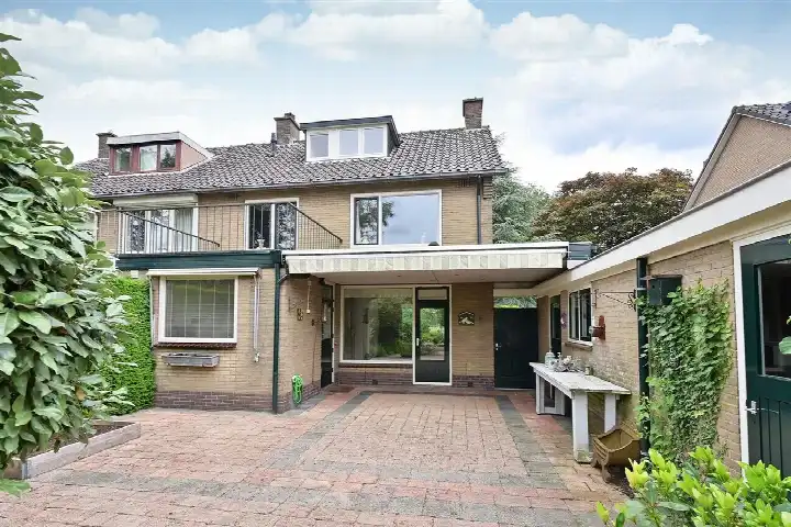
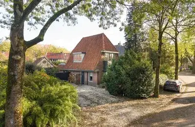
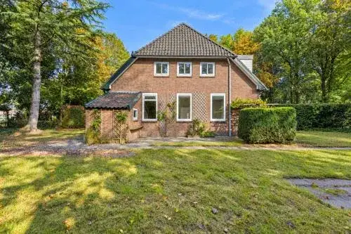
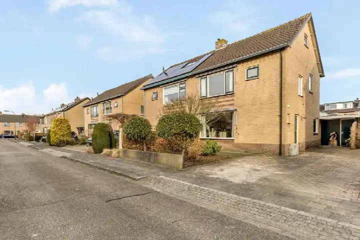
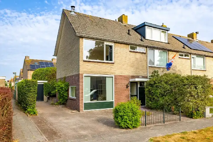
A 1936 semi-detached home in Hollandsche Rading
Tucked away in the village of Hollandsche Rading, this semi-detached house from 1936 sits on a plot of 470 m². The living area is 133 m² according to the BAG registration, which is 29% smaller than the neighbourhood average of 188 m². With a last known asking price of €700,000, that worked out to €5,263 per m². Compared with other [semi-detached houses in De Bilt], the price was on the high side. This home has not been online since 10 November 2026.
The home itself
The listing did not state the number of rooms, bedrooms or bathrooms, nor did it mention any outdoor space or installations. What is known is that the house was built in 1936 and carries energy label E. Label E was not an efficient label, so expect higher energy costs. The home was offered without further property details in the listing.
Life in Hollandsche Rading Kern
Hollandsche Rading Kern is a small community of around 1,350 residents, where 97% of the homes are single-family houses and 82% are owner-occupied. The village has a train station just around the corner, which a resident of the municipality of De Bilt mentions positively: "My neighbourhood is green, close to a station and lots of nice people live here!" Across the municipality, residents give an average score of 5.0 out of 10, based on three reviews. Some residents are less positive, describing the area as unsafe in the evenings. The neighbourhood recorded 51 crimes in total, a figure you can interpret for yourself. For more context, see [the Hollandsche Rading Kern neighbourhood].
Amenities and transport
The nearest primary school, the Protestant Christelijke Basisschool Bosbergschool, is just around the corner. For groceries, the closest Jumbo is a couple of streets away, with a Boni and another Jumbo within a ten-minute walk. The GP practice Huisartsenpraktijk Maartensdijk and the Service Apotheek Maertensplein are both a couple of streets away in Maartensdijk. Bus stops on the Vuurse Dreef and Tolakkerweg are on your doorstep, served by lines 58 and Flex, and the train station Hollandsche Rading is just around the corner. The municipality of De Bilt offers further amenities within reach. The address-level risk data indicates that road traffic noise is above the norm at 58 dB Lden, while railway and aircraft noise stay below the norm. The foundation risk indication is low, on sandy soil, and the home was built before 1970. Pluvial flooding at heavy rain is low, the current flood risk is medium, and heat stress is low now but medium by 2050. These are area-level indications, not an inspection of this specific home.
Source
When this home was still on the market, it was offered only via Dorenbos I Rasch Makelaars.
This summary was generated with AI and may contain errors. Always verify the details with the provider.
Features
Details of this home
Transfer
Price

Areas and volume
 Insure your home and belongingsGet insured
Construction
The WOZ value is set annually by the municipality with 1 January as its reference date, and therefore lags the market by about a year. It is an estimated market value, not a sale price.
Frequently asked questions
About Spoorlaan 38, Hollandsche Rading
What was the asking price for this semi-detached house?
The asking price was €700,000. With a living area of 133 m² according to the BAG registration, that came to €5,263 per m². The neighbourhood average price per m² for homes at the time for sale was €4,083, so this home was priced above that level. The average asking price in the neighbourhood was €762,500.
What property details are known about this home?
The listing stated that the home was a semi-detached house built in 1936 with energy label E. The living area is 133 m² and the plot is 470 m², both according to the BAG registration.
Why were there no property details in this listing?
The listing did not state the number of rooms, bedrooms or bathrooms, nor did it mention a garden, balcony or garage. It also does not provide information about insulation, heating or ownership. As a result, the layout and condition of the home cannot be assessed from the listing alone.
What is the energy label and what does it mean?
The home has energy label E. Label E was not an efficient label, so expect higher energy costs compared with more efficient homes. In the neighbourhood, most homes for sale had label C, so this home scores lower on energy efficiency than the typical offering in the area.
What is the WOZ value of this home?
The WOZ value is the municipal valuation used for tax purposes, and it is not available for this home in the data provided. Without it, no comparison between the WOZ value and the asking price could be made.
What are the noise levels around this address?
The address-level risk data shows road traffic noise at 58 dB Lden, which is above the noise norm. Railway noise is 38 dB Lden and aircraft noise is 42 dB Lden, both below the norm. These are area-level indications based on public data, not measurements at the property itself.
What is the foundation risk for this home?
The foundation risk indication for this address is low. The soil type is sand, and the home was built in 1936, before 1970. This is an area-level indication based on public data, not an inspection of the specific property. The actual foundation condition was not known from the listing.
What flood and climate risks apply to this address?
The climate risk data indicates that pluvial flooding at heavy rain is low, the current flood risk is medium, and the flood risk by 2050 is low. Heat stress is currently low but is expected to be medium by 2050. These are area-level indications from the Klimaateffectatlas, not an assessment of this specific home.
Which schools are near this home?
The nearest primary school is the Protestant Christelijke Basisschool Bosbergschool, just around the corner at 246 metres. Other primary schools within a couple of streets away include School met de Bijbel and Daltonschool Wereldkidz Kievit. For secondary education, Aeres VMBO Maartensdijk is about 2.3 km away.
What public transport options are available nearby?
The train station Hollandsche Rading is just around the corner at 275 metres. Bus stops on the Vuurse Dreef and Tolakkerweg are on your doorstep, both served by lines 58 and Flex. A third stop at Plantsoen is about 821 metres away, also on lines 58 and Flex.
What is the neighbourhood like in Hollandsche Rading Kern?
Hollandsche Rading Kern has around 1,350 residents, with 97% of homes being single-family houses and 82% owner-occupied. Residents of the municipality of De Bilt give an average score of 5.0 out of 10, based on three reviews. One resident praises the green surroundings and the station, while others express concerns about safety in the evenings.
How did the price compare with other homes in the neighbourhood?
The asking price of €700,000 was below the neighbourhood average of €762,500 for homes at the time for sale. However, the price per m² of €5,263 was higher than the neighbourhood average of €4,083 per m². The two homes at the time for sale in the neighbourhood range from €750,000 to €775,000.