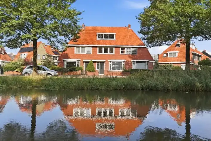
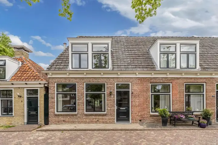
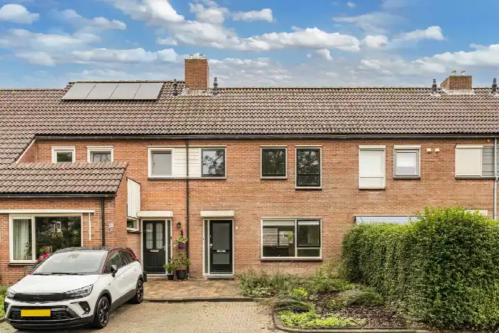
Jan Bogtstrastraat 19
Franeker Vliet Tuinen en Frisia, Waadhoeke
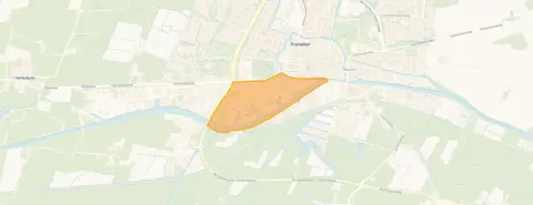 Area
AreaA terraced house in Franeker
This 1930 terraced house sits in the Franeker Vliet Tuinen en Frisia neighbourhood, a quiet corner of Franeker where residents give the district an average score of 8.42. The asking price of €235,000 is in line with the market, sitting 17% below the neighbourhood average asking price of €283,167. For context, the living area of 71 m² is 40% smaller than the neighbourhood average of 118 m². If you are weighing up options, [terraced houses in Waadhoeke]( /koopwoningen/waadhoeke/tussenwoningen/) give a sense of what else is on offer nearby.
The home itself
The listing gives the essentials: a terraced house built in 1930 with an energy label F. The living area is 71 m² according to the BAG registration, and the plot measures 121 m². The agent does not provide further details on layout, rooms, or installations, so the picture is limited to these facts. The energy label F is the least efficient label, so expect higher energy costs.
Life in Franeker Vliet Tuinen en Frisia
Residents of the district describe it as quiet and cosy, with one saying: "A quiet and safe neighbourhood" and another noting "Cheerful and cosy neighbourhood". A third resident adds: "Quiet neighbourhood, nice neighbours, unfortunately little to do for children. Accessibility is good, also public transport nearby. It is tidy and there are enough schools for the child's development." These views come from seven reviews of the wider district, not just this neighbourhood. The area counts 905 inhabitants, with a mix of ages and household types. For a closer look at what the area offers, [the Franeker Vliet Tuinen en Frisia neighbourhood]( /buurt/franeker-vliet-tuinen-en-frisia-waadhoeke/) page has more.
Amenities and transport
Daily errands are well covered. Poiesz supermarket is just around the corner, with Albert Heijn and Lidl a ten-minute walk away. Basisschool De Kabas is a couple of streets away, and Openbare Basisschool De Steven is a ten-minute walk. The GP practice Huisartsenpraktijk Zwager en Siemensma and Service Apotheek De Hertog are both a ten-minute walk. Bus stops on the Harlingerweg are on your doorstep, with lines 97 and 197, and the Voorstraat stop a five-minute walk offers lines 35, 75, 97, 197, 8061 and 8071. Franeker train station is a ten-minute walk. The municipality of [the municipality of Waadhoeke]( /gemeente/waadhoeke/) covers the wider area. Address-level risk data indicates the foundation risk is elevated, based on the 1930 construction on clay soil, with a note that 79% of properties in this postcode area were built before 1970. These are area-level indications, not an inspection of this specific home. Noise from road traffic is 47 dB Lden, below the norm, and pluvial flooding at heavy rain is medium. Flood risk is currently medium, dropping to low by 2050, while heat stress is low now and medium by 2050.
Source
At the time of writing the home is offered only via De Waard Makelaars en Taxateurs.
This summary was generated with AI and may contain errors. Always verify the details with the provider.
Features
Details of this home
Transfer
Price

Areas and volume
 Insure your home and belongingsGet insured
Construction
The WOZ value is set annually by the municipality with 1 January as its reference date, and therefore lags the market by about a year. It is an estimated market value, not a sale price.
Frequently asked questions
About Jan Bogtstrastraat 19, Franeker
How does the asking price compare to other homes in the neighbourhood?
The asking price of €235,000 is in line with the market, sitting 17% below the neighbourhood average asking price of €283,167. The median asking price in the neighbourhood is also €235,000, and the range runs from €225,000 to €389,500. The price per square metre is €3,310 based on the BAG living area of 71 m², which is 33% above the neighbourhood average of €2,488 per m².
What is the living area and plot size of this home?
According to the BAG registration, the living area is 71 m² and the plot measures 121 m². The agent does not state any additional details about the layout, such as the number of rooms or bedrooms. The home was built in 1930 and has an energy label F, which is the least efficient label, so expect higher energy costs.
What is the WOZ value of this property?
The WOZ value is the municipal valuation used for tax purposes, and it is not available here. Without this figure, it is not possible to compare the asking price to the official valuation. The asking price of €235,000 is in line with the market according to the neighbourhood average.
What is the foundation risk for this home?
The address-level risk data indicates an elevated foundation risk. This is based on the home being built in 1930 on clay soil, with a note that 79% of properties in this postcode area were built before 1970. In this neighbourhood, 1% of properties have an elevated risk of pile rot, according to the Klimaateffectatlas. These are area-level indications, not an inspection of this specific home.
What public transport options are available nearby?
The nearest bus stop is on the Harlingerweg, just around the corner, with lines 97 and 197. The Vijverstraat stop is a five-minute walk with lines 35 and 75, and the Voorstraat stop is also a five-minute walk with lines 35, 75, 97, 197, 8061 and 8071. Franeker train station is a ten-minute walk away.
What do residents say about living in this area?
Residents of the district give an average score of 8.42, based on seven reviews. One resident says: "A quiet and safe neighbourhood", while another notes "Cheerful and cosy neighbourhood". A third resident mentions: "Quiet neighbourhood, nice neighbours, unfortunately little to do for children. Accessibility is good, also public transport nearby." These reviews cover the wider district, not just this specific neighbourhood.
Are there supermarkets and schools within walking distance?
Yes, Poiesz supermarket is just around the corner, with Albert Heijn and Lidl a ten-minute walk away. Basisschool De Kabas is a couple of streets away, and Openbare Basisschool De Steven is a ten-minute walk. For secondary education, Simon Vestdijk regionale scholengemeenschap is a ten-minute walk. The GP practice and pharmacy are both a ten-minute walk.
What is the energy label and what does it mean?
The energy label is F, which is the least efficient label on the scale. This means you can expect higher energy costs compared to more efficient homes. The listing does not provide details on insulation or heating installations, so the label is the only indicator of energy performance available.