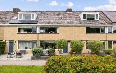
Ketelhuis 19
Stommeer, Aalsmeer
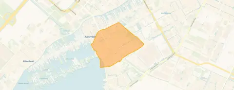 Neighbourhood
Aalsmeer's Stommeer neighbourhood
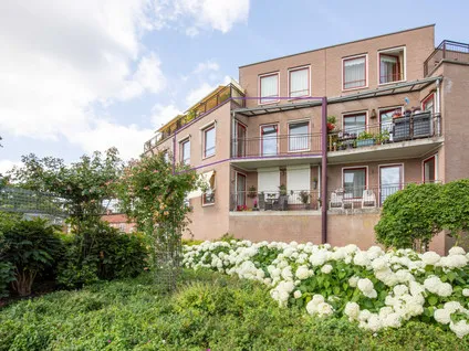
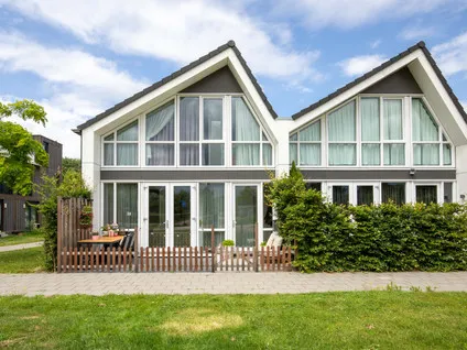
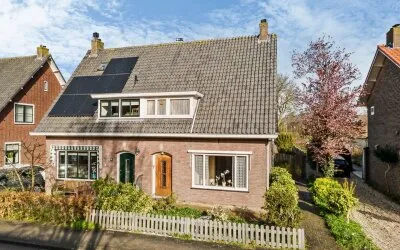
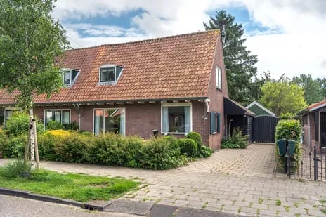
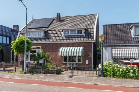
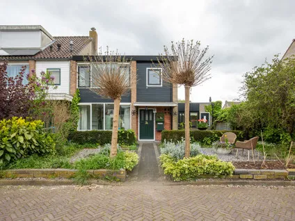
This terraced house on Ketelhuis 19 sits in the Stommeer neighbourhood of Aalsmeer, a residential area with a mix of ages and household types. The home was built in 2001 and has an energy label A, which is an efficient label. With a price of €495,000, the asking price is 24% below the average asking price of €651,440 for homes in the neighbourhood, so it is on the low side compared to the local market. For context, [terraced houses in Aalsmeer]( /koopwoningen/aalsmeer/tussenwoningen/) are part of the local housing stock.
The home itself
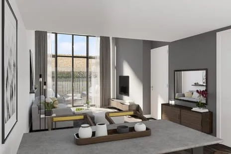
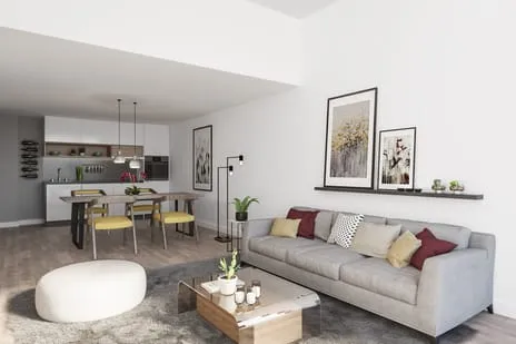
According to the agent, this terraced house has 4 rooms, including 3 bedrooms and 1 bathroom, spread over 2 floors. The living area is listed as 96 m² by the agent, while the BAG registration states 94 m². The plot measures 107 m² according to the agent, but the BAG registration gives 96 m². The home has a garden facing northwest, and the agent mentions insulation including roof insulation, double glazing, HR glazing, wall insulation and floor insulation. It is heated by a central heating boiler, and the property is freehold. The agent describes the setting as in a residential area with a free view.
Stommeer: a quiet, green spot
Residents of [the Stommeer neighbourhood]( /buurt/stommeer-aalsmeer/) give it an average score of 7.17, based on three reviews. One resident says: "Green and the old bus station have become nicely green. Too bad there's no bench." Another resident notes: "It's a nice neighbourhood with the Westeinderplas around the corner. Beautiful nature. And peace. Little nuisance from aircraft. Green and trees at your doorstep. Safe traffic situation. Child and dog friendly." A third resident mentions that there are too few contacts because of cultural differences. The neighbourhood has about 7,020 inhabitants, and the majority of homes are owner-occupied.
Amenities and transport
For daily errands, the Lidl is on your doorstep, with Albert Heijn and Vomar just around the corner. The Jozefschool Catholic primary school is a couple of streets away, and there is also a secondary school, Yuverta mavo Aalsmeer, within walking distance. The GP practice Huisartsenpraktijk E.F. Weve is just around the corner, and the pharmacy Apotheek Groen Aalsmeer is nearby. Bus stop Aalsmeer West/Centrum is a couple of streets away, served by line 340. The nearest train station is Hoofddorp, about 4.7 km away. For a wider range of services, [the municipality of Aalsmeer]( /gemeente/aalsmeer/) offers more options.
WOZ and address data
The WOZ value for this home is €441,000, with a reference date of 1 January 2025. The asking price is 12% above the WOZ value. Between 2020 and 2025, the WOZ value rose by 34%, from €328,000 to €441,000. According to public address data, the noise level from road traffic is 51 dB Lden, above the norm, and from air traffic 49 dB Lden, also above the norm. The foundation risk indication is low, and the soil type is classified as 'other'. For climate risks, pluvial flooding is indicated as elevated, while flood risk is low now and in 2050. Heat stress is low now but medium in 2050. These are area-level indications, not an inspection of this specific home.
Source and agent
At the time of writing, the home is offered via multiple channels, including EKZ | Makelaars Uithoorn.
This summary was generated with AI and may contain errors. Always verify the details with the provider.
Features
Details of this home
Transfer
Price
Energy
 Save up to € 400 on your energy billCompare now
Areas and volume
 Insure your home and belongingsGet insured
Layout
Construction
Outdoor space
The WOZ value is set annually by the municipality with 1 January as its reference date, and therefore lags the market by about a year. It is an estimated market value, not a sale price.
Frequently asked questions
About Ketelhuis 19, Aalsmeer
How does the asking price compare to the WOZ value?
The asking price of €495,000 is 12% above the WOZ value of €441,000, which was set on 1 January 2025. The WOZ value is the municipal valuation, not the current market value. The asking price is also 24% below the average asking price of €651,440 for homes in the Stommeer neighbourhood, according to the housing market data.
What is the layout of this terraced house?
According to the agent, the home has 4 rooms, including 3 bedrooms and 1 bathroom, spread over 2 floors. The living area is listed as 96 m² by the agent, while the BAG registration states 94 m². The plot measures 107 m² according to the agent, but the BAG registration gives 96 m². There is a garden facing northwest.
What is the energy label and what does it mean?
The energy label is A, which is an efficient label. The agent also mentions insulation including roof insulation, double glazing, HR glazing, wall insulation and floor insulation. The home is heated by a central heating boiler. The energy label is a measure of the energy performance of the home, and a higher label generally means lower energy costs.
What are the noise levels in this area?
According to public address data, the noise level from road traffic is 51 dB Lden, which is above the norm, and from air traffic it is 49 dB Lden, also above the norm. These are area-level indications based on public data, not a measurement at this specific home. The data is from 2022.
What is the foundation risk for this home?
The foundation risk indication for this address is low, according to public data. The soil type is classified as 'other'. This is an area-level indication, not an inspection of the specific home. It is based on public data sources such as the Atlas Leefomgeving and KCAF.
What are the climate risks for this location?
According to public climate data, pluvial flooding (from heavy rain) is indicated as elevated, while flood risk from rivers or sea is low now and in 2050. Heat stress is low now but medium in 2050. These are area-level indications, not predictions for this specific home.
Which supermarkets are nearby?
The Lidl is on your doorstep, about 256 metres away. Albert Heijn is about 508 metres away, and Vomar is about 548 metres away. There are also Jumbo and Hoogvliet within a short distance. In total, there are 16 supermarkets within 5 km.
What schools are in the area?
The Jozefschool Catholic primary school is about 207 metres away, and Openbare Basisschool Samen Een is about 376 metres away. For secondary education, Yuverta mavo Aalsmeer is about 723 metres away, and Yuverta vmbo Aalsmeer is about 1.2 km away. There are 19 schools within 5 km.
What public transport options are available?
The nearest bus stop is Aalsmeer, Aalsmeer West/Centrum, about 273 metres away, served by line 340. Another stop, Aalsmeer Midden, is about 628 metres away, also on line 340. The nearest train station is Hoofddorp, about 4.7 km away.
What is the neighbourhood like according to residents?
Residents of the Stommeer neighbourhood give it an average score of 7.17, based on three reviews. One resident says: "It's a nice neighbourhood with the Westeinderplas around the corner. Beautiful nature. And peace." Another mentions that there are too few contacts because of cultural differences. The reviews reflect the neighbourhood, not this specific home.
Experiences from Stommeer
How residents experience their neighbourhood
Green and the old bus station have become nicely green. Too bad there's no bench.
Auto-translated to English by AIToo few contacts, everyone is on their own because there are too many cultural people. We have lived here for 42 years in a large house with 4 rooms and a very large attic. We would like to live smaller, but then you are punished with a much higher rent.
Auto-translated to English by AIIt's a nice neighbourhood with the Westeinderplas around the corner. Beautiful nature. And peace. Little nuisance from aircraft. Green and trees at your doorstep. Safe traffic situation. Child and dog friendly. Aalsmeer has a nice centre. Lots to do. Always on the move. Water sports and many activities to do. Sports and games. Bus station present.
Auto-translated to English by AIStatistics for Stommeer
Figures on residents, liveability and the housing market
| Sale price | €651,440 | €625,000 |
|---|---|---|
| Sale per m² | €5,231 | – |
| Rent price | €2,183 p/m | €2,275 p/m |
| Rent per m² | €17 p/m | – |
Experiences from Aalsmeer
How residents experience their district
Green and the old bus station have become nicely green. Too bad there's no bench.
Auto-translated to English by AIToo few contacts, everyone is on their own because there are too many cultural people. We have lived here for 42 years in a large house with 4 rooms and a very large attic. We would like to live smaller, but then you are punished with a much higher rent.
Auto-translated to English by AIIt's a nice neighbourhood with the Westeinderplas around the corner. Beautiful nature. And peace. Little nuisance from aircraft. Green and trees at your doorstep. Safe traffic situation. Child and dog friendly. Aalsmeer has a nice centre. Lots to do. Always on the move. Water sports and many activities to do. Sports and games. Bus station present.
Auto-translated to English by AIStatistics for Aalsmeer
Figures on residents, liveability and the housing market
| Sale price | €700,600 | €613,750 |
|---|---|---|
| Sale per m² | €5,094 | – |
| Rent price | €2,369 p/m | €2,479 p/m |
| Rent per m² | €18 p/m | – |
Experiences from Aalsmeer
How residents experience their municipality
Since the completion of the neighbourhood in 2004, there has been a clear decline and impoverishment. Liveability is structurally under pressure. Assessment: The neighbourhood scores insufficient on the following aspects: Safety, Community spirit, Hygiene, Education / upbringing climate, Green spaces, Facilities, Accessibility. Explanation per aspect: Safety: Parking and driving on pavements and footpaths. Unsafe situations for pedestrians and playing children. Nuisance from hanging groups and fatbike groups, especially in the evenings. Insufficient visible enforcement. Community: High turnover in apartments, little connection to the neighbourhood. Hardly any social cohesion or mutual accountability culture. Little involvement in the living environment. Hygiene: Structural dog poop on grass fields; the clean-up duty is not observed. Lots of litter, including sweet and crisp wrappers, also in private gardens. Insufficient cleaning and maintenance by the municipality. Education / upbringing climate: Children play outside without supervision. Norms and values regarding waste, respect for others' property and public space are visibly lacking. Negative role model for younger children. Green: Poorly maintained green spaces. Grass fields polluted and therefore not usable for recreation. Unattractive and unkempt street scene. Facilities: Insufficient parking facilities, partly due to company vans. No clear facilities to combat nuisance (such as extra bins or supervised play areas). Accessibility: Pavements and footpaths often blocked by parked vehicles. Poor accessibility for the elderly, prams and people with disabilities. What could be improved: Active and visible enforcement of parking, dog poop and nuisance. Tackling long-term parked company vans. Improvement of municipal maintenance of green and public space. Placement of extra bins and targeted cleaning actions. Structural deployment of neighbourhood police and enforcement officers, especially in the evenings. Measures to strengthen social cohesion and encourage residents to take more responsibility. Clear communication about norms, rules and consequences.
Auto-translated to English by AIGreen and the old bus station have become nicely green. Too bad there's no bench.
Auto-translated to English by AIToo few contacts, everyone is on their own because there are too many cultural people. We have lived here for 42 years in a large house with 4 rooms and a very large attic. We would like to live smaller, but then you are punished with a much higher rent.
Auto-translated to English by AINice house Lots of green Shopping centre nearby Public transport accessibility could be better Not safe due to nuisance from youths, who learn their behaviour from their parents. Disrespectful, selfish. No sense of community. Hygiene: shit everywhere on the grass field is not cleaned up, youths just throw packaging into gardens.
Auto-translated to English by AII've been living here for almost 17 years now, everyone moved here at the same time, we can count on each other when something happens, we're there for each other, it feels like a family. Over the years it has changed a bit due to people moving, but it is and remains a nice place. Space for children to play, school nearby within walking distance, a Catholic, public and Christian school.
Auto-translated to English by AIThe neighbourhood started off quite well. New houses, new residents. However, after a number of residents moved away and were replaced by the next residents, it has deteriorated a lot. Besides a huge increase in nuisance from night flights from Schiphol, the mutual social behaviour has dropped to zero. It is a neighbourhood with many children who find the antisocial behaviour of their parents so normal that they don't know any better and copy their parents' behaviour. In recent years, there has been a lot of nuisance and vandalism by whole groups of terrorising children. These children are getting older and are now starting to show different behaviour or moving away. Addressing people and talking about it is not accepted. And bullying is a daily occurrence, especially if you keep your distance from these people. Because you already know that talking and addressing them backfires. Because if you don't join in or show the same antisocial behaviour, you are treated like a pariah. In Kudelstaart there is supervision by a neighbourhood police officer, and after the shooting you see more police and enforcement. However, if you contact the neighbourhood officer or ask the police for help, you can forget about it. We have plenty of beautiful nature and greenery in and around the neighbourhood. Education could be better. There is childcare, primary school education (the level is not great) and there is a VMBO (which also has a not-so-good reputation). However, for children who go to havo or vwo, you have to look further. Accessibility by public transport is very poor. There is a bus station in Aalsmeer that the bus from Kudelstaart goes to. However, the bus does not connect at all with the other buses. It would be nice if at least one bus every quarter or half hour went directly to the nearest train station (e.g. Hoofddorp) without having to transfer. Maybe the tram from Uithoorn could be extended to Kudelstaart. Facilities are sufficient but could also be better.
Auto-translated to English by AIIt's a nice neighbourhood with the Westeinderplas around the corner. Beautiful nature. And peace. Little nuisance from aircraft. Green and trees at your doorstep. Safe traffic situation. Child and dog friendly. Aalsmeer has a nice centre. Lots to do. Always on the move. Water sports and many activities to do. Sports and games. Bus station present.
Auto-translated to English by AIReasonably neat neighbourhood. Unfortunately, there is nuisance from screaming neighbours, drunk neighbours, antisocial behaviour towards neighbours who distance themselves from it. So if you don't belong or don't want to belong, you'd better brace yourself. Little empathy and understanding. A lot of nuisance from vandalism of cars and personal belongings. In addition, there are regularly groups of young people who terrorise the neighbourhood by "ring and run", and if you don't respond, they then bang on the windows. Furthermore, windows are smeared with eggs and yoghurt. The neighbourhood police officer is very hard to find, the police do nothing, confronting the neighbours backfires.
Auto-translated to English by AIStatistics for Aalsmeer
Figures on residents, liveability and the housing market
| Sale price | €846,820 | €703,009 |
|---|---|---|
| Sale per m² | €5,297 | – |
| Rent price | €2,273 p/m | €2,350 p/m |
| Rent per m² | €20 p/m | – |
Location and amenities
Ketelhuis 19, Aalsmeer







Risks and environmental factors
Noise, foundation and climate around this address