Schaepmanstraat 224A
Buyskade en omgeving, Amsterdam
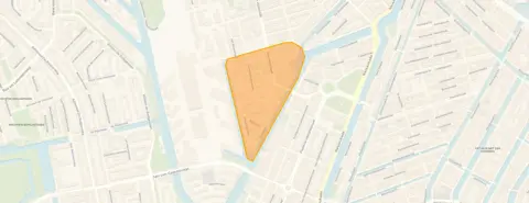 Area
AreaA pre-war apartment in Amsterdam's Staatsliedenbuurt
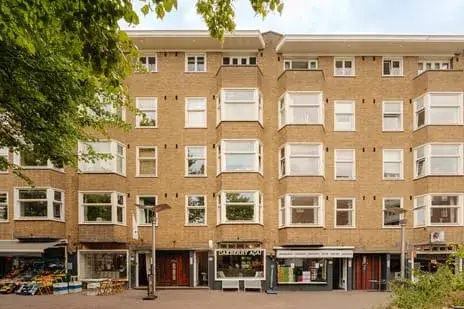
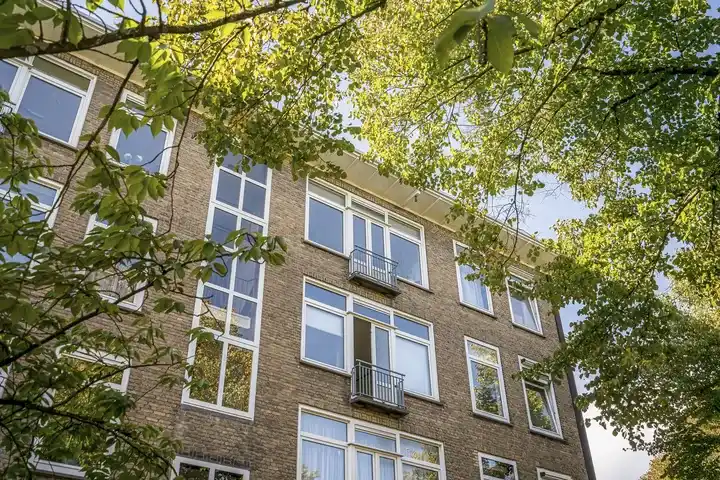
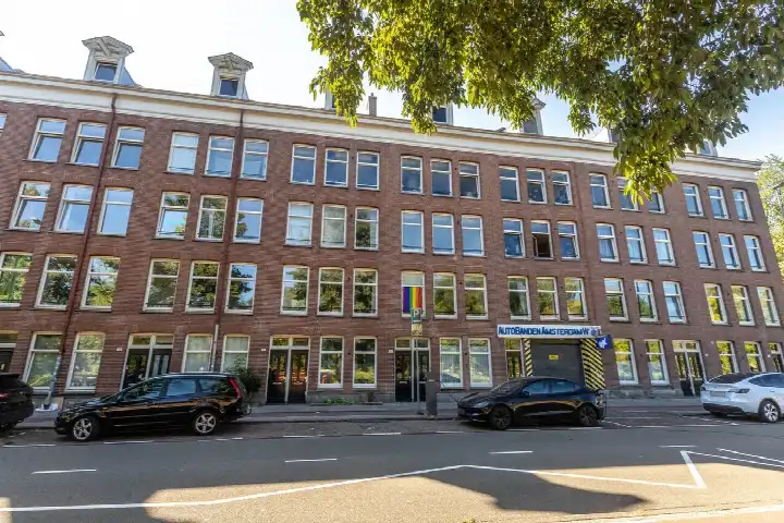
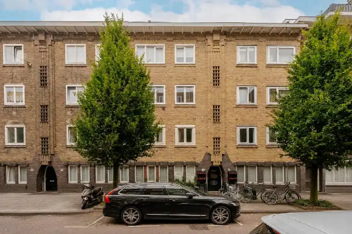
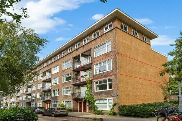
This apartment on Schaepmanstraat 224A sits in the Buyskade e.o. neighbourhood, part of the Staatsliedenbuurt district in Amsterdam. Built in 1917, it is a piece of the city's early twentieth-century housing stock. The asking price of €425,000 is keen compared with the neighbourhood average asking price of €932,222, a difference of 54 percent. For context, the average asking price per square metre in the neighbourhood is €9,825, while this home comes in at €7,870 per square metre based on the BAG registration. If you are looking at apartments in Amsterdam, this one sits at the lower end of the price range.
What the listing tells us
This listing does not state the number of rooms, bedrooms, bathrooms, or any details about the layout, garden, or installations. As a result, the home's interior arrangement remains unknown from the listing alone. What is clear is that the apartment has a living area of 54 square metres according to the BAG registration. The energy label is G, which is the least efficient label, so expect high energy costs. The home was built in 1917, a fact that speaks to its age but says nothing about its condition.
Life in Buyskade e.o.
Residents of the Staatsliedenbuurt district, where this neighbourhood sits, give their living environment an average score of 6.36, based on five reviews. One resident describes it as a "nice old working-class neighbourhood near the centre," noting the diverse mix of people and the proximity of Westerpark. Another says it is a "pleasant neighbourhood to live in," with beautiful Amsterdam buildings from around 1910 and friendly, involved residents. A third review is less positive, mentioning noise and social tensions. The district has 3,125 residents, with 56 percent living alone. The neighbourhood itself is part of the Buyskade e.o. neighbourhood, where the housing stock is a mix of older and newer buildings.
Amenities and getting around
The pharmacy is just around the corner, and the GP practice is a ten-minute walk away. For groceries, an Albert Heijn is a ten-minute walk, with a Dirk a bit further. Primary schools are close by, including Oecumenische basisschool De Catamaran and Basisschool De Bron, both a couple of streets away. Bus stops on Kostverlorenstraat and Van Beuningenplein, served by lines 21 and N88, are just around the corner. Amsterdam Centraal station is about two kilometres away. The wider area falls under the municipality of Amsterdam.
WOZ and address data
The WOZ value for this home is not stated in the available data, so no comparison with the asking price can be made here. The address does carry some area-level risk indications. Road traffic noise is measured at 49 dB Lden, which is above the noise standard, while railway and aircraft noise stay below their standards. The foundation risk indication is medium, as the building dates from before 1970 and the entire postcode area falls within a KCAF attention zone. Pluvial flooding risk is medium, while flood risk is low both now and in 2050. Heat stress is medium now and in 2050. These are area-level indications from public data, not an inspection of this specific home.
About the listing
At the time of writing the home is offered only via Edens Makelaardij. The listing is incomplete, with several property details not stated.
This summary was generated with AI and may contain errors. Always verify the details with the provider.
Features
Details of this home
Transfer
Price
Energy
 Save up to € 400 on your energy billCompare now
Areas and volume
 Insure your home and belongingsGet insured
Layout
Construction
The WOZ value is set annually by the municipality with 1 January as its reference date, and therefore lags the market by about a year. It is an estimated market value, not a sale price.
Frequently asked questions
About Schaepmanstraat 224A, Amsterdam
What does the asking price of €425,000 mean for this apartment?
The asking price is €425,000, which is 54 percent below the neighbourhood average asking price of €932,222. The price per square metre is €7,870 based on the BAG registration, compared with a neighbourhood average of €9,825 per square metre. This makes the price keen relative to the local market, though the home is also smaller than the neighbourhood average of 100 square metres.
What is known about the layout of this apartment?
The listing does not state the number of rooms, bedrooms, or bathrooms, nor does it mention a garden, balcony, or any installations. The only confirmed figure is the living area of 54 square metres according to the BAG registration.
Why are there no property details in this listing?
The listing is incomplete. It does not state the number of rooms, bedrooms, bathrooms, or any information about outdoor space, insulation, or heating. As a result, the home's layout and features cannot be described beyond the living area of 54 square metres and the energy label G.
What does energy label G mean for this home?
Energy label G is the least efficient label on the scale, so the home is likely to have high energy costs for heating and electricity. The label does not say anything about the condition of the building itself. In the neighbourhood, most homes for sale have better energy labels, but this apartment's label is G.
What do residents say about living in this area?
Residents of the Staatsliedenbuurt district give their living environment an average score of 6.36, based on five reviews. One resident calls it a "nice old working-class neighbourhood near the centre," praising the diversity and the nearby Westerpark. Another says it is a "pleasant neighbourhood to live in" with friendly, involved residents. A third review is critical, mentioning noise and social tensions.
What amenities are within walking distance?
The pharmacy is just around the corner at 144 metres, and the GP practice is about 858 metres away. An Albert Heijn supermarket is 600 metres away, with a Dirk at 745 metres. Primary schools including Oecumenische basisschool De Catamaran and Basisschool De Bron are within 400 metres. Bus stops with lines 21 and N88 are about 167 metres away.
What are the noise levels around this address?
Road traffic noise at this address is measured at 49 dB Lden, which is above the noise standard. Railway noise is 37 dB Lden and aircraft noise is 45 dB Lden, both below their respective standards. These are area-level indications from public data, not measurements taken at the property itself.
What is the foundation risk for this home?
The foundation risk indication for this address is medium. The building was constructed in 1917, before 1970, and the entire postcode area falls within a KCAF attention zone where 100 percent of properties were built before 1970. This is an area-level indication based on public data, not an inspection of this specific home.
How does this home compare with the neighbourhood average?
The asking price of €425,000 is 54 percent below the neighbourhood average asking price of €932,222. The living area of 54 square metres is 46 percent smaller than the neighbourhood average of 100 square metres. The price per square metre is €7,870, compared with a neighbourhood average of €9,825 per square metre.
What public transport options are available nearby?
Bus stops at Kostverlorenstraat and Van Beuningenplein, both about 167 to 199 metres away, are served by lines 21 and N88. A third stop, Van der Hoopstraat, is 392 metres away with the same lines. Amsterdam Centraal train station is approximately 2.1 kilometres from the home.