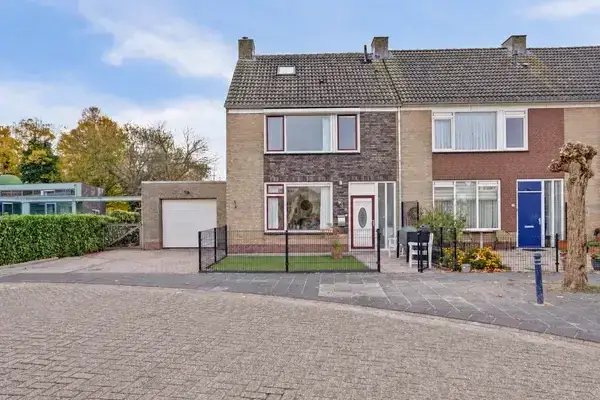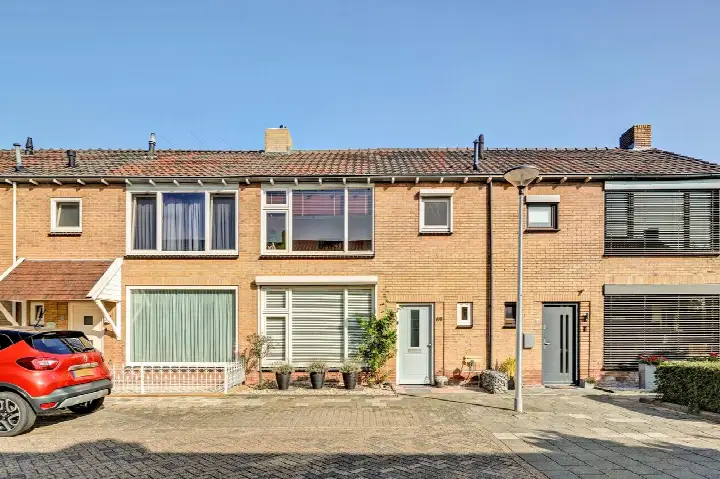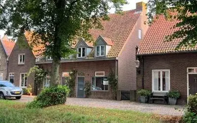





A classic end-of-terrace home in Oudheusden
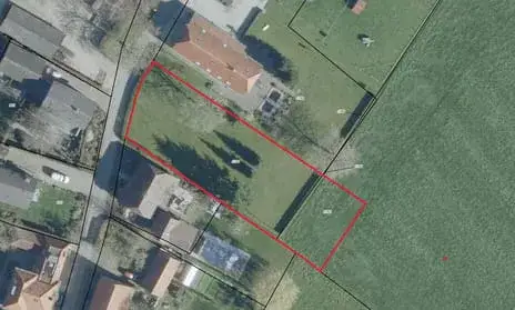
This end-of-terrace house on De Huterstraat 25 sits in Oudheusden, a village within the municipality of Heusden. Built in 1969, it has a living area of 93 square metres according to the BAG registration, while the agent lists 94 square metres. The plot measures 154 square metres. The asking price is €380,000, which works out at €4,043 per square metre based on the agent's floor area. For context, the average asking price for end-of-terrace houses in Heusden sits at a similar level.
The home itself
The house has five rooms, according to the agent. The energy label is B, which is an efficient label, so heating costs should be manageable. The home dates from 1969, a year that is simply a fact of its construction history. The listing does not mention a garden, balcony, or garage, so those details are not stated.
Life in Oudheusden
Oudheusden is a village with around 2,700 residents, and the average household size is 2.2 people. Residents give the neighbourhood a score of 6.42 out of 10, based on three reviews. One resident says: "It's nice to grow up in Oudheusden. There are many playgrounds, several primary schools, and the library is accessible." Another resident notes: "Bad, loitering youths harassing neighbours. I can't really say it's safe, they tear through the streets with cars or fatbikes." A third resident adds: "As far as the Hamelpark and the adjoining streets are concerned, investment should be made in traffic safety." The reviews paint a mixed picture, with praise for the family-friendly amenities but concerns about traffic and safety. The neighbourhood has a stable core of long-term residents, though one reviewer mentions a recent influx of newcomers. For more on the area, see the municipality of Heusden.
Amenities and transport
For daily errands, the Coop supermarket is just around the corner, and there are several other options within a short drive. Primary school BS De Dromenvanger is a couple of streets away, and the nearest GP practice is Huisartsenpraktijk AMEEdic in Genderen, about a ten-minute walk. The pharmacy, Apotheek 'Het Quadraat' Drunen, is a bit further. For public transport, the bus stop Oudheusden, Laagstraat is a five-minute walk, with lines 135 and 208. The nearest train station is 's-Hertogenbosch, about 11.5 kilometres away. According to area-level risk data, the home is in a zone with a medium foundation risk indication, based on the clay soil and the fact that most homes in this postcode area were built before 1970. This is an area-level indication, not an inspection of this specific property. The noise level from road traffic is 52 dB Lden, which is above the noise standard. For climate risks, pluvial flooding at heavy rain is elevated, and the current flood risk is elevated, dropping to medium by 2050. Heat stress is currently low but medium by 2050. These are all area-level indications from public data.
Source
At the time of writing, the home is offered only via Hofstede Land van Heusden.
This summary was generated with AI and may contain errors. Always verify the details with the provider.
Features
Details of this home
Transfer
Price

Areas and volume
Layout
Construction
The WOZ value is set annually by the municipality with 1 January as its reference date, and therefore lags the market by about a year. It is an estimated market value, not a sale price.
Frequently asked questions
About De Huterstraat 25, Oudheusden
What is the asking price per square metre for this home?
The asking price is €380,000, and the agent lists a living area of 94 square metres, which gives a price per square metre of €4,043. The BAG registration states 93 square metres, so the price per square metre would differ slightly if based on that figure. The listing does not include a comparison with the neighbourhood average.
How many rooms does this house have?
According to the agent, the house has five rooms. The listing does not specify how these rooms are divided into bedrooms, bathrooms, or living spaces. The energy label is B, which is an efficient label, so heating costs should be relatively low. The home was built in 1969.
What is the WOZ value of this property?
The WOZ value is the municipal valuation used for property taxes, and it is not always included in a listing. Without this figure, it is not possible to compare the asking price with the official valuation.
What is the foundation risk for this home?
The area-level foundation risk indication is medium. This is based on the clay soil and the fact that 95% of properties in this postcode area were built before 1970. This is an area-level indication from public data, not an inspection of this specific home. The noise level from road traffic is 52 dB Lden, which is above the noise standard.
What supermarkets are near De Huterstraat 25?
The nearest supermarket is Coop, about 325 metres away, which is just around the corner. Other options include Aldi at about 3.3 kilometres, SPAR at 3.6 kilometres, and Jumbo at 3.8 kilometres. For daily groceries, the Coop is the most convenient option within walking distance.
What schools are close to this home?
The nearest primary school is BS De Dromenvanger, about 367 metres away, which is a couple of streets away. Other primary schools include Rooms Katholieke Basisschool Th J Rijken at 2.5 kilometres and OBS De Groene Bogen at 3.3 kilometres. For secondary education, d'Oultremont College is about 3.5 kilometres away.
How is the public transport in Oudheusden?
The nearest bus stop is Oudheusden, Laagstraat, about 399 metres away, with lines 135 and 208. Another stop, Oudheusden, Herptseweg, is at 491 metres with line 208. The nearest train station is 's-Hertogenbosch, about 11.5 kilometres away. One resident notes that the bus to Den Bosch runs every 30 minutes, but other destinations are harder to reach.
What do residents say about living in Oudheusden?
Residents give the neighbourhood a score of 6.42 out of 10, based on three reviews. One resident says it is a nice place to grow up, with many playgrounds and primary schools. Another resident mentions concerns about traffic safety and loitering youths. A third resident highlights the lack of public transport options beyond the immediate area.
What is the energy label of this house?
The energy label is B, which is an efficient label. This means the home is likely to have relatively low energy costs compared with less efficient labels. The label does not say anything about the specific insulation or installations, but it is a good indicator of overall energy performance.
Is this home suitable for a family?
The home has five rooms, which could accommodate a family, but the listing does not specify the number of bedrooms. The living area is around 93-94 square metres, and the plot is 154 square metres.