Sint Pietersluisweg 56
Villapark, Maastricht
 Area
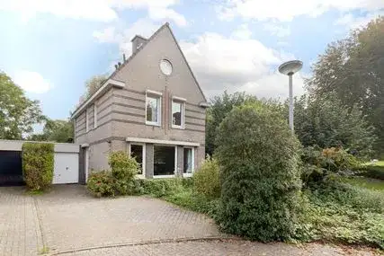
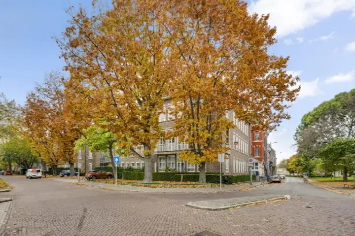
AreaA 1937 end-of-terrace house on the water
This end-of-terrace house sits on the Sint Pietersluisweg in Villapark, a residential area in the Buitenwijk Zuidwest district of Maastricht. Built in 1937, the home has an energy label E, which is the least efficient label, so expect higher energy costs. The asking price of €635,000 is in line with the market, based on the neighbourhood average asking price. For context, end-of-terrace houses in Maastricht are part of the local housing supply.
The home itself
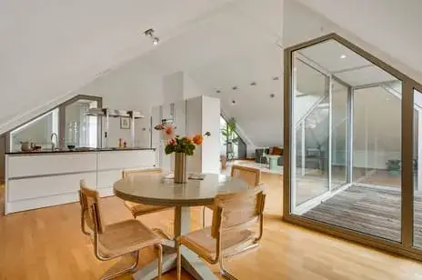
According to the agent, the home has three rooms, two bedrooms, and two bathrooms spread over four floors, with a volume of 531 m³. The living area is listed as 118 m² by the agent, while the BAG registration records 161 m². Similarly, the plot is 120 m² per the agent, but the BAG registration states 90 m². The home is heated by a central heating boiler and is situated on the water. It has been listed since 6 October 2026.
Villapark
Villapark is a neighbourhood where about 3,160 people live, and nearly half of the households are single-person households. Residents across the municipality of Maastricht give their living environment an average score of 7.45, based on 37 reviews. One resident says: "everything perfect lovely people and many amenities." Another notes: "Born here, many homes are poor, damp and drafty and too expensive." A third resident mentions that "people have often peered into my house" and that there is a "lack of parking," but also that "generally, people are polite if you greet them." These reviews reflect the wider municipality rather than this specific neighbourhood. For more on the area, see the Villapark neighbourhood.
Amenities and transport
Daily errands are well covered. The PLUS supermarket is just around the corner, with Coop a couple of streets away. The nearest primary school, Rooms Katholieke Basisschool St Pieter, is a five-minute walk. The GP practice Medisch Centrum Sint Pieter, Huisartsenpraktijk Buysrogge is a five-minute walk, and Apotheek Céramique is a ten-minute walk. Bus line 12 stops at Maastricht, St. Lambertuslaan, a five-minute walk away. Maastricht Randwyck train station is a ten-minute walk. For the wider area, the municipality of Maastricht offers more context.
WOZ and address data
The WOZ value on 1 January 2025 was €646,000, and the asking price is 2% below that value. Between 2020 and 2025, the WOZ value rose by 97%, from €328,000 to €646,000. As for address-level risks, these are area-level indications, not an inspection of this home. The foundation risk indication is low, with sandy soil. Pluvial flooding at heavy rain is elevated, and the flood risk is elevated both now and in 2050. Road traffic noise is 47 dB Lden, railway noise 8 dB Lden, and aircraft noise 40 dB Lden, all below the noise standard.
Source
At the time of writing, the home is offered via multiple channels, including MIJN HUIS en ik and MIJN HUIS en ik.
This summary was generated with AI and may contain errors. Always verify the details with the provider.
Features
Details of this home
Transfer
Price
Energy
 Save up to € 400 on your energy billCompare now
Areas and volume
 Insure your home and belongingsGet insured
Layout
Construction
The WOZ value is set annually by the municipality with 1 January as its reference date, and therefore lags the market by about a year. It is an estimated market value, not a sale price.
Frequently asked questions
About Sint Pietersluisweg 56, Maastricht
How does the asking price compare to the WOZ value?
The asking price of €635,000 is 2% below the WOZ value of €646,000, which was set on 1 January 2025. The WOZ value is the municipal valuation, not the current market value. Between 2020 and 2025, the WOZ value increased by 97%, from €328,000 to €646,000.
What is the layout of this home?
According to the agent, the home has three rooms, two bedrooms, and two bathrooms spread over four floors. The volume is 531 m³. The living area is listed as 118 m² by the agent, while the BAG registration records 161 m². The plot is 120 m² per the agent, but the BAG registration states 90 m².
What is the energy label and what does it mean?
The energy label is E, which is the least efficient label. This means you can expect higher energy costs compared to more efficient labels. The home was built in 1937 and is heated by a central heating boiler. No specific insulation features are stated in the listing.
What is the foundation risk for this address?
The foundation risk indication for this address is low, according to public risk data. This is an area-level indication based on the postcode area, not an inspection of this specific home. The soil type is sand. The home was built in 1937, before 1970, which is a factor in the risk assessment.
What are the flood risks for this property?
The climate risk data indicates that pluvial flooding at heavy rain is elevated, and the flood risk is elevated both now and in 2050. These are area-level indications from public data sources, not an assessment of this specific home. The home is situated on the water, according to the agent.
Which supermarkets are nearby?
The nearest supermarket is PLUS, about 744 metres away. Coop is approximately 952 metres away, and Lidl is about 1.2 kilometres from the home. There are 33 supermarkets within a 5-kilometre radius, so daily grocery shopping is well covered.
What schools are in the area?
The nearest primary school is Rooms Katholieke Basisschool St Pieter, about 332 metres away. Other nearby options include Bernard Lievegoed School at 893 metres and Basisschool Anne Frank at 923 metres. There are 45 schools within a 5-kilometre radius.
How is the public transport connection?
Bus line 12 stops at Maastricht, St. Lambertuslaan, about 485 metres away, and at Maastricht, Parkweg, about 502 metres away. The nearest train station is Maastricht Randwyck, approximately 1.6 kilometres from the home.
What do residents say about living in this area?
Residents across the municipality of Maastricht give their living environment an average score of 7.45, based on 37 reviews. One resident says: "everything perfect lovely people and many amenities." Another mentions that "many homes are poor, damp and drafty and too expensive." These reviews reflect the wider municipality, not specifically the Villapark neighbourhood.
How does the living area compare to the neighbourhood average?
The living area of 118 m², as listed by the agent, is 28% smaller than the neighbourhood average of 164 m². The BAG registration records a larger living area of 161 m². The price per square metre is €5,381, based on the agent's listing.