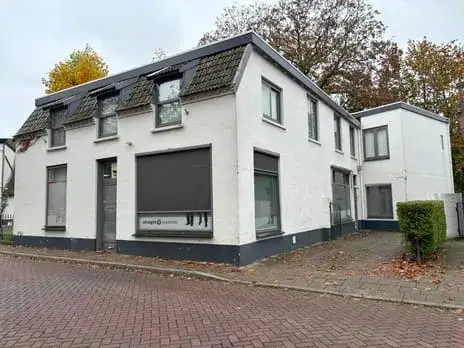
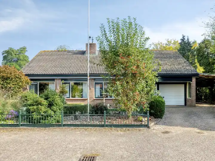
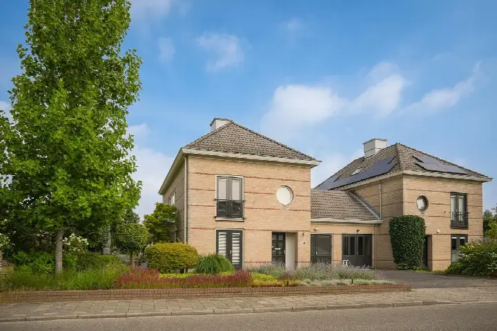
Waalbandijk 7
Verspreide huizen Dodewaard-West, Neder-Betuwe
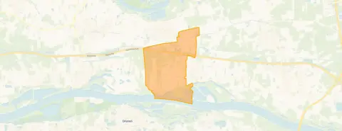 Area
AreaA riverside home with a story
This end-of-terrace house on the Waalbandijk sits in the Verspreide huizen Dodewaard-West area, a scattered settlement on the edge of Dodewaard in the municipality of Neder-Betuwe. Built in 1948, it carries the character of its era, while its energy label A+++ marks it as an efficient home by today's standards. The asking price of €719,000 is in line with the market, sitting 28% below the neighbourhood average asking price of €992,500. For context, the end-of-terrace houses in Neder-Betuwe give a sense of what this property type commands in the wider area.
The home itself
The living area measures 128 m² according to the BAG registration, on a plot of 430 m². The year of construction, 1948, is a fact of the building's history, and the energy label A+++ indicates an efficient label. No information is given about insulation, heating, or outdoor space such as a garden or garage.
The Verspreide huizen Dodewaard-West neighbourhood
This is a small community of 675 residents, where households with children make up 48% of the total. The average household size is 3.0, reflecting a family-oriented character. Resident reviews, based on three responses, give an average score of 6.96 for the district of Dodewaard, not specifically for this neighbourhood. One resident describes it as "cosy" and notes a "new housing estate," while another speaks of "regular nuisance" from drug dealing, adding that "Dodewaard is generally a pleasant village." A third resident is more critical, saying "everyone is out for themselves." These are the voices of the wider district, so they offer a glimpse rather than a full picture of this particular area. For more on the local context, see the Verspreide huizen Dodewaard-West neighbourhood.
Amenities and transport
Daily errands are manageable from here. The nearest supermarkets, Aldi and Jumbo, are both about a ten-minute walk away, with Coop and PLUS a couple of streets further. For primary education, Basisschool de Kubus is around a ten-minute walk, while secondary options like Pax Coothstraat are similarly close. The GP practice, Huisartspraktijk Dodewaard, and Apotheek de Linge Dodewaard are both within a ten-minute walk, and the Polikliniek CWZ Druten is a short drive. Public transport is limited: the nearest bus stops are in Druten, about a ten-minute walk, with lines 85 and 814, and the train station at Opheusden is roughly 2.7 km away. This is part of the municipality of Neder-Betuwe, where such rural connections are typical. Regarding address-level risks, the noise from road traffic is 42 dB Lden, from rail 31 dB Lden, and from industry 45 dB Lden, all below the relevant standards. The foundation risk indication is elevated, based on area-level data: the home was built in 1948 on clay soil, which may involve wooden piles or a shallow foundation, and the groundwater level is expected to drop towards 2050, increasing risk for wooden foundations. Pluvial flooding at heavy rain is indicated as medium, while current and 2050 flood risk are both low. These are indications at area level, not an inspection of this specific home.
Source
At the time of writing, the home is offered only via Remko Stevens Makelaardij BV.
This summary was generated with AI and may contain errors. Always verify the details with the provider.
Features
Details of this home
Transfer
Price
Energy
 Save up to € 400 on your energy billCompare now
Areas and volume
 Insure your home and belongingsGet insured
Layout
Construction
Outdoor space
The WOZ value is set annually by the municipality with 1 January as its reference date, and therefore lags the market by about a year. It is an estimated market value, not a sale price.
Frequently asked questions
About Waalbandijk 7, Dodewaard
How does the asking price compare to other homes in the neighbourhood?
The asking price of €719,000 is 28% below the neighbourhood average asking price of €992,500, which puts it in line with the market according to the precomputed comparison. The average price per m² in the neighbourhood is €5,181, while this home's price per m² is €5,617 based on the BAG living area. The neighbourhood has 4 homes currently for sale, with prices ranging from €625,000 to €1,200,000.
What is the living area and plot size of this home?
According to the BAG registration, the living area is 128 m² and the plot is 430 m². The price per m² is €5,617, calculated on the BAG living area. No information is given about a garden, balcony, or garage.
What is the energy label of this home?
The energy label is A+++, which is an efficient label. This means the home is likely to have relatively low energy costs compared to less efficient labels. In the neighbourhood, 25% of the homes for sale have label A, and 25% have label B, but this home's label is A+++.
What is the foundation risk for this home?
The foundation risk indication is elevated, based on area-level data. The home was built in 1948 on clay soil, which may involve wooden piles or a shallow foundation. In this postcode area, 59% of properties were built before 1970, and 1% of properties have an elevated risk of pile rot. The groundwater level is expected to drop towards 2050, which could increase risk for wooden foundations. This is an indication at area level, not an inspection of this specific home.
What are the noise levels around this address?
The noise from road traffic is 42 dB Lden, from rail 31 dB Lden, and from industry 45 dB Lden, all below the relevant standards. These figures are based on public data from the Atlas Leefomgeving and are area-level indications. They do not reflect an on-site measurement of this specific home, but they suggest that noise is not above the norm at this address.
What supermarkets are nearby and how far away are they?
The nearest supermarkets are Aldi at 1.8 km and Jumbo at 1.9 km, both about a ten-minute walk. Coop is at 2.1 km and PLUS at 2.3 km, a couple of streets further. There are 10 supermarkets within 5 km, so options are available for daily groceries. The distances are measured from the address, so actual walking times may vary.
What schools are in the area?
Basisschool de Kubus, a primary school, is at 2.0 km, about a ten-minute walk. For secondary education, Pax Coothstraat is at 2.0 km and Pax Klepperheide at 2.3 km. There is also SO-VSO De Kom, a special secondary school, at 1.9 km. In total, 21 schools are within 5 km, covering primary, secondary, and special education options.
How is the public transport connection from this home?
The nearest bus stops are in Druten, about 1.6 km away, with lines 85 and 814. The train station at Opheusden is 2.7 km from the home. Public transport accessibility is limited, as one resident of the district noted that it is hard to get there by public transport unless you walk half an hour from the station. By car, the area is accessible.
What do residents say about living in this district?
Resident reviews for the district of Dodewaard, based on three responses, give an average score of 6.96. One resident describes it as "cosy" with a "new housing estate," while another mentions "regular nuisance" from drug dealing but adds that "Dodewaard is generally a pleasant village." A third resident is critical, saying "everyone is out for themselves." These reviews reflect the district, not specifically this neighbourhood.
Why are there no property details in this listing?
The listing does not state the number of rooms, bedrooms, bathrooms, or any information about a garden, balcony, or garage. It also does not mention insulation, heating, or ownership details. As a result, the layout and features of the home are not described. The only property facts available are the living area of 128 m², the plot of 430 m², the year of construction 1948, and the energy label A+++.