IJsselstraat 9
IJsselstein-Binnenstad, IJsselstein
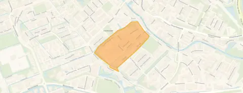 Area
AreaA historic apartment in the heart of IJsselstein
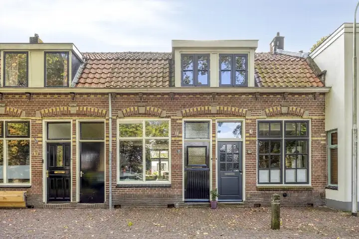
This apartment on IJsselstraat 9 sits in the oldest part of IJsselstein, where the streets have a distinctly historic character. The building dates from 1880, so this is a home with plenty of heritage. With a living area of 72 square metres according to the BAG registration, the asking price of €350,000 is keen compared with the neighbourhood average asking price of €475,556. That makes it one of the more affordable options among the [apartments in IJsselstein].
What the listing tells us
The listing is fairly brief, so the details are limited. The home has an energy label C, which means moderate energy costs can be expected. The property was built in 1880, a fact that speaks for itself. Beyond the year of construction and the energy label, the agent does not provide further details about the layout or installations in this listing.
Life in IJsselstein-Binnenstad
Residents across the district of IJsselstein give their surroundings an average score of 7.86, based on fifteen reviews. One resident describes a child-friendly, pleasant street with lots of greenery, social control and neighbours who talk to each other. Another resident, living on an industrial estate, notes there is little greenery there but says the neighbours are very friendly and they feel at home. The neighbourhood itself has around 1,010 inhabitants, with a mix of ages and household types. For a fuller picture of [the IJsselstein-Binnenstad neighbourhood], the reviews give a sense of what daily life is like here.
Daily essentials and getting around
Groceries are a couple of streets away, with Albert Heijn and Jumbo. Kindcentrum De Minstreel primary school is just around the corner, and there are several other schools within walking distance. The GP practice Huisartsenzorg IJsselstein, locatie 't Steyn is a five-minute walk, and the BENU Apotheek Nieuwpoort is a ten-minute walk. Bus stops on Overwaard and Ewoud/Boerhaaveweg, served by lines 31, 195 and 395, are a five-minute walk. The nearest train station, Utrecht Vaartsche Rijn, is 8.3 kilometres away. [The municipality of IJsselstein] covers the wider area.
WOZ and address data
The WOZ value is not stated in the available data, so no comparison with the asking price can be made here. The address does carry some risk indications from public data sources. The noise level from road traffic is 55 dB Lden, above the noise standard, based on 2022 data. The foundation risk indication is elevated, with the note that the home was built in 1880 on clay soil, possibly with wooden piles or a shallow foundation. Pluvial flooding at heavy rain is indicated as elevated, and the current flood risk is medium. These are area-level indications from public data, not an inspection of this specific home.
Source
At the time of writing the home is offered via multiple channels, including Moen Garantiemakelaars.
This summary was generated with AI and may contain errors. Always verify the details with the provider.
Features
Details of this home
Transfer
Price
Energy
 Save up to € 400 on your energy billCompare now
Areas and volume
 Insure your home and belongingsGet insured
Layout
Construction
Outdoor space
The WOZ value is set annually by the municipality with 1 January as its reference date, and therefore lags the market by about a year. It is an estimated market value, not a sale price.
Frequently asked questions
About IJsselstraat 9, Ijsselstein
What does the asking price of €350,000 mean for this apartment?
The asking price is €350,000 for a living area of 72 square metres according to the BAG registration. That works out at €4,861 per square metre. Compared with the neighbourhood average asking price of €475,556, this price is 26 percent lower, which the data describes as keen. The neighbourhood average asking price per square metre is €5,845, so this apartment sits below that level.
What is known about the layout of this apartment?
The listing does not state the number of rooms, bedrooms or bathrooms, nor does it mention a garden, balcony or garage. The only details given are the year of construction, 1880, and the energy label C. The living area is 72 square metres according to the BAG registration.
Why are there no property details in this listing?
The listing is incomplete. It does not state the number of rooms, bedrooms or bathrooms, and there is no information about outdoor space, insulation or heating installations. The only facts given are the year of construction, the energy label and the living area.
What does the energy label C mean for this home?
The energy label C indicates the home's energy performance as registered. A label C is a middle-of-the-range label, so energy costs will be moderate compared with more efficient homes. The label does not say anything about the condition of the building itself. No insulation details are given in the listing, so nothing further can be said about the home's energy efficiency.
What is the foundation risk for this address?
The foundation risk indication for this address is elevated, according to public data. The home was built in 1880 on clay soil, which may mean wooden piles or a shallow foundation. In this postcode area, 100 percent of properties were built before 1970, and 12 percent of properties in the neighbourhood have an elevated risk of pile rot, according to the Klimaateffectatlas. These are area-level indications, not an inspection of this specific home.
What are the noise levels like at this address?
The noise level from road traffic at this address is 55 dB Lden, which is above the noise standard, based on 2022 data. This is an area-level indication from public data sources, not a measurement taken at the property itself. The figure gives an indication of the traffic noise you might experience at this location.
What flood risk applies to this address?
The current flood risk at this address is indicated as medium, while the flood risk for 2050 is indicated as low. Pluvial flooding at heavy rain is indicated as elevated. Heat stress is currently low but is expected to be medium by 2050. These are area-level indications from public climate data, not an assessment of this specific property.
Which supermarkets and schools are nearby?
Albert Heijn is 600 metres away and Jumbo is 710 metres away, so groceries are within walking distance. Kindcentrum De Minstreel primary school is 315 metres away, and Basisschool 't Kasteel is 374 metres away. For secondary education, De Baanbreker is 345 metres away and Cals College IJsselstein is 747 metres away. The GP practice is 304 metres away and the pharmacy is 518 metres away.
How is the neighbourhood rated by residents?
Residents across the district of IJsselstein give their surroundings an average score of 7.86, based on fifteen reviews. One resident mentions a child-friendly street with greenery and social control, while another notes that an industrial estate has little greenery but friendly neighbours. These reviews describe the wider district rather than this specific neighbourhood, so they give a general impression of the area.
What public transport options are available?
The nearest bus stop is IJsselstein, Overwaard at 416 metres, served by lines 31, 195 and 395. The stop at IJsselstein, Oranje Nassaulaan is 548 metres away and serves line N6. The nearest train station is Utrecht Vaartsche Rijn at 8.3 kilometres. The bus stops are within a five-minute walk, making public transport accessible from this address.