Kasteel-Traverse 45
Stationsgebied, Helmond
 Area
AreaA bright apartment near Helmond station
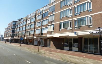
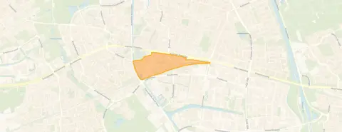
This apartment sits in Stationsgebied, the neighbourhood that wraps around Helmond's station area. It is a lively part of town, with the station and the shops of the centre within easy reach. The asking price of €299,000 sits 31% below the average asking price of €432,500 in the neighbourhood, which puts it on the low side for the area. For comparison, apartments in Helmond give a sense of what is on offer across the municipality.
Inside the home
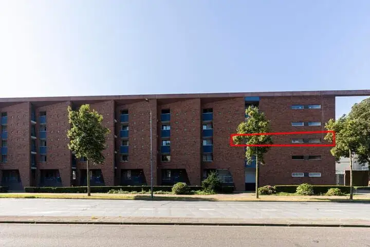
Built in 1997, this apartment on the second floor has three rooms, two bedrooms and one bathroom. The living area is listed as 93 m² according to the BAG registration, while the agent lists 90 m². The home has a volume of 340 m³ and spans four floors in the building. The energy label is B, which is an efficient label, so energy costs should be manageable.
Life in Stationsgebied
Stationsgebied is a compact neighbourhood with a mix of residents. Of the 1,085 people living here, a large share are single-person households. Residents of the district give it an average score of 8.13, based on four reviews. One resident says: "Quite a quiet and cosy neighbourhood. I've lived here for 10 years and it's cosy. Not too busy." Another notes that houses are being renovated and insulated on the outside, but that maintenance of front and back gardens is poor. The neighbourhood has a very high address density, making it one of the most urban areas in the region. For more context, the Stationsgebied neighbourhood page has further details.
Amenities and transport
Daily errands are easy from here. Zapolski supermarket is just around the corner, with Lidl a couple of streets away. The Jan van Brabant College is a five-minute walk, and Brede basisschool De Vuurvogel is a ten-minute walk. Huisartsenpraktijk Pril is just around the corner, and BENU Apotheek 't Heelhuis is a couple of streets away. The bus stop at Helmond Station is just around the corner, with lines 23, 24, 25, 26, 51, 52, 53, 54, 55, 150 and 320. Helmond train station is also just around the corner. The municipality of Helmond page gives a wider view of the area.
WOZ and address data
No WOZ value is available for this home. The address-level risk data from public sources indicates that road traffic noise is above the norm at 66 dB Lden, while railway and industrial noise are below their norms. The foundation risk indication is low, though the soil is peat, which is sensitive to settlement. Pluvial flooding at heavy rain is medium, and heat stress is medium, both currently and in 2050. These are area-level indications, not an inspection of this specific home.
Source
At the time of writing the home is offered only via Ramon Jongen Makelaardij.
This summary was generated with AI and may contain errors. Always verify the details with the provider.
Features
Details of this home
Transfer
Price

Areas and volume
 Insure your home and belongingsGet insured
Layout
Construction
The WOZ value is set annually by the municipality with 1 January as its reference date, and therefore lags the market by about a year. It is an estimated market value, not a sale price.
Frequently asked questions
About Kasteel-Traverse 45, Helmond
How does the asking price compare to other homes in Stationsgebied?
The asking price of €299,000 is 31% below the neighbourhood average asking price of €432,500. The average price per m² in the neighbourhood is €4,054, while this home is listed at €3,322 per m² based on the agent's floor area. Six homes are currently available in the neighbourhood, with prices ranging from €310,000 to €598,000.
What is the layout of this apartment?
This apartment on the second floor has three rooms, two bedrooms and one bathroom. The living area is 93 m² according to the BAG registration, while the agent lists 90 m². The home has a volume of 340 m³ and is part of a building with four floors. The property was built in 1997.
What is the energy label and what does it mean?
The energy label is B, which is an efficient label. This means the home is relatively energy-efficient compared to less efficient labels, so you can expect moderate energy costs. The label does not say anything about the structural condition of the home, only about its energy performance.
What are the noise levels around this address?
According to public address-level data, road traffic noise is 66 dB Lden, which is above the noise norm. Railway noise is 42 dB Lden and industrial noise is 45 dB Lden, both below their respective norms. These are area-level indications based on public data, not measurements taken at this specific home.
What is the foundation risk for this property?
The foundation risk indication for this address is low. The soil type is peat, which is noted as sensitive to settlement. This is an area-level indication from public data sources, not an inspection of this specific home. The risk level is given as low, meaning no elevated concern is indicated at this level.
What are the flood and heat risks for this area?
Pluvial flooding at heavy rain is indicated as medium, while flood risk from rivers or the sea is low, both currently and in 2050. Heat stress is medium, both currently and in 2050. These are area-level indications from the Klimaateffectatlas, not specific to this home.
Which supermarkets are nearby?
Zapolski supermarket is just around the corner at about 305 metres. Lidl is a couple of streets away at about 630 metres, and Ekoplaza is at about 705 metres. There are 27 supermarkets within 5 km of this address, so grocery shopping is well covered.
What schools are close to this apartment?
Jan van Brabant College, a secondary school, is a five-minute walk at about 291 metres. Brede basisschool De Vuurvogel, a primary school, is a ten-minute walk at about 758 metres. There are also several other schools within a short distance, including De Korenaer Helmond and De Hilt.
How is public transport from this location?
The bus stop at Helmond Station is just around the corner at about 279 metres, with lines 23, 24, 25, 26, 51, 52, 53, 54, 55, 150 and 320. Helmond train station is also just around the corner at about 276 metres. Additional bus stops at Zuidende and Piet Blomplein are within a short walk.
What is the neighbourhood like according to residents?
Residents of the district give it an average score of 8.13, based on four reviews. One resident says it is "Quite a quiet and cosy neighbourhood" and has lived there for 10 years. Another resident mentions that houses are being renovated and insulated on the outside, but that maintenance of front and back gardens is poor and there is no waste enforcement.
How many people live in Stationsgebied?
Stationsgebied has 1,085 residents. Of these, 67% live in single-person households, and 27% are households without children. The average household size is 1.4 people. The age profile shows 43% are between 25 and 45 years old, and 27% are 65 or older.
What is the crime situation in the neighbourhood?
The total number of registered crimes in the neighbourhood is 383. This figure covers all types of crime recorded in the area. The neighbourhood has a very high address density of 3,048 addresses per km², which is typical for a very strongly urban area.