




Kloveniersburgwal 61A
Zuiderkerkbuurt · 1011 JZ Amsterdam
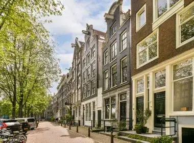
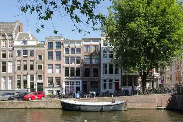
A canal-side home in the old heart of Amsterdam
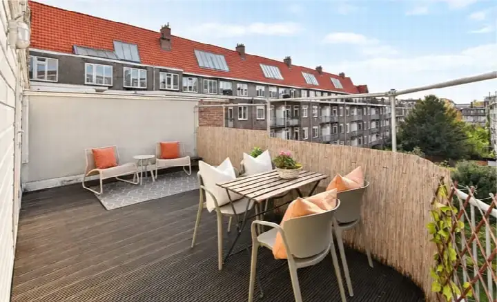
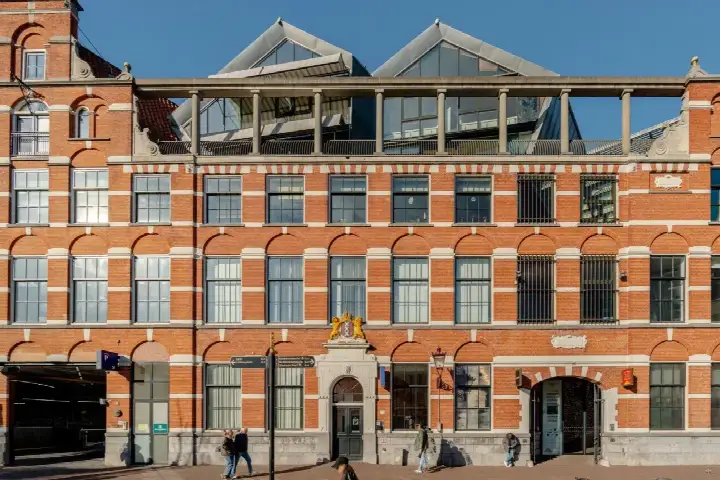
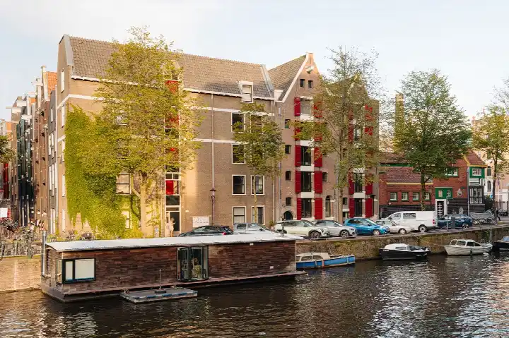
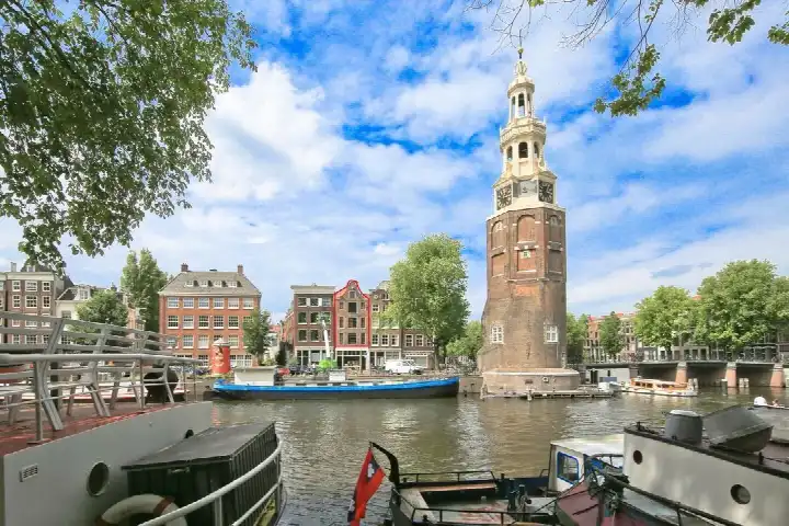
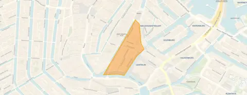
This apartment sits on the Kloveniersburgwal, one of Amsterdam's most atmospheric canals, in the Zuiderkerkbuurt within the Nieuwmarkt/Lastage district. The home dates from 1725, so it carries centuries of city history within its walls. This listing did not state the energy label. The last known asking price of €1,180,000 sat 17% above the average asking price of €1,012,636 for apartments in Amsterdam, which put it on the high side of the market. This home has not been online since 15 September 2026.
A home with generous proportions
The apartment offers a living area of 128 m² according to the BAG registration. With that floor area, the price worked out at €9,219 per m².
Life in the Zuiderkerkbuurt
Residents of the wider district give their living environment an average score of 7.91, based on six reviews. One resident says: "Nice neighbourhood, people look out for each other." Another adds: "We live in a nice quiet neighbourhood and contact with the surroundings is also pleasant." The neighbourhood itself counts around 1,600 residents, with a high share of single-person households. The area is very strongly urban, with an address density of 8,430 per km². For more context, have a look at the Zuiderkerkbuurt neighbourhood.
Daily life and getting around
Groceries are a couple of streets away, with Ekoplaza just around the corner and Albert Heijn and SPAR within a five-minute walk. For primary education, De Witte Olifant and St. Antoniusschool are both a couple of streets away. The GP practice Huisartsenpraktijk Oudemans is just around the corner, and the BENU Apotheek Dam is a five-minute walk. Metro Nieuwmarkt is on your doorstep with lines 51, 53 and 54, and Amsterdam Centraal station is a ten-minute walk. All of this sits within the municipality of Amsterdam.
WOZ and address data
The WOZ value is not stated in the available data. As for address-level indications, road traffic noise is measured at 60 dB Lden, above the noise standard, while rail and air traffic noise stay below their standards. The foundation risk indication is medium, as the building dates from before 1970 and the entire postcode area falls within a KCAF attention zone. Pluvial flooding at heavy rain is indicated as elevated, while current flood risk is low. These are area-level indications from public data, not an inspection of this specific home.
Source
When this home was still on the market, it was offered only via ME Makelaars B.V.
This summary was generated with AI and may contain errors. Always verify the details with the provider.
Features
Details of this home
Transfer
Price

Construction
The WOZ value is set annually by the municipality with 1 January as its reference date, and therefore lags the market by about a year. It is an estimated market value, not a sale price.
Frequently asked questions
About Kloveniersburgwal 61A, Amsterdam
How did the asking price compare to other homes in the neighbourhood?
The asking price of €1,180,000 was 17% above the average asking price of €1,012,636 in the neighbourhood. The median asking price in the area was €775,000, with prices ranging from €450,000 to €2,950,000. The average price per m² in the neighbourhood was €10,563, while this home worked out at €9,219 per m² based on the BAG floor area.
What is the living area of this apartment?
According to the BAG registration, the living area is 128 m². That is 33% larger than the neighbourhood average of 96 m².
What is the WOZ value of this home?
The WOZ value is not stated in the available data. The WOZ value was the municipal valuation used for tax purposes, and it was not part of this listing. If you want to know the current WOZ value, you would need to check the municipal records, but that information is not included here.
What are the noise levels around this address?
The address-level data indicates road traffic noise at 60 dB Lden, which is above the noise standard. Rail traffic noise is 43 dB Lden and air traffic noise is 45 dB Lden, both below their respective standards. These are area-level indications from public data, not measurements taken at the property itself.
What is the foundation risk for this home?
The foundation risk indication for this address is medium. The building was constructed in 1725, before 1970, and the KCAF attention zone covers 100% of the properties in this postcode area as built before 1970. This is an area-level indication based on public data, not an inspection of this specific home.
What supermarkets are nearby?
Ekoplaza is just around the corner at about 273 metres, and Albert Heijn and SPAR are both within a five-minute walk at roughly 330 to 340 metres. There are also additional options like another SPAR and an AH to go within about 380 metres, giving plenty of choice for daily groceries.
Which schools are close to this apartment?
Two primary schools are within a five-minute walk: De Witte Olifant at about 374 metres and St. Antoniusschool at about 392 metres. Further options include de Burght at about 1 km and ASVO at about 1 km as well. Secondary education is about 1.9 km away.
How is the public transport connection?
Metro Nieuwmarkt is on your doorstep at about 272 metres, with lines 51, 53 and 54. Metro Rokin at about 425 metres offers lines 4, 14, 52 and several night buses, and Waterlooplein at about 444 metres also serves lines 14, 51, 53 and 54. Amsterdam Centraal station is about 983 metres away.
What do residents say about living in this area?
Residents of the wider district give an average score of 7.91 out of 10, based on six reviews. One resident says: "Nice neighbourhood, people look out for each other." Another says: "Quiet neighbourhood and generally friendly people." These reviews describe the district as a whole, not specifically the Zuiderkerkbuurt.
What is the flood risk for this address?
The current flood risk is indicated as low, and it is expected to remain low by 2050. Pluvial flooding at heavy rain is indicated as elevated. Heat stress is currently medium and is expected to become elevated by 2050. These are area-level indications from public climate data, not an assessment of this specific property.