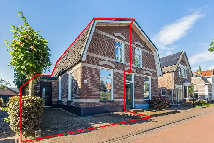
Deventerstraat 166
Welgelegen, Apeldoorn
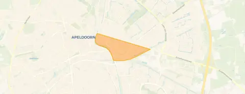 Area
AreaA pre-war semi-detached house in Welgelegen
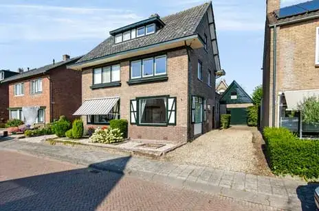
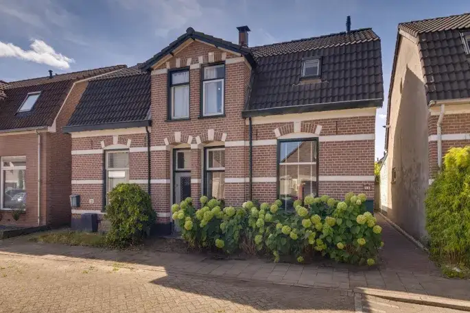
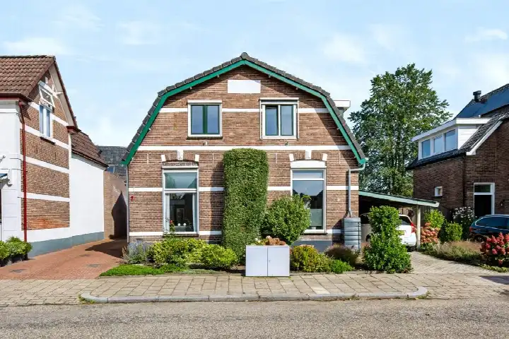
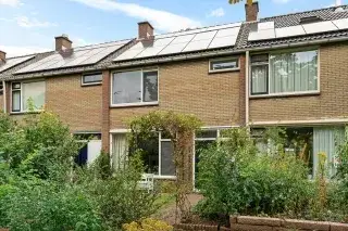
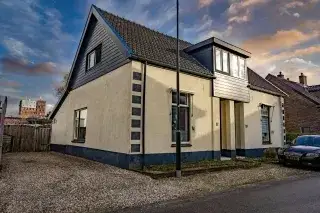
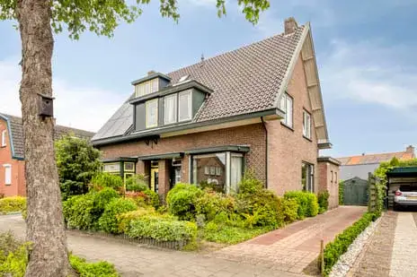
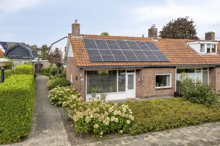
On Deventerstraat 166 in Apeldoorn stands a semi-detached house from 1910, in the Welgelegen neighbourhood. The asking price of €389,500 sits 37% below the average asking price of €623,100 for homes in this neighbourhood, which puts it on the low side of the local market. The living area is 94 m² according to the BAG registration, which is 36% smaller than the neighbourhood average of 147 m². For context, the current supply of semi-detached houses in Apeldoorn shows a range of prices across the municipality.
The home itself
This semi-detached house was built in 1910 and carries energy label F. The living area is 94 m² on a plot of 206 m², according to the BAG registration. The energy label F is the least efficient label, so expect higher energy costs compared to more efficient homes.
Life in Welgelegen
Welgelegen is a district in the east of Apeldoorn, and residents of the district give it an average score of 8.25 out of 10, based on seven reviews. One resident says: "Cosy neighbourhood, helpful neighbours and cheerful houses!". Another adds: "it's cosy, lots of people around you. plenty of walking spots also for walking your dog". A third resident notes: "There are many playgrounds and nice neighbours. A cosy neighbourhood for children and (young) families." The district counts about 4,040 inhabitants, with a mix of ages and household types. The housing stock is predominantly owner-occupied, at 77%. For more on the area, see the Welgelegen neighbourhood.
Amenities and transport
The daily routine is well covered here. Aldi is on your doorstep, with Dirk and Lidl just around the corner, and Jumbo a ten-minute walk away. For primary education, Openbare Basisschool De Mheen is a couple of streets away, as is Rooms Katholieke Basisschool Hertog van Gelre. The nearest GP is Huisartsencentrum Welgelegen, Praktijk Bruens, a ten-minute walk, with Apotheek Ooster-Welgelegen nearby. Bus stops at Julianakerk and Auroralaan are just around the corner, served by lines 2, 15 and 16, and Apeldoorn train station is a ten-minute walk. The municipality of Apeldoorn offers further amenities within easy reach, as described on the municipality of Apeldoorn. The address-level risk data indicates a road traffic noise level of 62 dB Lden, which is above the noise standard, based on 2022 data. Railway noise is 38 dB Lden, below the standard. The foundation risk indication is low, on sand soil, though this is an area-level indication rather than an inspection of this specific home. For climate, pluvial flooding at heavy rain is medium, while flood risk is low now and in 2050. Heat stress is low currently but medium by 2050. These are area-level indications from public risk data, not an assessment of this property.
Source and agent
At the time of writing, the home is offered via two channels, including GOOS Makelaardij and GOOS Makelaardij on Funda.
This summary was generated with AI and may contain errors. Always verify the details with the provider.
Features
Details of this home
Transfer
Price
Energy
 Save up to € 400 on your energy billCompare now
Areas and volume
 Insure your home and belongingsGet insured
Layout
Construction
Outdoor space
The WOZ value is set annually by the municipality with 1 January as its reference date, and therefore lags the market by about a year. It is an estimated market value, not a sale price.
Frequently asked questions
About Deventerstraat 166, Apeldoorn
How does the asking price compare to other homes in Welgelegen?
The asking price of €389,500 is 37% below the average asking price of €623,100 for homes currently for sale in the neighbourhood. The median asking price is €550,000, with the cheapest home at €349,000 and the most expensive at €895,000. The average price per m² in the neighbourhood is €4,508, while this home works out at €4,144 per m² based on the BAG living area.
What is the living area of this home?
According to the BAG registration, the living area is 94 m² on a plot of 206 m². This is 36% smaller than the neighbourhood average of 147 m². The agent does not provide a separate floor area figure, so the BAG registration is the only stated measurement.
What does energy label F mean for this home?
Energy label F is the least efficient label on the scale, so the home will have higher energy costs than a home with a more efficient label. In the neighbourhood, most of the current supply has a better energy label, with 43.8% at label A and 18.8% at label A+. Only 12.5% of the supply has label D or lower. The label does not say anything about the structural condition of the home itself.
What is the WOZ value of this home?
The WOZ value is determined by the municipality and is not part of the agent's listing information. Without this figure, it is not possible to compare the asking price to the municipal valuation.
What are the noise levels around this address?
The address-level risk data shows road traffic noise at 62 dB Lden, which is above the noise standard, based on 2022 data. Railway noise is 38 dB Lden, which is below the standard, based on 2023 data. These are area-level indications from public data sources, not measurements taken at the property itself.
What is the foundation risk for this home?
The foundation risk indication for this address is low, and the soil type is sand. The home was built before 1970, specifically in 1910. This is an area-level indication based on public risk data, not an inspection of this specific property. The foundation risk is one of several area-level indications that apply to the address.
What is the flood and climate risk at this address?
The climate risk data indicates that pluvial flooding at heavy rain is medium, while flood risk is low both now and in 2050. Heat stress is low currently but medium by 2050. These are area-level indications from the Klimaateffectatlas, not an assessment of this specific home. The data gives a general picture of the climate risks for the area.
Which supermarkets are near this home?
Aldi is the nearest supermarket, just around the corner at about 237 metres. Dirk and Lidl are also close by, at roughly 611 and 668 metres respectively. Jumbo is about 965 metres away, and there is an AH to go at about 1.1 kilometres. In total, there are 33 supermarkets within five kilometres of the address.
Which schools are close to this home?
Openbare Basisschool De Mheen is the nearest primary school, at about 324 metres, with 261 pupils. Rooms Katholieke Basisschool Hertog van Gelre is at about 440 metres, with 374 pupils. Montessori Kindcentrum Apeldoorn is at about 783 metres. For secondary education, Mheenpark (onderbouwlocatie) is at about 896 metres. In total, 80 schools are within five kilometres.
What public transport options are available nearby?
The nearest bus stop is Apeldoorn, Julianakerk, at about 202 metres, served by lines 2 and 15. Apeldoorn, Auroralaan is at about 237 metres, served by line 16. Apeldoorn, De Tol is at about 394 metres, served by lines 2, 15 and 16. The nearest train station is Apeldoorn, at about 1.1 kilometres.
What do residents say about the Welgelegen district?
Residents of the district give it an average score of 8.25 out of 10, based on seven reviews. One resident says: "Cosy neighbourhood, helpful neighbours and cheerful houses!". Another notes: "it's cosy, lots of people around you. plenty of walking spots also for walking your dog". A third says: "There are many playgrounds and nice neighbours. A cosy neighbourhood for children and (young) families." These reviews describe the district as a whole, not specifically this street.
Why are there no property details in this listing?
The listing does not state the number of rooms, bedrooms, bathrooms, or any details about the garden, balcony, or insulation. The agent has not provided these details in the listing.