Leedjes 2
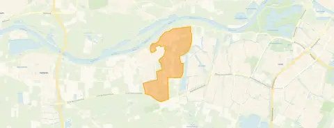
Buitengebied Driel Keulse Kamp-GrietenKamp-Leedjes, Overbetuwe
 Area
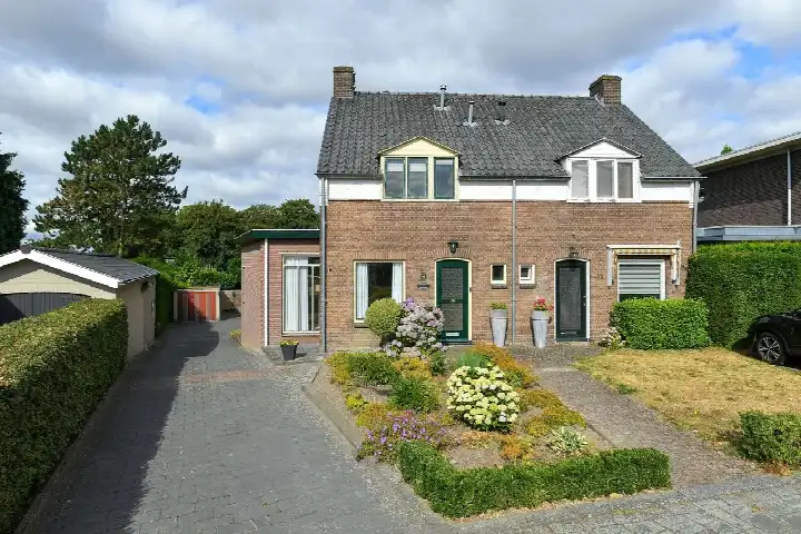
AreaA 1938 semi-detached home in the countryside
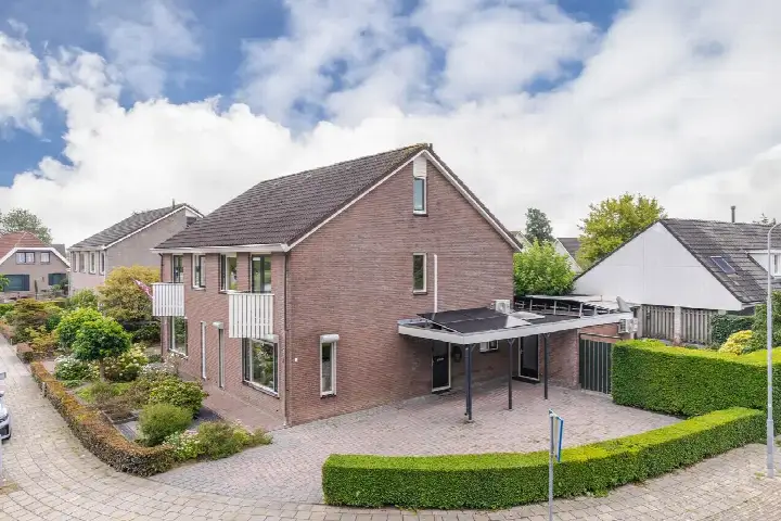
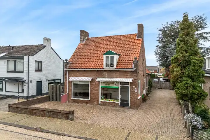
This semi-detached house from 1938 sits on a plot of 1,065 m² in the Buitengebied Driel Keulse Kamp-GrietenKamp-Leedjes, a rural corner of Driel in the municipality of Overbetuwe. The listing does not state the energy label, so you cannot judge running costs from the listing alone. With a living area of 216 m² according to the BAG registration, the asking price of €699,000 works out at €3,236 per m². That puts the price on the high side compared with other [semi-detached houses in Overbetuwe].
The home itself
The agent gives no further details about the layout, so the number of rooms, bedrooms and bathrooms is not stated. What is known is the year of construction, 1938, and the floor area of 216 m². The plot of 1,065 m² gives plenty of outdoor space around the house. Because the listing is incomplete, there is nothing more to say about the interior or installations.
Life in the Buitengebied
This is a small community of 315 residents, with a mix of ages and a quarter of residents aged 65 or over. Across the municipality of Overbetuwe, residents give an average score of 7.64 based on 22 reviews. One resident says: "The only thing is that they drive too fast down the street and there are too few parking spaces relative to the number of cars." Another describes it as "Quiet, reasonably social, zero amenities", adding that "Social control is fine without everyone interfering with each other". The neighbourhood has 83 homes, of which 88% are single-family and 84% owner-occupied. For more context, see [the Buitengebied Driel Keulse Kamp-GrietenKamp-Leedjes neighbourhood].
Amenities and transport
Daily errands are manageable from here. Albert Heijn is just around the corner, with another Albert Heijn a couple of streets away. Primary schools cb De Meeuwenberg and Basisschool De Kameleon are both about a ten-minute walk. Huisartsenpraktijk Driel is the nearest GP. Bus line 556 stops at Driel, Polenplein, a ten-minute walk away, and Arnhem Zuid station is 2.2 km from the door. The wider area falls under [the municipality of Overbetuwe].
WOZ value and address data
The WOZ value is €650,000 as of 1 January 2025, and the asking price sits 8% above that figure. Public risk data at address level shows an elevated foundation risk indication for this area, based on the 1938 construction on clay soil and the fact that 80% of properties in this postcode area were built before 1970. These are area-level indications, not an inspection of this specific home. Road traffic noise is measured at 45 dB Lden and railway noise at 33 dB Lden, both below the noise standard. The current flood risk indication is elevated, dropping to low by 2050.
Source
At the time of writing the home is offered via multiple channels, including Ras Makelaars, Funda, Huispedia and Vastgoed Nederland.
This summary was generated with AI and may contain errors. Always verify the details with the provider.
Features
Details of this home
Transfer
Price
Energy
 Save up to € 400 on your energy billCompare now
Areas and volume
 Insure your home and belongingsGet insured
Layout
Construction
Outdoor space
Location
The WOZ value is set annually by the municipality with 1 January as its reference date, and therefore lags the market by about a year. It is an estimated market value, not a sale price.
Frequently asked questions
About Leedjes 2, Driel
What does the asking price of €699,000 include?
The asking price for this semi-detached house is €699,000. The WOZ value is €650,000 as of 1 January 2025, which means the asking price is 8% above the municipal valuation. The price per square metre is €3,236 based on the BAG living area of 216 m². The plot measures 1,065 m².
What is the energy label of this home?
The agent has not published this field, so you cannot tell from the listing how energy-efficient the home is. The year of construction is 1938, but no conclusions about insulation or installations can be drawn from that alone.
How does the WOZ value compare to the asking price?
The WOZ value is €650,000 with a reference date of 1 January 2025. The asking price of €699,000 is 8% above that WOZ value. The WOZ is the municipal valuation and does not necessarily reflect the current market value. No further conclusions are drawn here.
What is the foundation risk for this property?
The foundation risk indication for this address is elevated, according to public data from KCAF and the Klimaateffectatlas. This is based on the 1938 construction on clay soil and the fact that 80% of properties in this postcode area were built before 1970. In this neighbourhood, 1% of properties have an elevated risk of pile rot. These are area-level indications, not an inspection of this specific home.
What amenities are nearby?
Albert Heijn is 799 m away, with another Albert Heijn at 1,962 m and a Jumbo at 2,424 m. Primary schools cb De Meeuwenberg and Basisschool De Kameleon are both within a kilometre. Huisartsenpraktijk Driel is the nearest GP at 949 m, and the pharmacy Service Apotheek Elderveld is 2,346 m away in Arnhem.
How is the public transport connection?
Bus line 556 stops at Driel, Polenplein, 765 m away, and at Driel, Ausemsstraat, 945 m away. Bus lines 36 and 805 stop at Driel, De Meikers, 963 m away. The nearest train station is Arnhem Zuid at 2,172 m.
What is the neighbourhood like?
The Buitengebied Driel Keulse Kamp-GrietenKamp-Leedjes has 315 residents and 83 homes. Across the municipality of Overbetuwe, residents give an average score of 7.64 based on 22 reviews. One resident mentions traffic speed and parking, while another describes the area as quiet with fine social control. The neighbourhood is rural with an urbanity level of 5, meaning not urban.
Why are there no property details in this listing?
The agent has not published the energy label, and no layout details such as rooms, bedrooms or bathrooms are given. The address itself is complete, so the location and neighbourhood data are accurate. The floor area of 216 m² comes from the BAG registration, and the plot is 1,065 m².
What is the flood risk for this address?
The current flood risk indication for this address is elevated, according to public data from the Klimaateffectatlas. By 2050, the indication drops to low. This is an area-level indication based on public risk data, not an inspection of this specific home. The soil type in this area is clay.
How many homes are there in the neighbourhood?
The neighbourhood has 83 homes in total, of which 88% are single-family homes and 84% are owner-occupied. The average household size is 2.5 people. Of the households, 38% have children and 23% are single-person households. The neighbourhood has an address density of 458 per km².