




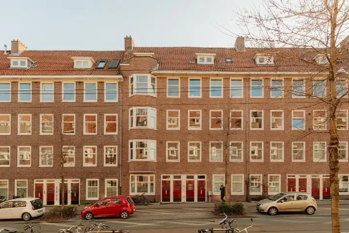
Heemstedestraat 41-1
Aalsmeerwegbuurt-West · 1059 EA Amsterdam

A 1933 apartment in Aalsmeerwegbuurt-West
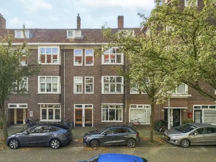
This apartment on Heemstedestraat sits in the Aalsmeerwegbuurt-West neighbourhood, part of the Hoofddorppleinbuurt district in Amsterdam. Built in 1933, it's a piece of pre-war Amsterdam housing stock. The last known asking price of €465,000 was keen compared to the neighbourhood average asking price of €673,107, a difference of 31 percent. For context, the average asking price per square metre in the neighbourhood was €9,412, while this home came in at €8,774 per square metre based on the BAG registration. This listing did not state the energy label, so that information was missing from the agent's publication. If you're looking at apartments in Amsterdam, this one sat at the lower end of the price range for the area. This home has not been online since 1 November 2026.
The home itself
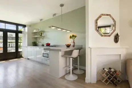
The listing provided limited detail about the interior. What is known is that the home is an apartment built in 1933, and the living area according to the BAG registration is 53 square metres. The agent had not published information about the number of rooms, bedrooms, or bathrooms, nor about any garden, balcony, or garage. There's no mention of insulation, heating systems, or whether there's an owners' association fee. So the picture is incomplete, but the address itself is fully confirmed, meaning the location and neighbourhood data are accurate.
The Aalsmeerwegbuurt-West neighbourhood
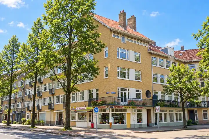
Across the municipality of Amsterdam, residents give their living environment an average score of 7.35, based on 252 reviews. One resident describes a very pleasant, quiet neighbourhood with lots of green and wonderful trees that offer cooling and relaxation, though they also mention daily mess around the waste containers as a persistent annoyance. Another resident speaks of a quiet, peaceful, relaxed, green, and social area with a nice mix of people. The neighbourhood itself has around 2,540 inhabitants, with a high proportion of single-person households at 52 percent. Most residents are between 25 and 45 years old. The housing stock here consists entirely of pre-war buildings, and 43 percent of homes are owner-occupied. For more on the Aalsmeerwegbuurt-West neighbourhood, the area is densely urban with an address density of 6,865 per square kilometre.
Amenities and transport
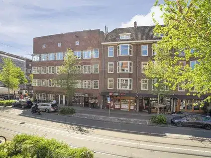
Daily errands are well covered around this home. The nearest GP is Huisartsenpraktijk Delflandplein, a couple of streets away, and the pharmacy Apotheek Delflandplein is just around the corner. For groceries, Albert Heijn and Dirk are both a couple of streets away, with a Lidl also within a five-minute walk. The nearest primary school is Oecumenische basisschool Nautilus, a five-minute walk, and there's also Cultuurprofielschool De Notenkraker nearby. Public transport is on your doorstep: tram stop Westlandgracht is just 95 metres away, served by lines 2 and N88. The nearest train station is Amsterdam Lelylaan, a ten-minute walk. All of this sits within the municipality of Amsterdam, where the city's broader amenities are easily accessible.
WOZ and address data
No WOZ value is available for this property in the data. Regarding address-level risk indications, the noise load from road traffic is 65 dB Lden, which is above the noise standard, based on 2022 data. Aircraft noise is 49 dB Lden, also above the standard, while railway noise at 38 dB Lden stays below it. These are area-level indications from public risk data, not an inspection of this specific home. The foundation risk indication is medium, which relates to the building being constructed before 1970, in 1933, and the area being a KCAF attention zone where all properties in this postcode area were built before 1970. For climate, pluvial flooding at heavy rain is elevated, while flood risk is low both now and in 2050. Heat stress is medium, both currently and projected for 2050. Again, these are indications at area level, not a verdict on this particular property.
Source
When this home was still on the market, it was offered only via Keij & Stefels B.V.
This summary was generated with AI and may contain errors. Always verify the details with the provider.
Features
Details of this home
Transfer
Price

Construction
The WOZ value is set annually by the municipality with 1 January as its reference date, and therefore lags the market by about a year. It is an estimated market value, not a sale price.
Frequently asked questions
About Heemstedestraat 41-1, Amsterdam
How did the asking price compare to other homes in the neighbourhood?
The asking price of €465,000 was 31 percent below the neighbourhood average asking price of €673,107. The average asking price per square metre in the neighbourhood was €9,412, while this home was listed at €8,774 per square metre based on the BAG registration. The price verdict was described as keen compared to the neighbourhood average. There were at the time 28 homes for sale in the neighbourhood, with prices ranging from €395,000 to €1,100,000.
What is the living area of this apartment?
According to the BAG registration, the living area is 53 square metres. This is 28 percent smaller than the neighbourhood average of 74 square metres. The agent had not published additional details about the layout, such as the number of rooms, bedrooms, or bathrooms.
Why was there no energy label in this listing?
The agent had not published this field, so there was no information available about the home's energy efficiency rating. This meant the energy performance of the apartment cannot be assessed from the listing data.
What is the foundation risk for this property?
The foundation risk indication for this address is medium. This is an area-level indication based on public risk data, not an inspection of this specific home. The building was constructed in 1933, before 1970, and the postcode area is a KCAF attention zone where 100 percent of properties were built before 1970. This contributes to the medium foundation risk indication for the area.
What are the noise levels around this address?
The noise load from road traffic is 65 dB Lden, which is above the noise standard, based on 2022 data. Aircraft noise is 49 dB Lden, also above the standard, based on 2022 data. Railway noise is 38 dB Lden, which stays below the noise standard, based on 2023 data. These are area-level indications from public risk data, not measurements taken at this specific property.
What supermarkets are nearby?
There are several supermarkets within walking distance. Albert Heijn is 344 metres away, Dirk is 359 metres away, and another Albert Heijn is 424 metres away. A Lidl is 499 metres from the home. In total, there are 147 supermarkets within 5 kilometres of this address, so grocery shopping is well covered in the area.
Which schools are close to this apartment?
Several schools are within walking distance. The nearest is SBO Tobiasschool, a special primary school, at 234 metres. Tobiasschool VMBO, a secondary school, is 267 metres away. Oecumenische basisschool Nautilus, a primary school, is 404 metres away, and Cultuurprofielschool De Notenkraker is 425 metres away. There are 182 schools within 5 kilometres of this address.
What public transport options are available?
Tram stop Westlandgracht is just 95 metres away, served by lines 2 and N88. Hoofddorpplein stop is 207 metres away with lines 2, 15, 62, and N88. The nearest train station is Amsterdam Lelylaan, 1,128 metres away. This gives good access to both tram and rail connections in the area.
What is the neighbourhood like according to residents?
Across the municipality of Amsterdam, residents give an average score of 7.35 based on 252 reviews. One resident describes a very pleasant, quiet neighbourhood with lots of green and trees that offer cooling and relaxation, though they note daily mess around waste containers as an issue. Another speaks of a quiet, peaceful, relaxed, green, and social area with a nice mix of people. These reviews reflect the wider municipality rather than this specific neighbourhood.
What is the flood risk for this address?
The current flood risk is low, and it is projected to remain low in 2050. Pluvial flooding at heavy rain is elevated. Heat stress is medium both currently and projected for 2050. These are area-level climate indications from public risk data, not assessments of this specific property. The data comes from the Klimaateffectatlas and reflects the broader area around this address.