sint monulphusweg 21
Villapark, Maastricht
 Area
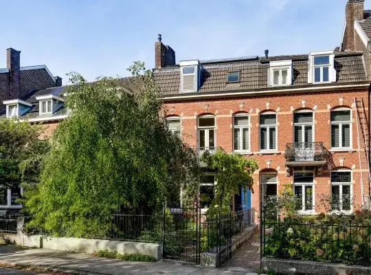
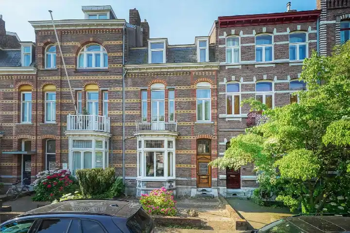
AreaA grand terraced house in Villapark
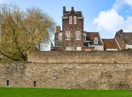
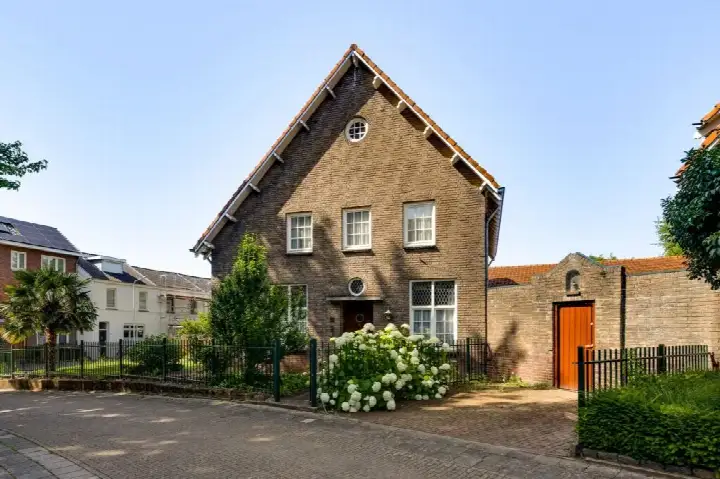
On Sint Monulphusweg 21 in Maastricht, this terraced house from 1925 sits in the Villapark neighbourhood, a part of the Buitenwijk Zuidwest district. The asking price of €850,000 is in line with the market, according to the comparison with the neighbourhood average. The home has a living area of 219 m² according to the BAG registration, which is 34% larger than the neighbourhood average of 164 m². For context, the average asking price for terraced houses in Maastricht sits at €630,143.
The home itself
The property is a terraced house built in 1925, with an energy label F. The living area is 219 m² according to the BAG registration, and the plot measures 122 m². The asking price works out at €3,881 per m² based on the BAG floor area. The listing does not provide further details about the layout, garden, or installations.
Villapark
The Villapark neighbourhood is home to around 3,190 people, with a mix of ages and household types. Residents across the municipality of Maastricht give their living environment an average score of 7.45, based on 37 reviews. One resident says: "everything perfect lovely people and many amenities." Another resident, however, notes: "Born here, many homes are poor, damp and drafty and too expensive." A third resident mentions curious neighbours and a lack of parking, but also friendly elderly people and a decent shopping centre nearby. These reviews reflect the wider municipality rather than Villapark specifically.
Amenities and transport
The GP practice Medisch Centrum Sint Pieter, Huisartsenpraktijk Buysrogge is just around the corner, and the Coop supermarket is a couple of streets away. The nearest primary school, Rooms Katholieke Basisschool St Pieter, is also a couple of streets away. Bus line 12 stops at Maastricht, Glacisweg on your doorstep, and Maastricht, Prins Bisschopsingel is a five-minute walk away with line 10. The nearest pharmacy, Apotheek Céramique, is a ten-minute walk, and Maastricht train station is about 1.5 km away. According to public address-level risk data, the road traffic noise level is 53 dB Lden, which is above the noise standard, while railway and aircraft noise remain below their standards. The foundation risk indication is medium, as the home was built before 1970 and 60% of properties in this postcode area date from before that year. Pluvial flooding at heavy rain is indicated as elevated, while flood risk is low now and in 2050. Heat stress is indicated as medium now and in 2050. These are area-level indications, not an inspection of this specific home.
Source
At the time of writing the home is offered only via AMH Makelaars.
This summary was generated with AI and may contain errors. Always verify the details with the provider.
Features
Details of this home
Transfer
Price
Energy
 Save up to € 400 on your energy billCompare now
Areas and volume
 Insure your home and belongingsGet insured
Layout
Construction
Outdoor space
Frequently asked questions
About sint monulphusweg 21, Maastricht
What is the asking price for this terraced house in Villapark?
The asking price is €850,000. This is in line with the market, according to the comparison with the neighbourhood average asking price of €630,143. The price per m² is €3,881 based on the BAG floor area of 219 m², which is 34% larger than the neighbourhood average of 164 m².
What is the energy label and what does it mean for costs?
The energy label is F. Label F is not an efficient label, so expect relatively high energy costs for heating and electricity. The listing does not state any insulation features. The home was built in 1925, which is a fact about its age rather than a statement about its condition.
What is the WOZ value of this property?
The WOZ is the municipal valuation used for tax purposes, and it is not available for this property in the data provided.
What are the noise levels around this address?
According to public address-level risk data, road traffic noise is 53 dB Lden, which is above the noise standard. Railway noise is 13 dB Lden and aircraft noise is 39 dB Lden, both below their respective standards. These are area-level indications based on public data, not measurements taken at the property itself.
What is the foundation risk for this home?
The foundation risk indication is medium. This is because the home was built before 1970, specifically in 1925, and 60% of properties in this postcode area date from before 1970. This is an area-level indication from public data, not an inspection of this specific home.
What supermarkets and schools are nearby?
The Coop supermarket is 435 metres away, and an Albert Heijn is 937 metres away. The nearest primary school is Rooms Katholieke Basisschool St Pieter at 346 metres, with Openbare Basisschool Binnenstad at 555 metres. The GP practice Medisch Centrum Sint Pieter is 123 metres away.
What public transport options are available?
Bus line 12 stops at Maastricht, Glacisweg at 141 metres and at Maastricht, St. Lambertuslaan at 191 metres. Bus line 10 stops at Maastricht, Prins Bisschopsingel at 296 metres. The nearest train station is Maastricht, at 1,452 metres.
How do residents rate living in this area?
Residents across the municipality of Maastricht give their living environment an average score of 7.45, based on 37 reviews. One resident says: "everything perfect lovely people and many amenities." Another resident notes: "Born here, many homes are poor, damp and drafty and too expensive." These reviews reflect the wider municipality, not specifically the Villapark neighbourhood.
What is the neighbourhood like in terms of demographics?
Villapark has around 3,190 residents. The largest age group is 65 and older at 28%, followed by 45 to 65 at 27%. Single-person households make up 46% of households, and 23% of households have children. The address density is 2,122 per km², which indicates a strongly urban area.
Why are there no property details in this listing?
The listing does not state details about the layout, number of rooms, bedrooms, bathrooms, garden, or installations. As a result, the description of the home itself is limited to the property type, year of construction, energy label, and floor areas.