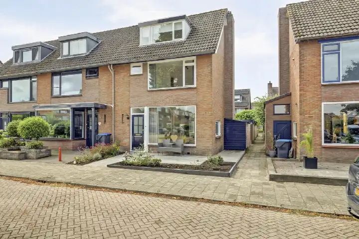
Mastmeen 16
Scheepswaard, Harderwijk
 Area
AreaA quiet spot in Scheepswaard
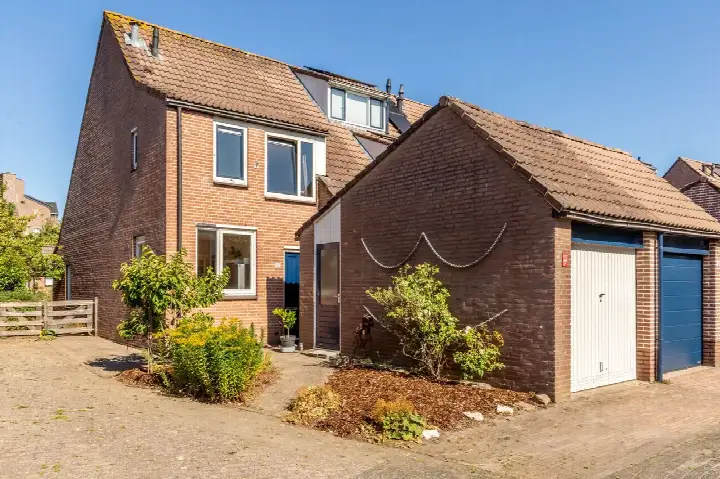
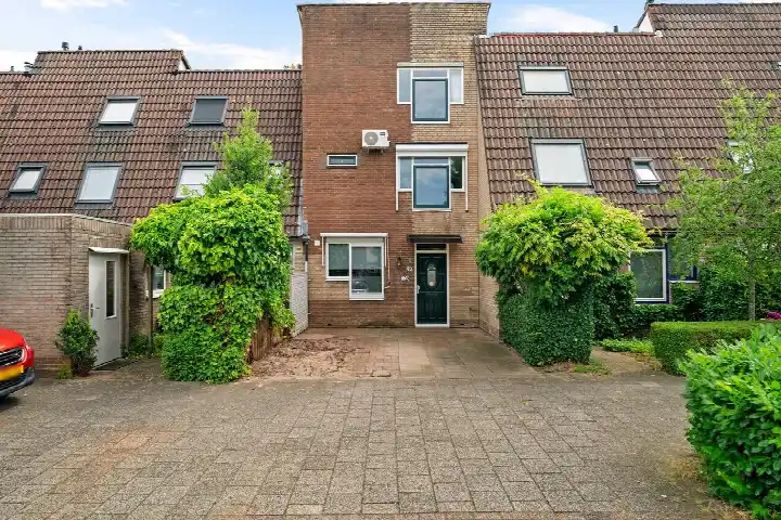
Mastmeen 16 sits on a quiet road in a residential area, a setting the agent describes as peaceful. This end-of-terrace house from 1974 is listed at €499,000, which is on the high side compared with the average asking price of €449,000 for the one other home currently for sale in the neighbourhood. At €3,441 per square metre, based on the agent's floor area, the price is also above the neighbourhood average of €3,535 per square metre for homes on the market. For context, end-of-terrace houses in Harderwijk give you an idea of what this property type typically costs in the municipality.
Inside the home
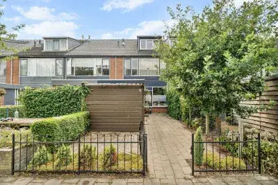
The agent lists this as a five-room home with four bedrooms and two bathrooms spread over three floors, with a volume of 527 cubic metres. There is a front and rear garden, with the rear garden facing northeast and accessible via the back alley. The property is freehold, has double glazing, and is heated by a combi boiler with partial underfloor heating. The BAG registration records a living area of 116 square metres, while the agent's listing states 145 square metres. The plot is 191 square metres according to both sources.
Life in Scheepswaard
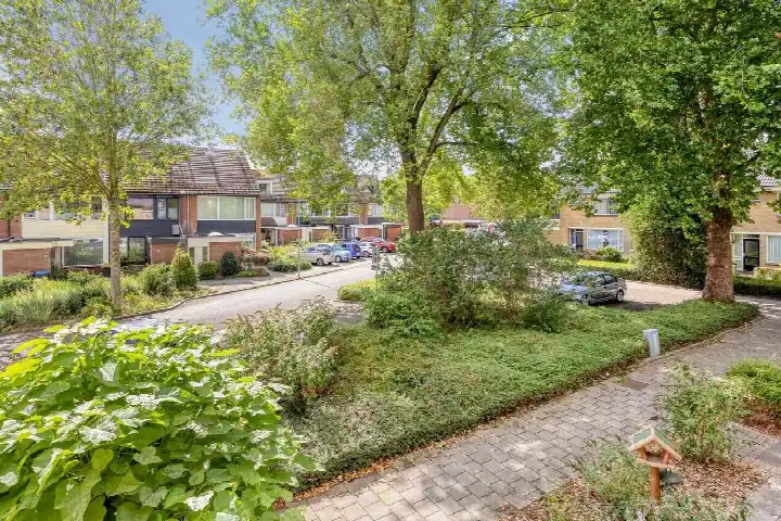
Residents of the wider district give their living environment an average score of 8.3 out of 10, based on four reviews. One resident says: "It is a pleasant neighbourhood with affordable homes. The price/quality ratio is good. However, there is some litter, especially around the waste containers." Another adds: "Many families with children, quiet and safe. No through traffic to or from the city centre, so very quiet after 10 PM." The neighbourhood has around 950 residents, and most homes here were built between 1970 and 1990. The Scheepswaard neighbourhood is described by residents as green, with trees and shrubs, and close to a lake.
Amenities and getting around
Daily errands are well covered. Jumbo supermarket is just around the corner, with SPAR express a ten-minute walk away. Christelijke basisschool Het Baken is a couple of streets away, and K.B.S Alfons Ariëns is also within walking distance. Huisartsenpraktijk van der Hulst and BENU Apotheek Stadsweiden are both just around the corner, and Sint Jansdal hospital is a ten-minute walk. Bus stops at De Roef and Voorste Wei are a couple of streets away, served by lines 101 and 513. Harderwijk train station is a ten-minute walk. The municipality of Harderwijk offers further amenities within easy reach.
WOZ and address data
No WOZ value is available for this property. The address-level risk data from public sources indicates that road traffic noise is 40 dB Lden, railway noise 30 dB Lden, and aircraft noise 12 dB Lden, all below the relevant noise standards. The foundation risk indication is low, though the soil is clay, which is noted as sensitive to settlement. Pluvial flooding risk is low, as is current flood risk and flood risk in 2050. Heat stress is currently low but is indicated as medium by 2050. These are area-level indications based on public data, not an inspection of this specific home.
Source
At the time of writing, the home is offered via multiple channels, including Vinke Veluwe Makelaars and Vinke Veluwe Makelaars.
This summary was generated with AI and may contain errors. Always verify the details with the provider.
Features
Details of this home
Transfer
Price
Energy
 Save up to € 400 on your energy billCompare now
Areas and volume
 Insure your home and belongingsGet insured
Layout
Construction
Outdoor space
The WOZ value is set annually by the municipality with 1 January as its reference date, and therefore lags the market by about a year. It is an estimated market value, not a sale price.
Frequently asked questions
About Mastmeen 16, Harderwijk
How does the asking price compare with other homes in Scheepswaard?
The asking price of €499,000 is above the average asking price of €449,000 for the one other home currently for sale in the neighbourhood. Based on the agent's floor area of 145 square metres, the price per square metre is €3,441, which is slightly below the neighbourhood average of €3,535 per square metre for homes on the market. The figures describe the current market situation.
What is the layout of this end-of-terrace house?
According to the agent, the home has five rooms, four bedrooms and two bathrooms spread over three floors, with a volume of 527 cubic metres. There is a front and rear garden, with the rear garden facing northeast and accessible via the back alley. The property is freehold. The BAG registration records a living area of 116 square metres, while the agent's listing states 145 square metres.
What is the energy label and what does it mean for costs?
The home has energy label C. This is a mid-range label, so you can expect moderate energy costs for heating and electricity. The agent notes that the home has double glazing and is heated by a combi boiler with partial underfloor heating. The energy label is a standard measure of the home's energy performance, not a statement about its structural condition.
What do residents say about living in this area?
Residents of the wider district give their living environment an average score of 8.3 out of 10, based on four reviews. One resident mentions a pleasant neighbourhood with affordable homes and a good price/quality ratio, though there is some litter around waste containers. Another highlights that it is quiet after 10 PM with no through traffic, and that schools, supermarkets, a GP, dentist, train station and hospital are all within 10 minutes by bike.
What are the noise levels around this address?
The address-level risk data indicates road traffic noise of 40 dB Lden, railway noise of 30 dB Lden, and aircraft noise of 12 dB Lden, all below the relevant noise standards. These figures come from public data sources and are area-level indications, not measurements taken at this specific home. The noise levels are all within the legal limits.
What is the foundation risk for this property?
The foundation risk indication for this address is low. The soil is clay, which is noted as sensitive to settlement. This is an area-level indication based on public data from sources such as KCAF, not an inspection of this specific home. The low risk level means there is no elevated concern indicated for foundation issues in this area.
What flood and climate risks apply to this address?
The address-level climate data indicates a low risk of pluvial flooding, low current flood risk, and low flood risk in 2050. Heat stress is currently low but is indicated as medium by 2050. These are area-level indications from the Klimaateffectatlas, not an assessment of this specific property. The figures describe the broader area's exposure to climate-related risks.
Which supermarkets are closest to this home?
Jumbo supermarket is just around the corner at about 339 metres away. SPAR express is about 1.4 kilometres away, a ten-minute walk, and Albert Heijn is about 1.5 kilometres away. Vomar and another Jumbo are also within about 1.6 kilometres. In total, there are 20 supermarkets within five kilometres of this address.
What schools are within walking distance?
Christelijke basisschool Het Baken is a couple of streets away at about 208 metres, with 166 pupils. K.B.S Alfons Ariëns is about 415 metres away, and Vrije School Valentijn is about 475 metres away. De Olijfboom is about 513 metres away. There are 40 schools within five kilometres of this address, covering primary and secondary education.
How accessible is public transport from this home?
Bus stops are a couple of streets away: Harderwijk, De Roef at about 301 metres serves line 101, and Harderwijk, Voorste Wei at about 347 metres serves line 513. Harderwijk, Vliepad at about 405 metres serves both lines 101 and 513. Harderwijk train station is about 1 kilometre away, a ten-minute walk.
What is the neighbourhood like in terms of demographics?
Scheepswaard has around 950 residents. The average household size is 2.4 people, with 43 percent of households having children and 26 percent being single-person households. The age spread is fairly even, with 17 percent under 15, 23 percent aged 25 to 45, and 21 percent aged 65 or older. The housing stock consists entirely of single-family homes, with 55 percent owner-occupied.
Is there any indication of crime in the neighbourhood?
The CBS data records 11 total crimes in the neighbourhood. This figure covers all types of reported crime and is presented without interpretation. The neighbourhood has a moderate urbanity level, with an address density of 1,323 per square kilometre. Residents describe the area as quiet and safe, though this is their personal experience rather than a statistical judgement.