Eykmanlaan 1
Dieren-West boven spoorlijn, Rheden
 Area
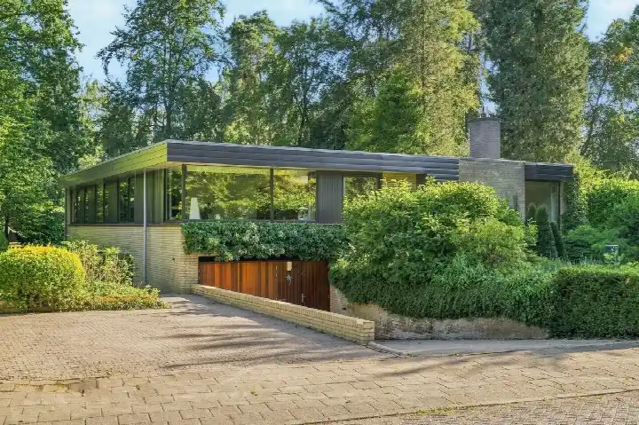
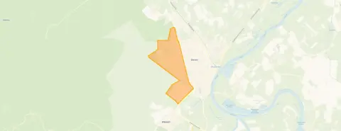
AreaA detached home at the edge of the woods
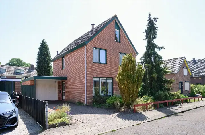
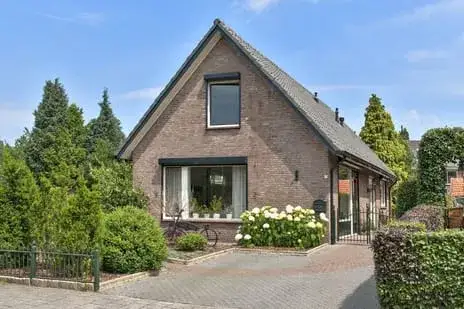
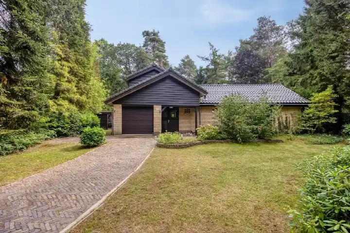
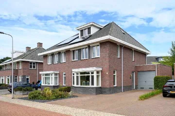
Tucked away on a quiet road at the edge of the forest, this detached house from 1970 sits in the Dieren-West boven spoorlijn neighbourhood of Dieren. The setting is described by the agent as bordering the woods, on a quiet road, in a residential area, with a free view. With a price of €795,000, the asking price is on the high side compared with the average asking price in the neighbourhood, which comes to €488,545. For context, [detached houses in Rheden]( /koopwoningen/rheden/vrijstaande-woningen/) are the property type in question here.
The home itself
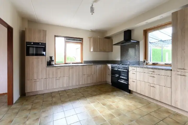
According to the agent, this detached family home offers seven rooms, including five bedrooms and one bathroom, spread over three floors. The living area is listed as 164 m² by the agent, while the BAG registration records 155 m². The plot measures 475 m² in both sources. The home has a garden all around and an attached brick garage. It is fully owned, and the agent notes insulation in the roof, double glazing, wall insulation and floor insulation, plus a central heating boiler. The energy label is B.
Life in Dieren-West boven spoorlijn
Residents give this neighbourhood an average score of 7.96, based on four reviews. One resident describes it as "gezellig en groen" (cosy and green), noting that the station is close by and the intercity stops there, so you can be in Zutphen or Arnhem in ten minutes. Another resident says it is a beautiful, quiet neighbourhood surrounded by nature, though there are a few spots where you would not want to walk in the evening, and people drive quite fast on the streets. A third resident mentions that drivers regularly speed through the 30 km/h zone, which does not improve road safety, and that pavements are uneven due to tree root growth. The neighbourhood has around 4,065 inhabitants, with a mix of ages and household types. For more on the area, see [the Dieren-West boven spoorlijn neighbourhood]( /buurt/dieren-west-boven-spoorlijn-rheden/).
Amenities and transport
Daily errands are well covered here. The Jumbo supermarket is just around the corner, and the Lidl is a couple of streets away. For primary education, Katholieke Basisschool De Vlinder and De Akker are both within a five-minute walk. The nearest GP is the Dierense Huisartsengroep Hagenau, Praktijk B. Aldewereld, and the BENU Apotheek Dieren is nearby. Bus line 525 stops at Dieren, Helfrichlaan on your doorstep, and the train station Dieren is a ten-minute walk away. The municipality of Rheden, of which Dieren is part, offers further amenities and connections, as described on [the municipality of Rheden]( /gemeente/rheden/).
WOZ and address data
The WOZ value is not stated in the available data, so no comparison with the asking price or historical development can be made here. Regarding address-level risks, the noise from road traffic is 35 dB Lden and from railway traffic 28 dB Lden, both below the noise standard, according to the 2022 and 2023 reference years. The foundation risk indication is low, with a note that 54% of properties in this postcode area were built before 1970, and the soil type is sand. For climate risks, pluvial flooding and current flood risk are low, as is heat stress now, though heat stress in 2050 is indicated as medium. These are area-level indications from public data, not an inspection of this specific home.
Source
At the time of writing, the home is offered via multiple channels, including REBO Vastgoed Groep | Wonen and REBO Vastgoed Groep | Wonen.
This summary was generated with AI and may contain errors. Always verify the details with the provider.
Features
Details of this home
Transfer
Price
Energy
 Save up to € 400 on your energy billCompare now
Areas and volume
 Insure your home and belongingsGet insured
Layout
Construction
Outdoor space
The WOZ value is set annually by the municipality with 1 January as its reference date, and therefore lags the market by about a year. It is an estimated market value, not a sale price.
Frequently asked questions
About Eykmanlaan 1, Dieren
How does the asking price compare with other homes in the neighbourhood?
The asking price of €795,000 is on the high side compared with the average asking price in the neighbourhood, which is €488,545. That is 63% above the neighbourhood average. The average asking price per square metre in the neighbourhood is €3,576, while this home is listed at €4,848 per square metre, based on the agent's floor area. These figures come from the current listings in the area.
What is the layout of this detached house?
According to the agent, the home has seven rooms, including five bedrooms and one bathroom, spread over three floors. The living area is listed as 164 m² by the agent, while the BAG registration records 155 m². The plot measures 475 m². There is a garden all around the house and an attached brick garage. The property is fully owned.
What is the energy label and what does it mean for costs?
The energy label is B. This label indicates the home's energy performance as registered, and a B label generally means moderate energy costs compared with less efficient labels. The agent also notes that the home has roof insulation, double glazing, wall insulation and floor insulation, along with a central heating boiler. These features can contribute to keeping the home warm, but the label itself does not guarantee specific costs.
What is the foundation risk for this address?
The foundation risk indication for this address is low, according to public data. The soil type is sand, and the note mentions that 54% of properties in this postcode area were built before 1970. This is an area-level indication, not an inspection of this specific home. It means that, based on regional data, the risk of foundation issues is considered low.
What are the noise levels around this home?
The noise from road traffic is 35 dB Lden, and from railway traffic it is 28 dB Lden, both below the noise standard, according to the 2022 and 2023 reference years. These are area-level indications from public data. The home is on a quiet road at the edge of the woods, as described by the agent, but the noise figures reflect the surrounding area, not a measurement at the property itself.
What supermarkets are nearby?
The nearest supermarket is Jumbo, about 925 metres away, and Lidl is about 962 metres away. SPAR, Aldi and Albert Heijn are all within roughly 1.1 to 1.2 kilometres. These distances mean you can walk to the closest options in about ten minutes, making daily grocery shopping convenient without needing a car.
Which schools are close to this home?
Two primary schools are within a short walk: Katholieke Basisschool De Vlinder at about 404 metres and De Akker at about 466 metres. There is also SBO 't Sterrenbos, a special primary school, at about 553 metres. For secondary education, the nearest school is about 1.1 kilometres away. These are the closest options according to the data.
How is the public transport connection from this address?
Bus line 525 stops at Dieren, Helfrichlaan, about 192 metres away, and also at Dieren, Zilverakkerweg and Dieren, Eduard van Beinumlaan, all within about 450 metres. The nearest train station is Dieren, about 1.5 kilometres away, which is roughly a ten-minute walk. The station offers intercity services, as noted by a resident, though specific destinations are not listed here.
What do residents say about living in this neighbourhood?
Residents give the neighbourhood an average score of 7.96, based on four reviews. One resident calls it "gezellig en groen" (cosy and green), with the station close by. Another describes it as a beautiful, quiet neighbourhood surrounded by nature, though noting some spots to avoid in the evening and fast driving. A third mentions speeding in the 30 km/h zone and uneven pavements due to tree roots.
What is the climate risk for this address?
The climate risk indications for this address are mostly low. Pluvial flooding (from heavy rain) is low, current flood risk is low, and heat stress now is low. However, heat stress in 2050 is indicated as medium. These are area-level indications from the Klimaateffectatlas, not a detailed assessment of this property. They give a general sense of how the area may be affected by climate factors.