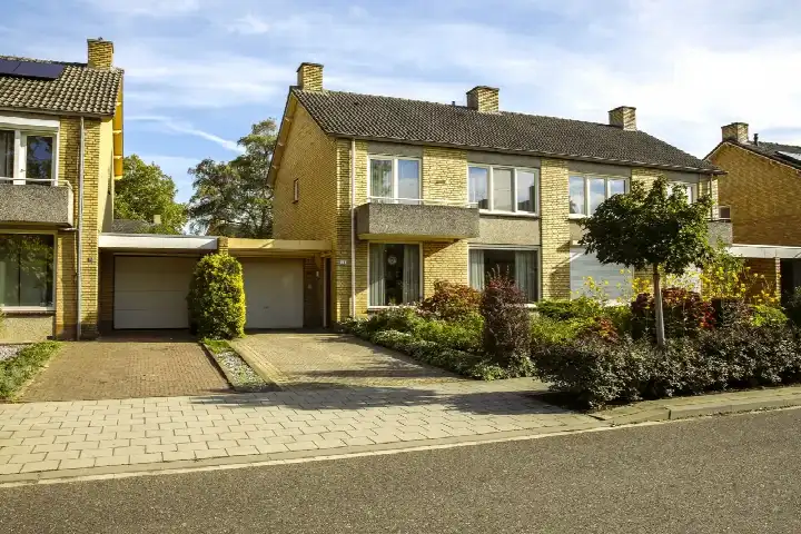
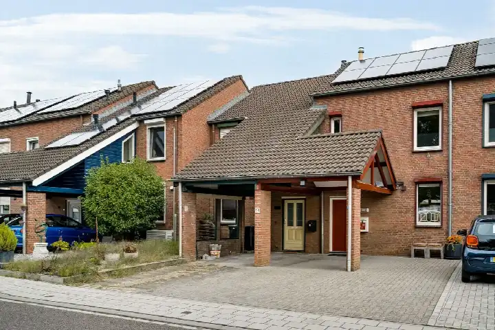
A terraced house in Hoogvonderen
This terraced house on Ambachtsingel 19 sits in Hoogvonderen, a neighbourhood in Roermond where homes from the 1970s and 1980s dominate. The asking price of €325,000 is keen compared with the average asking price in the neighbourhood, which comes to €424,250. For context, terraced houses in Roermond are listed at an average of €3,091 per square metre, while this home is priced at €2,826 per square metre according to the agent's listing.
The home itself
Built in 1981, this two-storey terraced house offers six rooms, including three bedrooms and one bathroom. The living area is 115 square metres according to the agent, while the BAG registration records 118 square metres. The plot measures 163 square metres. The home has a front garden and a back garden of 66 square metres, accessible from the west via the back alley, plus a carport. It is freehold, with insulation in the roof, double glazing, wall and floor insulation, and a central heating boiler. The energy label is C.
Hoogvonderen
Hoogvonderen is a residential area with a mix of ages: about 28 percent of residents are between 45 and 65, and 22 percent are 65 or older. Residents across the municipality of Roermond give their living environment an average score of 7.91, based on twenty reviews. One resident says: "Quietly situated in nature on a dead-end road. Good accessibility to the city and motorway and all amenities." Another notes: "It's a quiet neighbourhood with lots of greenery, but it could be even more for my liking." A third adds: "Cosy neighbourhood with lovely people." These reviews reflect the wider municipality, not just this neighbourhood. For more on the area, see the municipality of Roermond.
Amenities and transport
Daily errands are well covered. The Lidl is just around the corner, with an Aldi and a PLUS a couple of streets away. Openbare Basisschool De Brink is a five-minute walk, and Basisschool Vincent van Gogh is a ten-minute walk. The GP practice Het Roosendael and the BENU Apotheek Donderberg are both just around the corner, and the Laurentius Ziekenhuis is a ten-minute walk. Bus stops at Ambachtsingel (lines 62 and 63) and WC Donderberg (line 1) are within a five-minute walk, and Roermond station is about 1.9 kilometres away.
WOZ and address data
The WOZ value is not stated in the available data, so no comparison with the asking price can be made. According to public risk data at address level, the noise from road traffic is 49 dB Lden, which is above the Dutch standard, while railway noise is 30 dB Lden, below the standard. The foundation risk indication is low, with sandy soil. For climate, pluvial flooding at heavy rain is elevated, while the current flood risk and the 2050 flood risk are both low. Heat stress is currently low but is expected to be medium by 2050. These are area-level indications, not an inspection of this specific home.
Source
At the time of writing, the home is offered via multiple channels, including Jack Frenken makelaars & adviseurs.
This summary was generated with AI and may contain errors. Always verify the details with the provider.
Features
Details of this home
Transfer
Price

Areas and volume
Construction
Frequently asked questions
About Ambachtsingel 19, Roermond
How does the asking price compare with other homes in Hoogvonderen?
The asking price of €325,000 is 23 percent below the average asking price in the neighbourhood, which is €424,250. The average asking price per square metre in the neighbourhood is €3,091, while this home is listed at €2,826 per square metre according to the agent. The price verdict is described as keen, meaning it is on the low side compared with the neighbourhood average.
What is the layout of this terraced house?
This is a two-storey terraced house with six rooms, including three bedrooms and one bathroom. The living area is 115 square metres according to the agent, while the BAG registration records 118 square metres. The plot measures 163 square metres. There is a front garden and a back garden of 66 square metres, accessible from the west via the back alley, plus a carport.
What is the energy label and what does it mean for costs?
The energy label is C. This label indicates a moderate level of energy efficiency, so heating and electricity costs are likely to be average compared with more efficient homes. The home has roof insulation, double glazing, wall insulation and floor insulation, which can help keep energy use in check. The exact energy costs depend on usage and energy prices.
What is the WOZ value of this home?
The WOZ value is not stated in the available data. The WOZ value is the municipal valuation used for property taxes, and it is determined annually by the municipality. Without this figure, it is not possible to compare the asking price with the official valuation. The asking price is €325,000.
What are the noise levels around this address?
According to public risk data at address level, the noise from road traffic is 49 dB Lden, which is above the Dutch standard of 48 dB. Railway noise is 30 dB Lden, which is below the standard. These are area-level indications based on public data, not measurements taken at this specific home. The data is from 2022 for road traffic and 2023 for railway noise.
What is the foundation risk for this home?
The foundation risk indication for this address is low, and the soil type is sand. This is an area-level indication based on public data, not an inspection of this specific home. A low risk means that foundation problems are less likely, but it does not guarantee that no issues exist. The data comes from the KCAF foundation risk map.
What are the flood and heat risks for this area?
For climate risks, pluvial flooding at heavy rain is elevated, meaning there is a higher chance of water on the street during intense rainfall. The current flood risk from rivers or the sea is low, and the 2050 flood risk is also low. Heat stress is currently low but is expected to be medium by 2050. These are area-level indications, not predictions for this specific property.
Which supermarkets and schools are nearby?
The nearest Lidl is about 580 metres away, with another Lidl at 1.2 kilometres, an Aldi at 1.4 kilometres, and a PLUS at 1.5 kilometres. For schools, Openbare Basisschool De Brink is 461 metres away, Basisschool Vincent van Gogh is 636 metres, and Basisschool de Kasteeltuin is 699 metres. Yuverta vmbo Roermond for secondary education is 901 metres away.
How is the public transport connection from this home?
The nearest bus stop is Roermond, Ambachtsingel, about 360 metres away, with bus lines 62 and 63. Other stops within 500 metres include Roermond, WC Donderberg and Roermond, Beethovenstraat, both served by line 1. The nearest train station is Roermond, about 1.9 kilometres away. No travel times or destinations are stated in the data.
What do residents say about living in this area?
Residents across the municipality of Roermond give their living environment an average score of 7.91, based on twenty reviews. One resident says: "Quietly situated in nature on a dead-end road. Good accessibility to the city and motorway and all amenities." Another notes: "It's a quiet neighbourhood with lots of greenery." These reviews reflect the wider municipality, not just this neighbourhood.