Barkasstraat 3
Schepenbuurt Cartesiusweg en omgeving, Utrecht
 Area
AreaA 1946 terraced house in Utrecht's Schepenbuurt
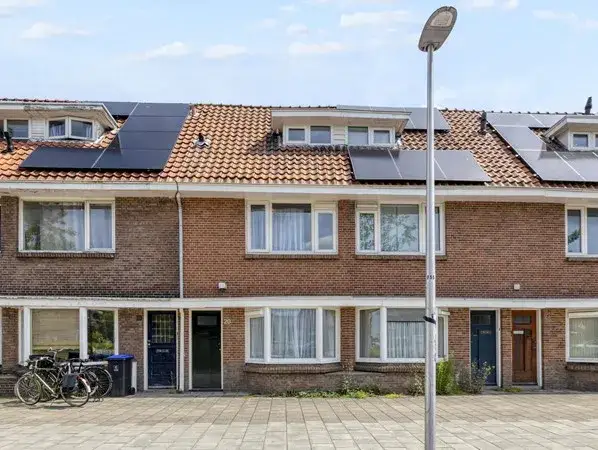
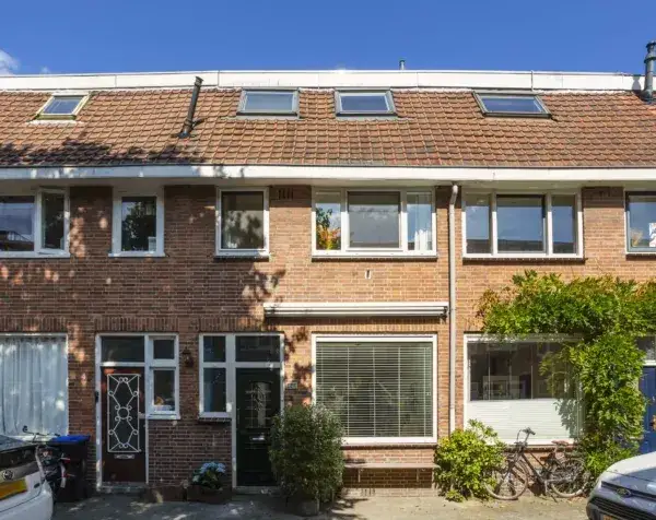
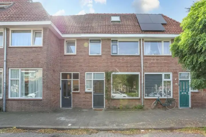
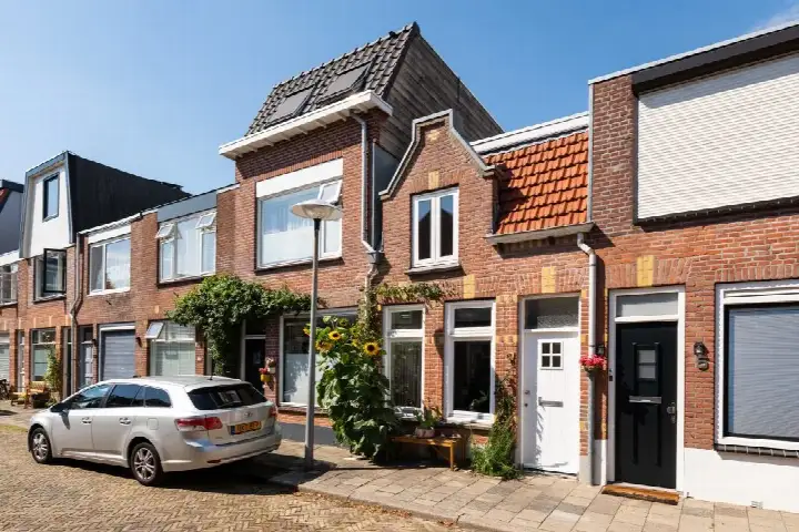
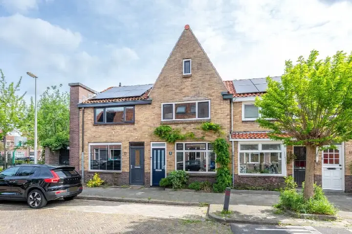
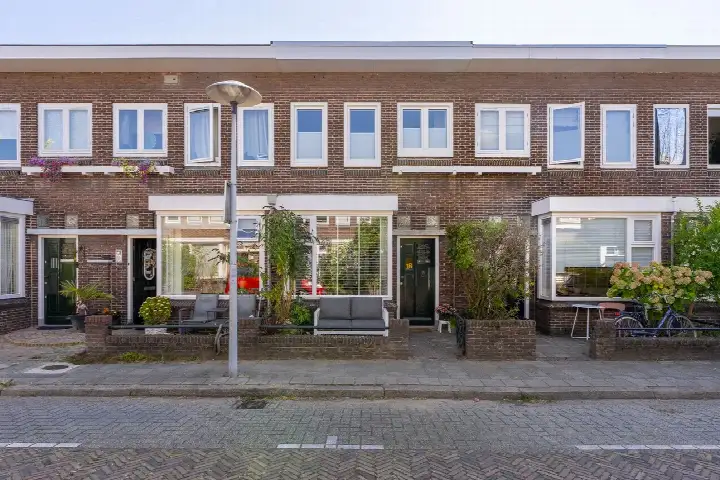
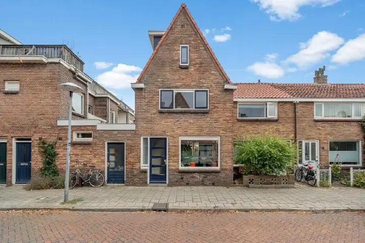
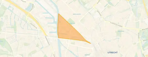
This 1946 terraced house on Barkasstraat 3 sits in the Schepenbuurt, Cartesiusweg e.o. neighbourhood in the west of Utrecht. It is a lively, urban area with a real mix of ages and household types, and the street itself is part of a residential setting. The asking price of €599,000 is 24% below the average asking price of €790,492 for homes in this neighbourhood, which puts it on the low side compared with the local market. For context, the average asking price per m² in the neighbourhood is €7,118, while this home is listed at €5,348 per m² based on the agent's floor area. If you are looking at [terraced houses in Utrecht], this one stands out for its price position.
The home itself
According to the agent, this is a five-room terraced house with four bedrooms and one bathroom spread over three floors, with a volume of 377 m³. The living area is listed at 112 m² by the agent, while the BAG registration records 92 m². The plot measures 101 m² according to both sources. The home has a back garden with a sunny terrace, and it is offered as full ownership. The agent notes that the property has roof insulation and double glazing, and it is heated by a central heating boiler. The energy label is C, which means you can expect moderate energy costs for a home of this age.
Life in the Schepenbuurt
Residents of the district of West, which includes this neighbourhood, give their area an average score of 7.37 based on eleven reviews. One resident describes it as "cosy, student-like, with a park on the doorstep, where people sit when the weather is nice," and mentions a pub in the neighbourhood and a shopping centre within walking distance. Another resident appreciates "so many nice shops in the area" and the walks to the Muntkade and Park Oog en Al. A third resident notes it is "a reasonably quiet neighbourhood" but adds that "there is absolutely no social contact." The neighbourhood itself has around 1,830 residents, with a high proportion of single-person households at 50%. The area is very strongly urban, with an address density of 3,186 per km². For more on the area, see [the Schepenbuurt, Cartesiusweg e.o. neighbourhood].
Amenities and transport
The daily essentials are within easy reach. A primary school, Agora Hub030, is a couple of streets away, and the secondary school Academie Tien is a ten-minute walk. For groceries, the nearest Albert Heijn is about a ten-minute walk, with Aldi and Nettorama just a bit further. The GP practice Julius Gezondheidscentra is a ten-minute walk, and the pharmacy Apotheek Deli-Bergema is just around the corner. For public transport, the bus stop Utrecht, Thomas à Kempisplantsoen is just around the corner with lines 5, 12, 13, 28, 73, N1 and 120, and the stop Utrecht, Schepenbuurt is a couple of streets away with lines 11, 12 and 120. The nearest train station, Utrecht Zuilen, is a ten-minute walk. All of this is within [the municipality of Utrecht], which offers a full range of urban facilities.
WOZ and address data
No WOZ value is available for this property in the records, so there is no municipal valuation to compare with the asking price. The address-level risk data from public sources indicates that the noise load from road traffic is 51 dB Lden, above the noise standard, and from rail traffic 59 dB Lden, also above the standard. The noise from air traffic is 42 dB Lden, not above the standard, and from industry 53 dB Lden, above the standard. The foundation risk indication for this area is medium, based on the fact that the home was built before 1970 and that 100% of properties in this postcode area date from before 1970. In this area, 2% of properties have an elevated risk of pile rot according to the Klimaateffectatlas. For climate risks, pluvial flooding at heavy rain is elevated, while flood risk is low both now and in 2050, and heat stress is low now but medium by 2050. These are area-level indications, not an inspection of this specific home.
Source and agent
At the time of writing, the home is offered via multiple channels, including PEEK&POMPE MAKELAARS and listings on Huispedia and Funda. The agent is PEEK&POMPE MAKELAARS.
This summary was generated with AI and may contain errors. Always verify the details with the provider.
Features
Details of this home
Transfer
Price
Energy
 Save up to € 400 on your energy billCompare now
Areas and volume
 Insure your home and belongingsGet insured
Layout
Construction
Outdoor space
The WOZ value is set annually by the municipality with 1 January as its reference date, and therefore lags the market by about a year. It is an estimated market value, not a sale price.
Frequently asked questions
About Barkasstraat 3, Utrecht
How does the asking price compare with other homes in the neighbourhood?
The asking price of €599,000 is 24% below the average asking price of €790,492 for homes currently for sale in this neighbourhood. The median asking price is €722,000, and prices range from €495,000 to €1,275,000. The average asking price per m² in the neighbourhood is €7,118, while this home is listed at €5,348 per m² based on the agent's floor area of 112 m².
What is the layout of this terraced house?
According to the agent, this is a five-room terraced house with four bedrooms and one bathroom spread over three floors, with a volume of 377 m³. The agent lists the living area at 112 m², while the BAG registration records 92 m². The plot measures 101 m². The home has a back garden with a sunny terrace and is offered as full ownership.
What is the energy label and what does it mean for costs?
The energy label is C. This is a mid-range label, so you can expect moderate energy costs for heating and electricity. The agent notes that the home has roof insulation and double glazing, which can help keep energy use in check. The home was built in 1946, so the label reflects the age of the property.
What is the foundation risk for this property?
The foundation risk indication for this area is medium. This is based on the fact that the home was built before 1970, and 100% of properties in this postcode area date from before 1970. In this area, 2% of properties have an elevated risk of pile rot according to the Klimaateffectatlas. This is an area-level indication, not an inspection of this specific home.
What are the noise levels like at this address?
The address-level risk data shows that the noise load from road traffic is 51 dB Lden, above the noise standard, and from rail traffic 59 dB Lden, also above the standard. Noise from air traffic is 42 dB Lden, not above the standard, and from industry 53 dB Lden, above the standard. These are area-level indications based on public data, not measurements at the property itself.
What supermarkets are nearby?
The nearest supermarket is Albert Heijn at about 1,065 metres, which is roughly a ten-minute walk. Aldi and Nettorama are both at about 1,152 metres, and Jumbo is at 1,158 metres. Boni is slightly further at 1,263 metres. There are 72 supermarkets within a 5 km radius, so you have plenty of choice for daily groceries.
Which schools are close to this home?
The nearest primary school is Agora Hub030 at about 593 metres, which is a five-minute walk. Van Asch van Wijckschool is at 757 metres, and the 2e Marnixschool is at 1,001 metres. For secondary education, Academie Tien is at 744 metres. There are 140 schools within a 5 km radius, covering both primary and secondary education.
What public transport options are available?
The nearest bus stop is Utrecht, Thomas à Kempisplantsoen at about 326 metres, with lines 5, 12, 13, 28, 73, N1 and 120. The stop Utrecht, Schepenbuurt is at 366 metres with lines 11, 12 and 120. The nearest train station is Utrecht Zuilen at 745 metres, which is about a ten-minute walk. There is also a bus stop at Utrecht, Station Zuilen at 763 metres.
What is the neighbourhood like according to residents?
Residents of the district of West, which includes this neighbourhood, give their area an average score of 7.37 based on eleven reviews. One resident describes it as "cosy, student-like, with a park on the doorstep," while another appreciates the many nice shops and walks to the Muntkade and Park Oog en Al. A third resident notes it is reasonably quiet but with little social contact.
What is the flood risk for this area?
The climate risk data indicates that pluvial flooding at heavy rain is elevated, while flood risk is low both now and in 2050. Heat stress is low now but is expected to be medium by 2050. These are area-level indications based on the Klimaateffectatlas, not an assessment of this specific property.